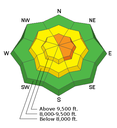
Forecast for the Skyline Area Mountains

Issued by Brett Kobernik on
Tuesday morning, January 29, 2019
Tuesday morning, January 29, 2019
The snowpack is slowly adjusting to last week's snow and wind which drifted LOTS of snow. It's becoming less probable for a person to trigger an avalanche in the majority of the terrain but it's still likely on the higher elevation more east facing slopes that have been wind loaded with snow. A CONSIDERABLE danger still exists in those locations. Buried persistent weak layers of sugar snow are inherently deceiving and often cause avalanches long after we think things are safe.

Low
Moderate
Considerable
High
Extreme
Learn how to read the forecast here


