Join us for the 33rd Backcountry Benefit - Get Your Tickets Now!

Forecast for the Skyline Area Mountains

Brett Kobernik
Issued by Brett Kobernik on
Tuesday morning, January 13, 2026

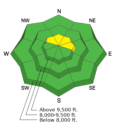
The chances for triggering an avalanche continue to decrease. It may be possible in spotty locations along the higher ridgelines where wind has created fresh drifts. If the drifts are in areas where weak faceted snow is present near the ground, these are the most likely areas to trigger something.

The majority of the terrain has a LOW avalanche danger. A "pockety" MODERATE danger exists in the described terrain.
Low
Moderate
Considerable
High
Extreme
Learn how to read the forecast here
Weather and Snow

General Conditions: Riding conditions contiue to slowly deteriorate. Temperatures have been warm with highs in the mid 30s. Wind has been from the north and picked up speed a bit late Monday.

Mountain Weather: High pressure continues to dominate our weather for the foreseeable future. Expect high temperatures in the mountains to be in the mid to upper 30s. Wind will generally be from a northerly direction and could get a bit breezy at times through the week. No storms are in sight.
Avalanche Problem #1
Persistent Weak Layer
Type
Location
Likelihood
Size
Description

In the unlikely event where you may trigger an avalanche, it will most likely involve some weak sugary faceted snow deeper in the snowpack. The chances for triggering something are becoming less and less with time. Unfortunately, the weak faceted snow won't be going away. As a matter of fact, more will probably form during the upcoming dry spell. For now, things are mostly quiet.

General Announcements
This forecast is from the U.S.D.A. Forest Service, which is solely responsible for its content. This forecast describes general avalanche conditions and local variations always occur.