UDOT PLANNED AVALANCHE CLOSURES!!

Forecast for the Skyline Area Mountains

Brett Kobernik
Issued by Brett Kobernik on
Monday morning, December 22, 2025

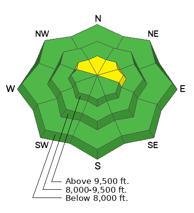
Avalanche conditions remain quiet. The overall avalanche danger rating on the Skyline remains LOW.

Low
Moderate
Considerable
High
Extreme
Learn how to read the forecast here
Weather and Snow
Current Conditions: The astonishing warm weather is changing the snow that's on the ground. It has been so warm for so long now that the entire snowpack has become damp at least up to 10,000'. This is very odd for late December. This should be a good thing because all this snow was loose, weak sugary facets. Now it is wet mush and should eventually freeze into a hard crust. Time will tell if this warming really helped us. I need to prowl around a bit more in the higher terrain but I'm hopeful.
Temperatures were well into the 40s on Sunday and hovered near 40 overnight. Wind has been light to moderate in speed from the west southwest.
Mountain Weather: Warm weather is going to continue over the next few days. Anticipate partly cloudy to mostly cloudy skies, temperatures into the 40s, light to moderate southwest wind shifting a little more south and even southeast tomorrow and Wednesday. A storm moves through later in the week. It doesn't look real promising for our zone but we might see a few inches of measurable snow if we're lucky. Overall, things look warm for the most part through the extended forecast.
General Announcements
This forecast is from the U.S.D.A. Forest Service, which is solely responsible for its content. This forecast describes general avalanche conditions and local variations always occur.