
Observation Date
1/4/2026
Observer Name
Magerl
Region
Skyline » Fairview Canyon » Blind Fork » GE Hill
Location Name or Route
GE Hill area
Comments
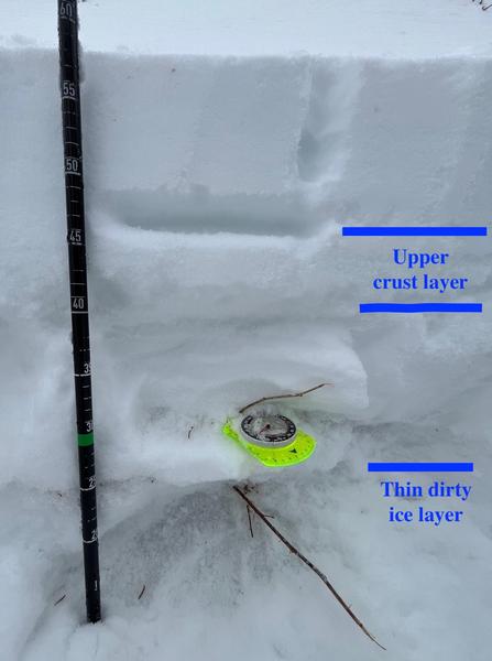
Dug a pit on a steep NW facing road cut at 9,400 feet. ECTN. The snow seemed welded into place. When forced to fail, each time it broke all the way to the ground. There is a stout, dirty ice layer about 25 cm from the ground. A second hard crust layer that runs from 40 to 45 cm from the ground. Total depth 58 cm. The snow at the ground was large wet grains, some about as loose as yesterday, some more cohesive.
On south-facing at 9,200 feet, the average snow depth was about 20 cm/8 inches. Not much coverage.


Today's Observed Danger Rating
Low
Tomorrows Estimated Danger Rating
Low


