Forecast for the Salt Lake Area Mountains

Drew Hardesty
Issued by Drew Hardesty for
Monday, April 8, 2019
This morning the avalanche danger is LOW. However, it will quickly rise to MODERATE and may reach Considerable with the intense spring sun and warm temperatures. You'll need to constantly monitor snow surface conditions while you're out today. If snow starts to become damp, heavy and loose it's time to move to cooler slopes.

Watch for Cornices today. While traveling ridge lines make sure to give yourself more than enough distance from the edge as they often break back much further than anticipated.

There remains the chance in specific areas for very large glide avalanches to occur.
Low
Moderate
Considerable
High
Extreme
Learn how to read the forecast here
Special Announcements
Grizzly Gulch will be closed TODAY and TOMORROW as Alta conducts rescue training

Summer is a busy time for the UAC working on our fall and winter planning, putting together the Fall Fundraiser and the Utah Snow and Avalanche Workshop (USAW), and updating our education programs. In addition, this summer we will be finishing up the website redesign project. Your donation shows you’re invested in this community all year round! You can still be part of the UAC’s success in 2019.

Our final podcast for the season has been released HERE. Low Danger - A Story in 5 Parts. Thanks much to our producer Benjamin Bombard and our sponsors Arva, Prival, and 2nd Tracks Sports.
Weather and Snow
This forecast is written by Bo Torrey and approved by Drew Hardesty.
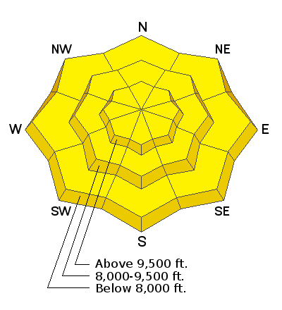
Overnight temperatures hovered around freezing at most weather stations but clear skies and a light breeze will have provided a shallow refreeze to the snow surface above 8000'. Yesterday's riding conditions may have rivaled the best groomed ski runs one could find anywhere (except for the old ruts and frozen wet debris "clinkers").
This morning winds are out of the west-northwest at 10-20 mph with gusts into the upper 20's at most stations. Winds will gradually decrease through the morning into the early afternoon before shifting to the Southwest and increasing ahead of the incoming storm.
Skies will be mostly clear with the possibly of some high thin clouds that could help keep the snow surface from heating quickly. Cloud cover will move into the area by late this afternoon ahead of the storm.
A series of major spring storms is on tap for this week beginning Tuesday afternoon and continuing into Friday eve bringing with it 10"-20" (SWE 0.85"-1.55+"). The pattern remains active into early next week.
Recent Avalanches
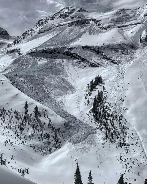
Cloud cover and light winds helped to keep things locked up yesterday. There was no reported avalanche activity yesterday.
Ad
Avalanche Problem #1
Wet Snow
Type
Location
Likelihood
Size
Description
The main concern for today will be wet avalanches. Last night's shallow refreeze won't last long with today's temperatures forecast to be in the mid-40's. Thin clouds and light winds could help to extend the life of the frozen snow surface but you'll need to monitor that while you're on snow today. Heating happens fast this time of year, with the snow changing in a matter of minutes. Watch for the usual signs of wet activity including rollerballs, point releases, and damp, heavy, loose snow. Use slope aspects to your advantage today to find soft snow and make sure you're off of and out from under steep slopes by the time things are wet and sloppy. Keep in mind what you'll be traveling under as you exit the mountains today.
Video: Great video of Wet Snow conditions from Trent's field day on Saturday.
Avalanche Problem #2
Gliding Snow
Type
Location
Likelihood
Size
Description
Glide avalanches are difficult to forecast as they seem to happen at unpredictable times. What we know is that when we have a number of continuously warm days, lack of solid refreeze and smooth ground surfaces are prime conditions for these avalanches to occur. Before releasing, the snowpack typically produces large, visible cracks in the snow which tell us where these avalanches can occur. Overnight air temperatures are not a good indicator of the stability of this avalanche problem as glide avalanches can fail in the middle of the night when temperatures are at its coldest.
They often happen where the snowpack rests on top of rock slabs or smooth surfaces. Common places to find these cracks and glide avalanches are Broads Fork, Stairs Gulch, and Mill B South, and upper Raymond Slabs in upper Porter Fork. Knowing when they will occur is very difficult to forecast.
Photo of glide avalanche in Broads Fork (M. White).
Additional Information
See Doug Wewer's pic of wet grains - snow melt creating liquid water dissolves the bonds between the grains. Add steep terrain and something (humans, infrastructure) AT RISK, and you have wet avalanche danger.
General Announcements
This information does not apply to developed ski areas or highways where avalanche control is normally done. This forecast is from the U.S.D.A. Forest Service, which is solely responsible for its content. This forecast describes general avalanche conditions and local variations always occur.