UDOT PLANNED AVALANCHE CLOSURES!!

Forecast for the Salt Lake Area Mountains

Drew Hardesty
Issued by Drew Hardesty for
Saturday, April 18, 2020
Depending on cloud cover, I expect the danger for wet avalanches to rise toward CONSIDERABLE today on steep easterly to south to westerly facing aspects. Avoid steep terrain when the snow is wet, punchy, and unconsolidated. Wet concrete-like debris may pile up deeply in terrain traps and below sustained terrain.
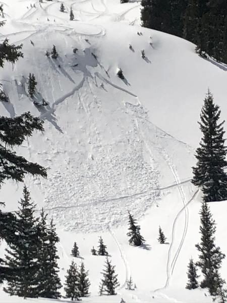
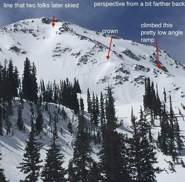
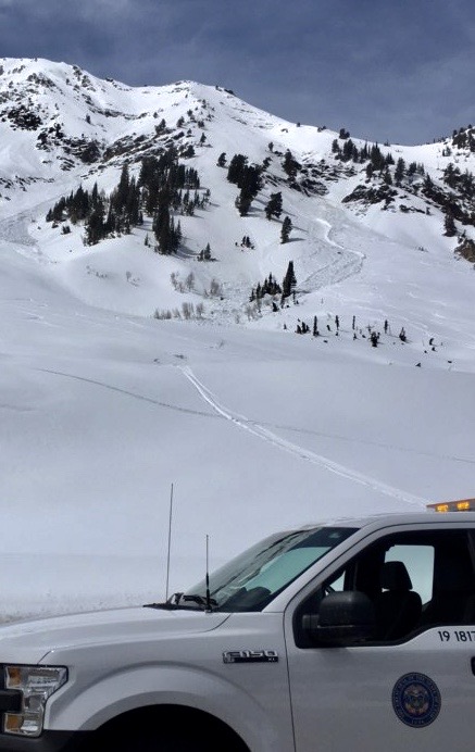
A tricky MODERATE danger exists for triggering soft slab avalanches 12-18" deep down to last week's temperature crust. These are most likely on northwest to east facing aspects above about 9000'. They are tricky because they may still be triggered at a distance and in terrain you may not expect. Wind drifts may be found in the highest terrain.
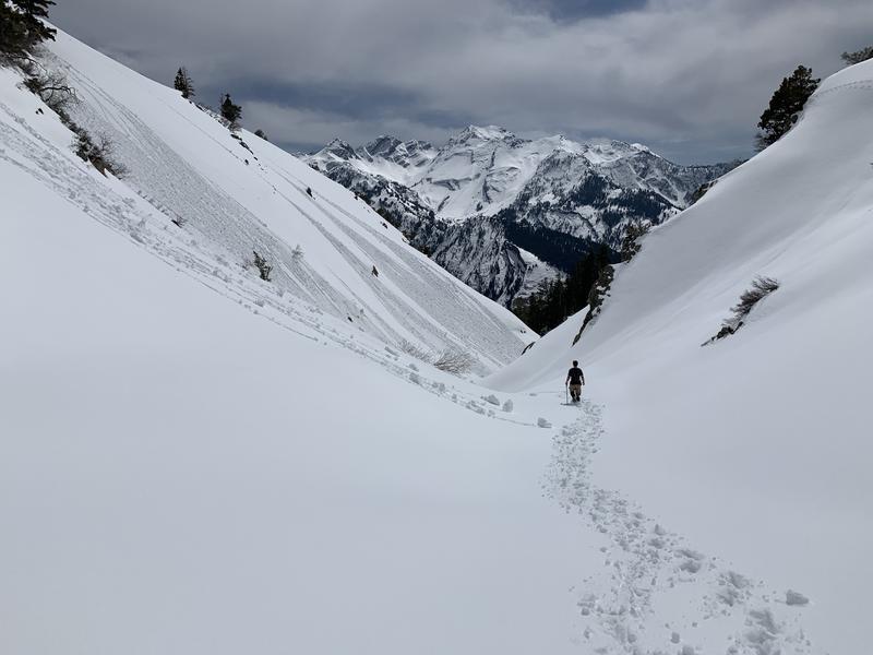
Remember that slope angle is the great equalizer. Low angle slopes continue to ride well. Low Risk High Reward.
Low
Moderate
Considerable
High
Extreme
Learn how to read the forecast here
Special Announcements
The Avalanche Research Program at Simon Fraser University is conducting an online survey to examine how people use avalanche safety information. They want to hear from all backcountry users to understand how they process information provided in public avalanche forecasts. Anyone who completes the survey before May 15th will be entered to win cash prizes.
Weather and Snow
Skies are partly cloudy.
Winds aloft are from the west, blowing 10mph with gusts to 15.
Mountain temperatures are in the mid-20s.
Snow surfaces are soft settled powder on the northerly aspects; all other aspects will have breakable crust this morning that will soften with sun and warmth.

For today, we'll see partly cloudy skies with some chance of spillover clouds and showers bubbling up from the south. Winds will be from the west/northwest blowing 10-15mph. Mountain temps will rise to the mid to upper 30s up high; the mid to upper 40s down low. Generally unsettled weather is expected tomorrow through the week without any significant storms.
Recent Avalanches
Another 12 avalanches were reported to our office yesterday that included a cross-loaded wind slab on Lake Peak (NE facing at 10,200'), at least two soft slabs running on last week's crust/facet layer in Pioneer Bowl (NNE at 9800') and the Guild Line (9400' at NW in Silver Fork) and two (way too late in the day to be skiing south facing) skier-triggered wet loose that came close enough to LCC road that UDOT closed a portion of the road. Photos below include lower Pioneer and Lake Peak/No Name.
Ad
Avalanche Problem #1
New Snow
Type
Location
Likelihood
Size
Description
It will still be possible to trigger a soft slab 12-18" thick resting on last week's thermal crust. The structure is poor with a mix of weak faceted grains above a hard crust...with a consolidating slab now on top. Collapsing and cracking may or may not be evident. Some of these avalanches may still be triggered at a distance. These avalanches may occur both in and out of wind affected terrain. NOTE this last point. Some of these avalanches have been triggered well off the ridgelines in seemingly benign terrain in gladed areas. Do Not take any steeper terrain for granted even if it is well below treeline. Getting caught in "even" a 12" deep and 75' wide avalanche can wrap someone around a tree or bury them in a terrain trap. See examples of this terrain in the top picture above and the video below.
These will be most pronounced on northwest through east facing aspects above about 9000', but still possible in other terrain.
Absent clear signs of instability, simple snow tests on low angle representative slopes (Extended Column Tests and others) should tell the tale. Extra Caution is warranted.
Avalanche Problem #2
Wet Snow
Type
Location
Likelihood
Size
Description
This morning's temperatures are 15-20°F warmer than they were yesterday morning and, depending on cloud cover, the crusts will thaw and the snow will become unstable earlier than yesterday. Natural and human triggered wet sluffs and wet slabs will run fast and far on last week's suncrusts. When the snow starts becoming damp, move to a cooler slope or lower angle terrain. Note that even some mid and low elevation northeast and northwest aspects may produce wet sluffs during the heat of the day (2nd photo example).
Public Safety Message: Please consider if you are putting others at risk with your timing and terrain selection. 1st photo.
Additional Information
Information on outdoor recreation - The State of Utah created this webpage with information about recreating on both state and federal public lands during the current health crisis.

Skiing and riding at closed ski resorts - Some resorts allow access now, and some do not. Please check HERE for the latest info on ski area access.

New to the backcountry (including riding at closed resorts) - Watch the award-winning, 15 minute Know Before You Go video, or take the 5-part, free online-learning series.
General Announcements
This information does not apply to developed ski areas or highways where avalanche control is normally done. This forecast is from the U.S.D.A. Forest Service, which is solely responsible for its content. This forecast describes general avalanche conditions and local variations always occur.