Check out our Holiday Auction - Sign Up for the Utah Snow and Avalanche Workshop (USAW)

Forecast for the Salt Lake Area Mountains

Mark Staples
Issued by Mark Staples on
Wednesday morning, March 30, 2022
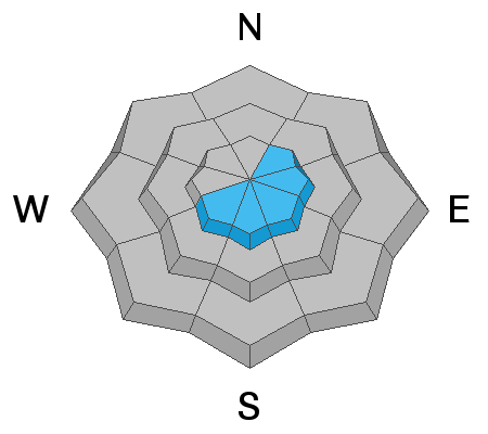
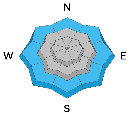
A wide range of snow conditions today has created a wide range of avalanche conditions and a lot of uncertainty for me as I write this forecast. Overall the avalanche danger is MODERATE, but some places may have a higher or lower hazard. Some things I would be looking for today are:
At upper elevations, look for and avoid areas with wind drifted snow. At the same time evaluate how the new snow is bonded to itself and the old snow surface.
At mid and upper elevations on more northerly facing slopes, there is a buried persistent weak layer that caused many soft slab avalanches this month. This layer has likely gotten wet and since gained strength as it cooled and refroze, but I'm not sure and it deserves evaluation.
At low elevations, the main issue is wet snow, but look for any place with wet, unfrozen, and unsupportable snow to tell you that wet avalanches may be a problem.
Low
Moderate
Considerable
High
Extreme
Learn how to read the forecast here
Special Announcements
Two generous UAC supporters are challenging the community to invest in the future of the UAC’s forecasting program during the 2022 Spring Campaign. They will match your donation, dollar for dollar, up to $10,000.
Weather and Snow
Yesterday afternoon and evening, thunderstorms rolled through northern Utah bringing rain, snow, and lightning. Precipitation type and amounts varied a lot. The rain/snow line was generally around 8000 ft. Most snow/rain fell in the Cottonwood Canyons which generally received 4-8 inches of dense snow and graupel (0.3-0.8 inches of water) with slightly higher amounts in some mid-canyon areas, maybe an inch of snow on top of the Park City ridgeline, and no precip just a little further east off the ridgeline.
This morning, air temperatures are hovering near freezing around 8000 ft, mid to low 20s F near 10,000 ft, and mid-30s F below 8000 ft. Winds at most ridgelines are blowing from the northwest 7-16 mph and gusting 25 mph. Winds at the highest elevations are blowing 25 mph gusting 40 mph.
Today, skies will slowly clear before more clouds return this evening. Temperatures around 8000 ft should warm to near 40 deg F while temperatures at higher elevations should warm to the upper 20s F. Winds will continue from the north and northwest as they are this morning and ease a little this afternoon. Tomorrow temperatures will be similar, winds will be light from the southwest and west, and just an inch or two of snow should fall.
Snow conditions: The key today is to gain elevation where temperatures are colder. Even though the snowpack is insulated by a blanket of new snow, it should be refreezing as I type this morning. You'll know by how far your feet sink into the snow if it's refrozen or not. The dense snow may be surfy and fun. At low elevations mostly below 8000 ft, rain fell yesterday and the snowpack remains wet and unfrozen.
Recent Avalanches
Last weekend's record heat caused many wet avalanches. Few people were out yesterday to see what was happening, but I suspect there was some wet avalanche activity at low elevations due to heavy rain.
Ad
Avalanche Problem #1
Wind Drifted Snow
Type
Location
Likelihood
Size
Description
The new snow is relatively warm and dense and should be bonded to itself well, but don't take this for granted. Look for any signs of instability like shooting cracks or small avalanches on small slopes.
The main place I would expect to find or trigger a soft slab avalanche today will be under ridgelines or other terrain features that have wind drifted snow as a result of winds from the northwest. Winds should be easing this afternoon, and these wind slabs should stabilize by tomorrow or the next day.
Avalanche Problem #2
Persistent Weak Layer
Type
Location
Likelihood
Size
Description
What happened to the buried persistent weak layer of facets (1-3' deep) that formed during the long dry period in Jauary and February? It just received a relatively heavy load of snow that is stressing it, and I'm not ready to blindly trust this layer. Today, I would pull out my shovel (because that's what I do for work but it's also what I do to stay alive) and evaluate this layer in several locations. I would perform numerous extended column tests and look to see if this layer has gotten harder to push my hand into. My suspicion is that this layer became wet during record heat this weekend, but it should be cooling and stabilizing today.
Avalanche Problem #3
Wet Snow
Type
Location
Likelihood
Size
Description
Below about 8000 ft, the snowpack is wet and unsupportable due to above freezing temperatures and rain. It has likely started to develop channels to allow liquid water to drain through itself which will limit wet snow avalanche activity. HOWEVER, wet loose avalanches are still definitely possible with such a wet, sloppy mess of a snowpack and I would not spend any time at low elevations today. If traveling through these areas, just avoid any steep slopes.
A related problem to wet avalanches are glide avalanches which happen in places where the snowpack rests on a smooth surface like a rock slab (places like Stairs Gulch, Broads Fk, and Mill B South of Big Cottonwood Canyon). When liquid water reaches the bottom of the snowpack, a glide crack opens as the entire snowpack moves downhill until at a random time it releases catastrophically producing a glide avalanche. One was observed this weekend in Broads Fork, and I won't be surprised to hear of more happening.
General Announcements
Who's up for some free avalanche training? Get a refresher, become better prepared for an upcoming avalanche class, or just boost your skills. Go to https://learn.kbyg.org/ and scroll down to Step 2 for a series of interactive online avalanche courses produced by the UAC.
This information does not apply to developed ski areas or highways where avalanche control is normally done. This forecast is from the U.S.D.A. Forest Service, which is solely responsible for its content. This forecast describes general avalanche conditions and local variations always occur.