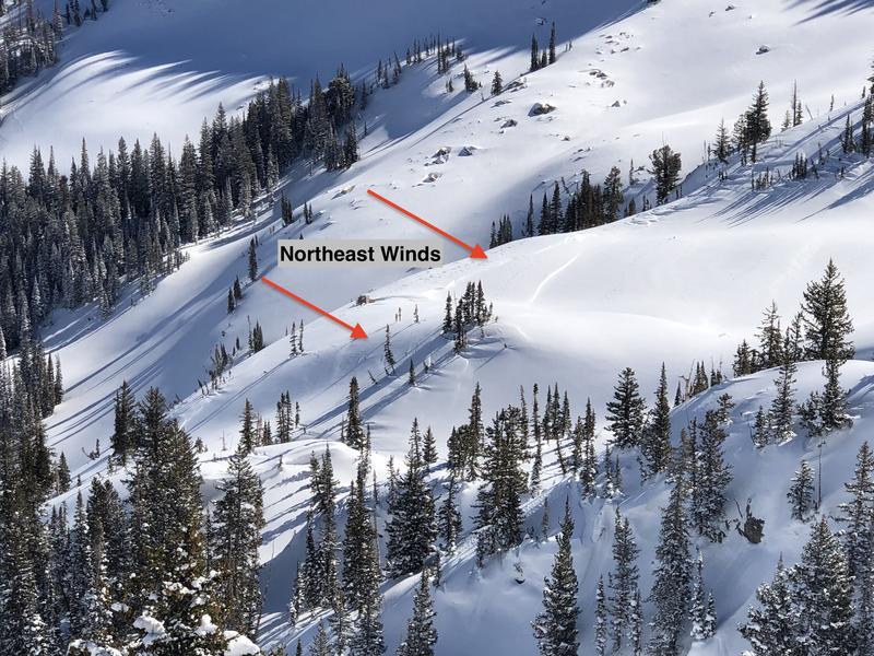
Although the snowpack was slowly adjusting the past week to the several feet of snow from Feb 12-19, strong winds overnight and into today will add a new load, further stressing the buried persistent weak layer (PWL) on slopes with fresh wind drifts. Look at the locator rose for this PWL problem to see how it is distributed (all upper-elevation aspects and mid-elevations west through north through southeast) where triggering avalanches several feet deep and hundreds of feet wide is possible. I am most concerned about areas where the snowpack is shallow, such as steep, rocky terrain or slopes that have previously avalanched. I also am finding a weaker and thinner snowpack structure outside of the upper Cottonwoods, such as Millcreek Canyon and the Park City Ridgeline.
We may see this weak layer become active: Strong winds and forecasted snowfall tonight and into Saturday will further stress the PWL.
Most folks I know continue to be wary of our PWL problem and are avoiding steep slopes where this problem exists. Yesterday, I was on top of an untracked, 32° slope (avalanche terrain) on a NE aspect. I used my probe and found the snowpack to be ~150 cms deep, with a 4F/1F hard, 1-meter slab on top of 30-40 cms of weak facets. Although I wasn't getting any collapsing or other signs of instability, I did not like the structure of a strong slab on top of weak facets and backed off. Instead, I moved to an adjacent 28° slope which was not in avalanche terrain.