Observation Date
2/25/2021
Observer Name
Greg Gagne
Region
Salt Lake » Little Cottonwood Canyon
Location Name or Route
Upper Big and Little Cottonwood Canyons
Comments
I have spent the past 2-3 weeks in the "periphery" regions - notably Millcreek, Park City Ridgeline, and low and mid-Big Cottonwood Canyon. In all of these locations, the snowpack is generally thinner and overall weaker (especially Millcreek and PC ridgeline), and where I would expect to see more issues with the buried PWL. The snowpack in the upper Cottonwoods is much thicker - generally 1.5 - 2.5m thick, with a 1-2m slab on top of weaker facets at the ground.
Overall, am thinking the upper Cottonwoods are looking much stronger than in outlying/periphery areas, and from what I saw today, it seems the likelihood of triggering a deeper avalanche is possible, but becoming less likely.
With such a deep snowpack digging pits is now taking much longer, so I'm digging a few quick pits to get a sense of the structure, and then using my probe to gauge depths and location of facets.
On top of an untracked, 32° slope on a NE aspect I used my probe and found the snowpack to be ~150 cms deep, with a 4F/1F hard, 1-meter slab on top of 30-40 cms of weak facets. Although I wasn't getting any collapsing or other signs of instability, I did not like the structure of a strong slab on top of weak facets, and I backed off. Instead, I moved to an adjacent 28° slope which was not in avalanche terrain. Although the likelihood of triggering a deeper avalanche is reducing, you have to do the work of inspecting the structure on steeper slopes, and avoiding slopes where the snowpack is thinner. This can be more widespread in areas outside of the core of the upper Cottonwoods, but also on slopes that have already slid or in thinner, rocky areas where there may be a thinner snowpack.
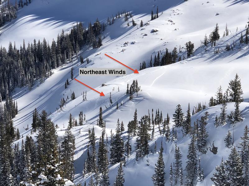
We have had some strong winds this past week and they can cross-load on all aspects, well-down off of ridelines. These drifts were from recent N/NE winds and cross-loaded slopes in open, alpine terrain. When I see this occurring, it is a reminder that wind drifts can be found on almost any aspect down off of ridges.
Today's Observed Danger Rating
Moderate
Tomorrows Estimated Danger Rating
Moderate


