The UAC is deeply saddened to report two avalanche fatalities. The first occurred on Wednesday, February 18th in the Big Flat area of Snake Creek near Midway. A snowmobiler was caught, carried, and buried in an avalanche, and unfortunately, recovery efforts were unsuccessful. The preliminary report can be found HERE.
The second fatality occurred on Thursday, February 19th, in the backcountry adjacent to Brighton Ski Resort. A young girl was caught, carried, and buried by an avalanche and did not survive. The preliminary report can be found HERE.
Our sincerest condolences are with all those impacted. The UAC is investigating both accidents in partnership with local law enforcement.
6 am: Skies are mostly clear and temperatures range through the 20's °F. Winds are blowing from the southwest and are light, with gusts in the teens mph.
Today: Temperatures will rise into the upper 30's and low 40's °F and winds will blow from the southwest and remain light, with gusts of 15-25 mph along exposed ridges and summits.
Tuesday/Wednesday: Winds will increase overnight and into tomorrow as a warm storm system enters the region Tuesday, with snowfall lasting through Wednesday. Rain/snow lines through Tuesday will be around 8,000 feet, lowering to 7,000 feet on Wednesday. Snowfall totals of 8-10 inches of dense snow containing over an inch of water are expected by late Wednesday.
Where do we start? In the past week, nearly 60 avalanches have been reported to the UAC, with easily many more that haven't heard of. In addition to the two fatalities this past week, avalanche accidents on Saturday included:
- Chicken S&$t Ridge where a snowboarder was caught and carried, sustaining a leg injury.
- Butler Basin where two skiers were ascending a steep, north-facing slope and triggered an avalanche up to two feet deep and 250 feet wide. Both skiers were completely buried. Fortunately, other skiers in the area saw the slide and rescued both. One rider had a leg injury, while the other is in the hospital in critical condition.
- Ant Knolls a close call/near miss where a snowmobiler was caught and carried, fortunately ending up on top of the debris. The avalanche was up to three feet deep and 500 feet wide.
On Sunday, two avalanches included
- Toots to Boot (Millcreek Canyon) which was two feet deep, 200 feet wide, and ran 1,000 vertical feet. Remotely triggered from the ridgeline.
- Days Fork where a snowboarder unintentionally triggered an avalanche over a foot deep and 50 feet wide.
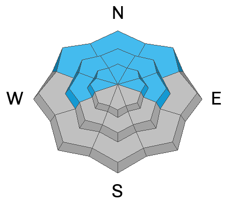
All of these avalanches occurred in northerly-facing terrain and failed on the "Dry January" PWL layer that is now buried 1-3 feet deep. Many of these avalanches were remotely triggered from ridgelines or below the steeper slopes, such as Sunday's avalanche in Millcreek Canyon shown in the photo below.
Late Sunday, we received report of an avalanche in Caribou Basin in the Snake Creek Drainage involving a snowmachiner. Search and rescue teams and the UAC will be on the site early this morning and we will keep you informed as we learn more about this avalanche.
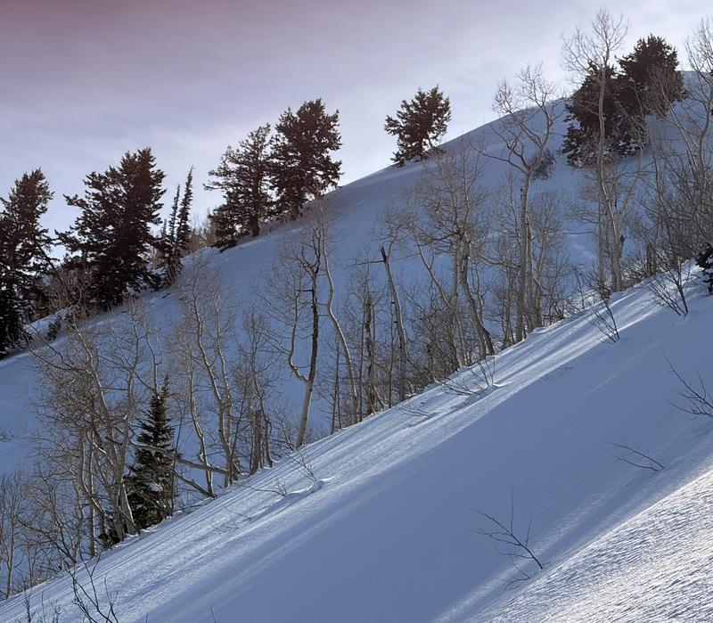
Remotely-triggered avalanche in Millcreek Canyon on Sunday failing on PWL. [Photo: C Gregersen]