Avalanche Warning
What: The avalanche danger for the warning area is HIGH today.
Where: The mountains of northern, central, southwestern, and southeastern Utah, including the Abajo Range, as well as southeastern Idaho.
Impacts: Recent heavy snow combined with strong wind has created widespread areas of unstable snow. Both human-triggered and natural avalanches are likely.
What to do: Avoid all avalanche terrain. Stay off of and out from under slopes steeper than 30°. Carry and know how to use avalanche rescue equipment. Find safer riding conditions on slopes less than 30° with no overhead hazard
Warning Times: Thursday, 2/19/26 at 6:00 AM MST through 6:00 AM MST Friday, 2/20/26
Avalanche Warning vs. Watch: The UAC upgraded our Avalanche WATCH to our first Avalanche WARNING of the season today. An Avalanche WARNING, the most severe avalanche alert product we have, is issued when large avalanches are certain or very likely in many areas and when unusually dangerous avalanche conditions exist. More info on each of these from Bruce Tremper and Drew Hardesty HERE.
Since Monday evening, an impressive series of storms moved through the state. Yesterday, the flow briefly shifted to northwest, a pattern that typically favors the Cottonwoods, producing notable snowfall before returning to southwest flow by midday. Heavy snow and strong winds persisted through most of the day, tapering off just before midnight, with the bulk of precipitation falling between 5 AM and 5 PM. Final storm totals as of this morning are:
LCC: up to 47 inches of snow // 4.70 inches of H2O
BCC: up to 35 inches of snow // 3.28 inches of H2O
PC Ridgeline: up to 28 inches of snow // 2.71 inches of H2O
Today, the storm has moved out, leaving a few light showers with little accumulation. Snowfall should stay under 1 inch during the day. Temperatures will climb into the upper teens to low 20s, with southwesterly winds blowing 10 to 15 mph along most upper elevation ridgelines, gusting to 25 mph and up to 35 mph at the highest peaks.
Another system arrives this evening, mainly impacting central and southern Utah, with northern Utah on the edge and likely seeing lower totals. Snow should begin between 6 and 10 pm, with the best chance for steadier snowfall Friday afternoon before drying out Friday night.
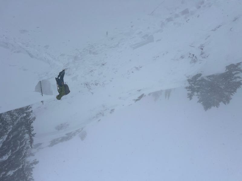
Yesterday was a very active day in the backcountry, with observers reporting highly sensitive conditions and widespread soft slab avalanches. Avalanches, both natural and skier-triggered, were observed on a range of aspects from north through east, and even some southeast-facing slopes, at elevations roughly between 8200 and just over 10,000 feet. Slabs failed from 20 inches up to 3 feet deep, reflecting a snowpack that was reactive and unstable across much of the backcountry.
Travel conditions were challenging, and these reports likely capture only a fraction of the avalanche activity that occurred. Observations included one close call near Nutty Putty, where a backcountry party was caught in a large avalanche while descending low-angle terrain in poor visibility. Two members were caught, one partially buried and self-rescued, the other fully buried but uninjured. The avalanche appeared to be a storm slab, likely triggered remotely higher on the slope. We appreciate these insightful observations.
Primary avalanche activity from yesterday included:
- Summit Park – NE aspect – 8200 ft – Soft slab – Skier triggered – 20 inches deep – 50 feet wide
- Davenport Hill – NE aspect – 10100 ft – Soft slab – Skier triggered – 2 feet deep – 80 feet wide
- Jaws – N aspect – 10200 ft – Soft slab – Skier triggered – 2 feet deep – 60 feet wide
- Silver Fork Headwall – N aspect – 9900 ft – Soft slab – Skier triggered – 20 inches deep – 100 feet wide
- Cardiff Fork – Aspect and elevation unknown – Soft slab – Trigger unknown – 2 feet deep – 70 feet wide
- Nutty Putty – NE aspect – 9400 ft – Soft slab – Skier triggered – 2 feet deep – Width unknown
- West Desolation Ridge – N aspect – 9300 ft – Soft slab – Natural – 2.5 feet deep – 60 feet wide
- West Desolation Ridge – NW aspect – 8900 ft – Soft slab – Natural – 3 feet deep – 900 feet wide
- Emma Ridges – SE aspect – 9500 ft – Soft slab – Skier triggered – Depth unknown – 40 feet wide
- Big Mac – E aspect – 9600 ft – Soft slab – Natural – 20 inches deep – 200 feet wide
An impressive example of an avalanche crown occurred on a slope where the terrain immediately below the crown was only 27 degrees, failing on faceted and buried near-surface facets with a moderately hard slab. Just left of the main West Desolation Ridge on a shorter, steeper slope. (W. Ambler)
Ski resorts also reported an active day, with natural avalanche cycles and large results from explosives. Strong winds, heavy snowfall, poor visibility, and chairlift icing limited terrain openings.
You can view all recent observations here.