Join us at our 2nd Annual Blizzard Ball

Forecast for the Salt Lake Area Mountains

Nikki Champion
Issued by Nikki Champion on
Monday morning, November 20, 2023
Heads up: Avalanche season is here!
This recent storm delivered up to 19 inches of new snow accompanied by elevated winds. Human-triggered new snow and wind-drifted snow avalanches may be expected in steep terrain. High-elevation shady aspects, that were holding old snow before this most recent storm, pose the highest potential avalanche risk. Be sure to have a partner and carry the necessary rescue gear of a transceiver, probe, and shovel.
While burial risk is generally low, the danger lies in being carried over and through consequential terrain, causing significant traumatic injury. Exercise caution, as it's still early in the season with limited skiing and riding options

We’ll issue updates as conditions change.
Low
Moderate
Considerable
High
Extreme
Learn how to read the forecast here
Special Announcements
Check out the ski areas uphill travel policies before you head up to their terrain.
Weather and Snow
This morning, skies are overcast and it is lightly snowing in the mountains. Mountain temperatures are sitting in the mid-teens to mid-20s F. Along the 9000' ridgelines winds are blowing from the west at speeds of 15-20 mph, with gusts up to 20 mph. At the 11,000' ridgelines, winds are gusting up to 30 mph. Overnight gusts did get close to 70 mph along the highest ridgelines. As of 6 AM, the storm totals were:
Upper LCC: 12-19" (1.50-2.20" H2O)
Upper BCC: 4-8" (.30-.55" H2O)
PC Ridgeline: 3.5-6" (.30-.80" H2O)
Today, the storm will taper off this morning. Skies will remain overcast, and temperatures will climb into the upper 20s and low 30s F. Winds will transition to become more northeasterly. At the 9000' ridgelines, winds will average 10-20 mph, with gusts up to 30 mph. At the 11,000' ridgelines winds will gust up to 35 mph. The mountains could get an additional trace amount of snowfall this morning.
Outlook, A high-pressure ridge moves in on Tuesday, creating some inversions. Another system is expected on Thursday and Friday, bringing around 0.20-0.30 inches of liquid, and it's colder, so the snow will likely be less dense than this storm.

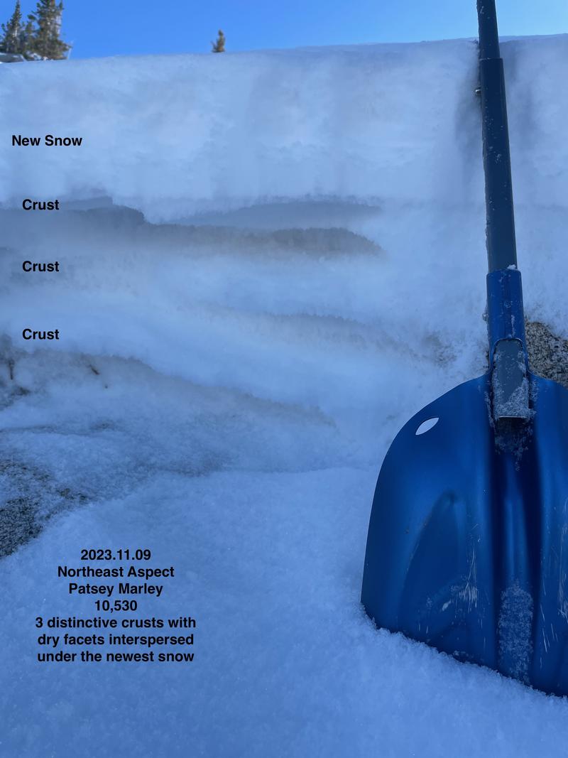
Prior to this storm, most of the southerly and westerly aspects were bone dry. The mid and upper elevation northerly aspects, however, held a mess of 12-20" of wind and temperature crusts interspersed with weak sugary snow (photo Kelly, Kelly, Grainger below). This is a weak base for our season's snowpack. Remember, anytime there is enough snow to ride, there is enough snow to slide.
Recent Avalanches
Yesterday, we began to get our first reports of avalanches in the backcountry. Most of these avalanches were reported as soft slabs of new snow or wind-drifted snow, primarily in the upper elevation northerly facing terrain.
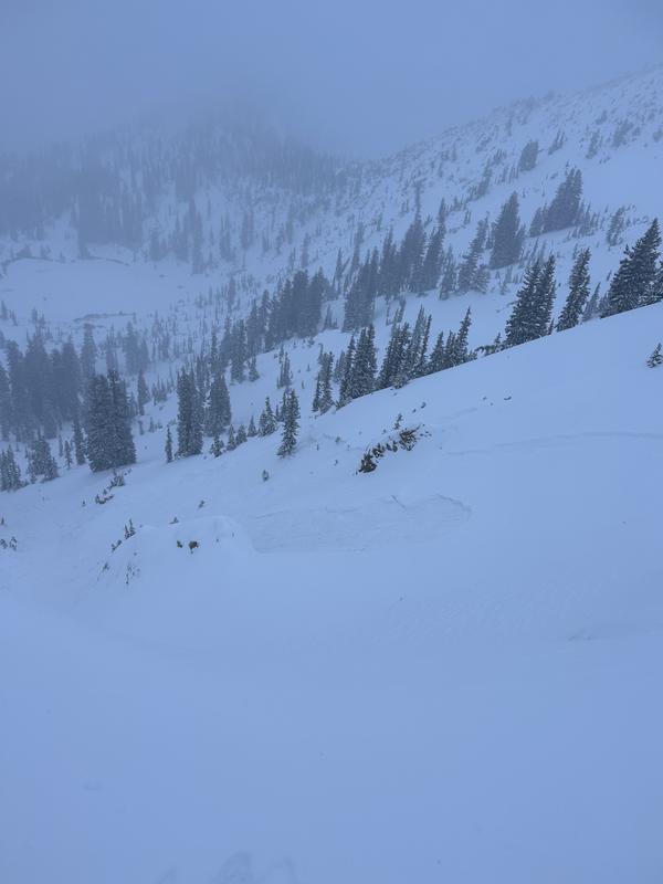
Near Rocky Point, on a NE aspect at 10,400' a small slab of wind-drifted snow ran 18" on old faceted grains and 200' wide. Find the full observation HERE.
We have had a few other snow and avalanche observations trickle in as people have been getting out and about. Check them out HERE.
If you find something interesting submit it to the UAC HERE.

Check out the ski areas uphill travel policies if you're thinking of taking an early season lap in ski area terrain.
Ad
Avalanche Problem #1
New Snow
Type
Location
Likelihood
Size
Description
The Upper Cottonwoods received up to 2" of water and nearly 20" of snow. Outside the wind zone, there remains a potential for sluffing and shallow, sensitive soft slabs of storm snow.
I'm unsure how quickly the new snow will be settling and bonding to itself. The new snow has not been bonding well to the old crusts and weak snow surfaces, but will likely begin to settle out quickly on Southerly aspects that did not hold onto any snow prior to this storm.

Dave Kelly talks about the conditions prior to the storm in the upper Little Cottonwood and the increasing avalanche hazard. Find his full observation HERE.
Avalanche Problem #2
Wind Drifted Snow
Type
Location
Likelihood
Size
Description
The winds began to pick up overnight, with gusts near 70 mph at the highest ridgelines. These elevated North and Northwest winds will have caused some soft snow to drift at the upper elevations. Although these drifts should be small, you want to avoid getting caught in one in steep, consequential terrain.
The uncertanity lies in the potential weakening and faceting at the snow surface before this most recent storm. While we don't know the extent of this faceting, it seems most prevalent in upper elevation, northerly-facing slopes – precisely where there's the most snow. Look for signs, like shooting cracks and whumphing, indicating the presence of this unstable. Consider conducting snowpack tests. The challenge with faceted snow is that, if beneath fresh wind slabs, they can keep the slabs unstable for more than 48 hours.
Additional Information
It’s never too early to start thinking about avalanches. Here are a few things to consider doing:
  • Learn online. We have over 5 hours of free online learning at the Know Before You Go Website
  • Check out the upcoming in-person Know Before You Go events HERE
  • Sign up for an on-snow class
  • Check out the UAC's education progression HERE
  • Get your avalanche rescue gear ready for winter. Put fresh batteries in your transceiver and update the firmware. Inspect your shovel and probe. Get your airbag backpack ready by possibly doing a test deployment and updating the firmware if it is an electric version or getting your canister refilled if it's not electronic.