All ski areas are closed to uphill traffic now including Alta. However, Alta has left the summer road open to uphill traffic with access to Catherine's Pass.
Since yesterday afternoon, 7-15 inches of snow has fallen (containing 0.8-1.5 inches of water). Strong winds from the south blew yesterday and switched to the W and WNW overnight. This morning, winds at 11,000 feet are averaging 50-60 mph and gusting 80-90 mph from the WNW. Winds at lower ridgelines are blowing 15-30 mph and gusting 30-50 mph.
Temperatures started dropping around midnight, and this morning temperatures are about 20 degrees F at many trailheads, in the teens F above 9000 ft, and single digits F at 11,000 ft.
Today, snowfall should taper off, and skies should remain cloudy in the mountains. Temperatures shouldn't warm up much and remain in the teens F in many areas. Winds should remain strong at the highest elevations. At most places winds should ease later this morning and average 12-25 mph from the WNW and gust to 35 mph.
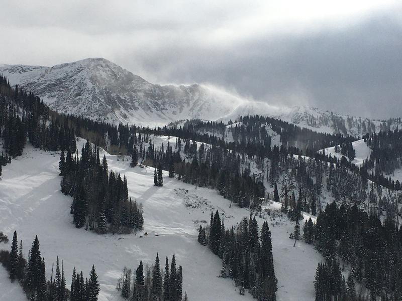
Photo of strong winds transporting snow yesterday in Little Cottonwood Canyon
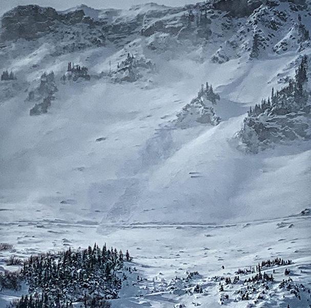
One small natural avalanche was observed yesterday as the winds started transporting snow. There were likely more but hard to see due to the drifting snow.
Photo - Natural avalanche in Albion Basin on an east-facing slope near 9700 feet. (D. Coyne)