Join us for the 33rd Backcountry Benefit - Get Your Tickets Now!

Forecast for the Salt Lake Area Mountains

Drew Hardesty
Issued by Drew Hardesty on
Thursday morning, January 8, 2026

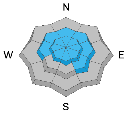
Areas of CONSIDERABLE danger exist in heavily wind loaded, steep west to north to east facing terrain in the upper elevations. If you enter steep avalanche prone terrain today, you'll most likely trigger loose dry sluffs on all aspects; however it'll be the lingering hard wind slab avalanche that'll do damage. And these may be up to 2-4 feet deep. Extra Caution is advised in this terrain.

During periods of heavy snowfall, loose dry avalanches may run naturally. Low angle terrain (30° or less) will have excellent skiing and riding today owing to the new low density snow.

Low
Moderate
Considerable
High
Extreme
Learn how to read the forecast here
Special Announcements

Be mindful of avalanche workers and SAR personnel - IF YOU TRIGGER an avalanche near a ski area, please report it to the ski patrol dispatch or Alta Central (801-742-2033). Rescue personnel don’t want to be subjected to dangerous conditions if the scene is clear. More on this in Backcountry Emergency Protocols

Weather and Snow

This is a good old fashioned cold front!

As of 6AM, storm totals are about 6" (0.40" snow-water-equivalent) in the upper Cottonwoods and along the Park City Ridgeline. The Ogden mountains have picked up 6-8"; the Provo mountains 2-4" (though possibly up to 8" along the Cascade Ridgeline.)

I expect to see snow continue for most of the day, with occasional periods of higher intensity, along with the "dreaded lake effect". We'll see. Storm totals by tomorrow morning could be 8-12" of cold smoke. Maybe more. I hate to say it, but Get it while you can, because we go high and dry after this. Temper that, though, because you'll see a fair bit of snow moving in steep terrain today. More below.

Currently, temps are in the upper teens enroute the low single digits. Winds are gusty with frontal passage, with some gusts up high clocking 40-50mph. But most instrumentation is showing winds from the west-northwest blowing 15-20mph. I don't think winds are going to be much of a factor; they'll blow 10-15mph from the northwest.* (The highest ridgelines will probably see 20mph winds..). Temps bottom out tonight in the low single digits with light snowfall possible. Sunny skies are expected this weekend.
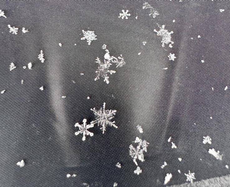
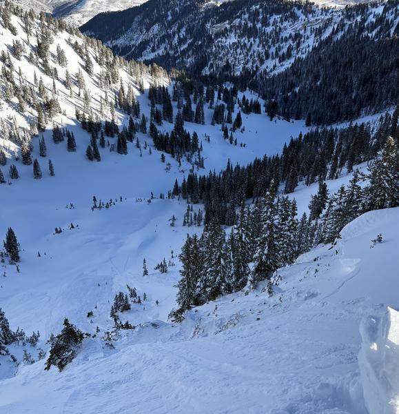
Photo above from Dave Kelly yesterday. There'll be a lot more of these today

Recent Avalanches

Early reports are that the new storm snow is running naturally in the steepest terrain this morning....

Significant avalanches from yesterday include explosive control work (Wyssen exploders) in upper LCC that triggered a large hard slab into old weak faceted snow on a steep northeast facing slope at 10,600'. This avalanche then sympathetically triggered another, similar, avalanche adjacent to it that also failed in the old faceted snow. These were described as Size 2.5-3, which means big enough to bury and destroy a car, a wood frame house, or break a few trees.

Otherwise we only heard about some longer running loose dry sluffs and pockets of lingering wind slab.

Read all backcountry observations here.

Avalanche Problem #1
New Snow
Type
Location
Likelihood
Size
Description

Loose dry point release sluffs will be the most common avalanches you'll see today. The new snow will likely have a poor bond with the old snow surfaces and run fast and far on all aspects at the mid and upper elevations. During periods of high snowfall rates, these may run naturally and entrain all the new low density snow. Note that it generally takes a bit of a steep slope angle for these to run (approaching 40° in steepness)...but if they're running naturally, you don't want to be in runout zones (ie - the Superior apron).

Avalanche Problem #2
Wind Drifted Snow
Type
Location
Likelihood
Size
Description

You can still trigger a lingering soft or hard slab of wind drifted snow today. New drifts will be very soft and relegated to the higher peaks and ridgelines, but older slabs will be harder and more stubborn...and may give little indication of warning until you're well out on the slope. These drifts are remain most prominent on north to east facing slopes. Remember that slab avalanches released naturally as recently as Monday that failed within the storm snow or down to the Christmas Eve rain crust. Caution is still advised in the wind zone.

A snowmobiler was caught and carried in a large wind slab avalanche on the Wasatch back (area known as First Cornice) on Monday. Trent and Brooke went to investigate this close call the following day and their report can be found HERE; the video below.

Avalanche Problem #3
Persistent Weak Layer
Type
Location
Likelihood
Size
Description

Large avalanches stepping to the ground have occurred as recently as Tuesday in the backcountry (upper Days Fork) and as recently as yesterday in upper LCC (explosive triggered at the ski areas). The most likely place to trigger one of these deadly hard slab avalanches in heavily wind loaded west to north to east facing terrain of the upper elevations. What makes these difficult is that snow tests give conflicting results...and the usual tell-tale signs of cracking and collapsing will be absent. The only clues are the avalanches themselves (see the upper Days slide below, pc:SDonovan) and the poor structure that exists on these slopes. In essence, you're rolling the dice. I will continue to avoid steep rocky wind loaded terrain for a bit more.

Additional Information

More history on avalanche work with explosives and artillery in Little Cottonwood Canyon HERE

General Announcements

This information does not apply to developed ski areas or highways where avalanche control is normally done. This forecast is from the U.S.D.A. Forest Service, which is solely responsible for its content. This forecast describes general avalanche conditions and local variations always occur.