Forecast for the Salt Lake Area Mountains

Greg Gagne
Issued by Greg Gagne on
Friday morning, January 7, 2022
Dense storm and wind-drifted snow have created a CONSIDERABLE avalanche danger on mid and upper elevation aspects facing west to north and east where avalanches may break down 3-10' into old, weak snow down near the ground. A Moderate danger exists on southerly aspects at the mid and upper elevations. There is a Moderate danger at lower elevations where wet avalanches are possible.

The good news is that excellent and safer riding can be found on lower-angle slopes with no overhead hazard.
Low
Moderate
Considerable
High
Extreme
Learn how to read the forecast here
Special Announcements
Help us help you: Take this quick quiz after you read the forecast. This will test what you've learned from today's forecast. You'll get feedback on what you learned and we'll find out how well we are conveying our message. You'll automatically be entered in a drawing for gear at the end of the season.
Weather and Snow
Temperatures range through the 20's F and skies are partly cloudy. Winds are from the west/southwest and at mid-elevations are averaging in the 20's with gusts in the 30's. Along the upper-most ridges, winds are averaging in the 30's and 40's with gusts in the 50's mph.
Storm totals from the past few days may have modest snow amounts, but impressive water (Snow Water Equivalent, or SWE) numbers:
Little Cottonwood 20"/3.75"
Big Cottonwood 16"/2.6"
Park City Ridgeline 15"/2.3"
Further to our north, the Logan mountains picked up over 2' of snow containing over 6" of water.
Snow quality is decent above about 9,500' with dense, surfy snow that makes for easy and fun travel and riding conditions. Once you drop below that elevation, the snow becomes increasingly damp to saturated.
Mostly clear skies this morning will give way to increasing clouds this afternoon. Winds will be from the west/southwest and it will be breezy. At mid elevations winds will average in the teens with gusts in the 20's mph. Along upper elevation ridges, winds will average in the 30's with gusts in the 50's mph. Temperatures will be quite warm for early January, with 10,000' temperatures rising into the mid 30's F. Snowfall overnight with minor accumulations into Saturday - hopefully we'll pick up 4" from this storm. Colder temperatures forecast for the weekend with high pressure building into the region.
Unfortunately, once the Friday night/Saturday storms clear out there no storms are forecast for at least the next several days.
Recent Avalanches
Our Week in Review - where we highlight significant snow and weather events - has been published.

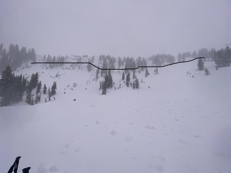
Backcountry observations from Thursday include three natural avalanches that likely ran sometime during the day on Wednesday or early Thursday morning.
Wilson Glade
Lane's Leap
These two avalanches likely failed within recent storm/wind-blown snow.
The most impressive was the Silver Fork Headwall which was 2' deep (although deeper in places) and 800' wide. This slide also involved mostly new snow but may have also stepped down into old faceted snow in places.
Ad
Avalanche Problem #1
Persistent Weak Layer
Type
Location
Likelihood
Size
Description
There is a persistent weak layer (PWL) of old faceted snow down near the ground with 3-10' of snow on top of it. This PWL exists on mid and upper elevation slopes facing west through north and east. It does not exist on south-facing slopes as any early season snow melted away and December snowfall landed on bare ground on these slopes. This PWL has been fracturing and producing large, dangerous avalanches over the past few weeks. Since Wednesday, we have added 1-2' of dense snow containing up to 3" of water weight as well as wind-loaded snow- stressing this buried weak layer.
We are moving in the right direction towards this PWL problem becoming dormant, but for now, I continue to avoid being on or underneath any steep slope facing west/north/east at the mid and upper elevations.
Avalanche Problem #2
Wind Drifted Snow
Type
Location
Likelihood
Size
Description
Strong winds Wednesday and into Thursday created dense wind drifts at the mid and upper elevations, and increasing winds today from the west/southwest may create fresh pockets of wind-drifted snow. These dense drifts may allow you to get well-onto a wind slab before fracturing - watch for shooting cracks as signs of instability.
Avalanche Problem #3
Wet Snow
Type
Location
Likelihood
Size
Description
A rain/snow line of 7,500' saturated the snowpack at lower elevations and combined with warm temperatures today make wet avalanches possible below about 8,000'. Wet, loose debris may pile up deeply in terrain traps.
Avoid ice climbing terrain until cooler temperatures arrive over the weekend as there is potential for wet snow to come down from above.
Roof-alanches - where roofs shed their entire snowpack - are also likely today. These can be quite dangerous - avoid being underneath steeper roofs that have a layer of snow on top.
General Announcements
Who's up for some free avalanche training? Get a refresher, become better prepared for an upcoming avalanche class, or just boost your skills. Go to https://learn.kbyg.org/ and scroll down to Step 2 for a series of interactive online avalanche courses produced by the UAC.
This information does not apply to developed ski areas or highways where avalanche control is normally done. This forecast is from the U.S.D.A. Forest Service, which is solely responsible for its content. This forecast describes general avalanche conditions and local variations always occur.