Join us at our 2nd Annual Blizzard Ball

Forecast for the Salt Lake Area Mountains

Greg Gagne
Issued by Greg Gagne on
Friday morning, January 3, 2025
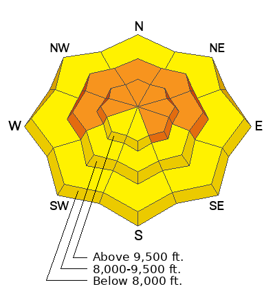
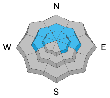
The avalanche danger is CONSIDERABLE on mid and upper-elevation aspects facing west, north, east, and upper-elevation aspects facing southeast where a dangerous persistent weak layer exists. Human-triggered avalanches are likely and natural avalanches are possible. Avalanches may be 2-4 feet deep and hundreds of feet wide. All other slopes have a MODERATE avalanche danger where human-triggered avalanches are possible.
Small, wet-loose avalanches are possible at low and mid elevations with today's warm temperatures.
These are dangerous and increasingly complex avalanche conditions. Lower-angled slopes < 30° in steepness away from all avalanche terrain are strongly recommended.
Low
Moderate
Considerable
High
Extreme
Learn how to read the forecast here
Special Announcements
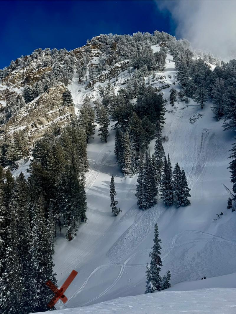
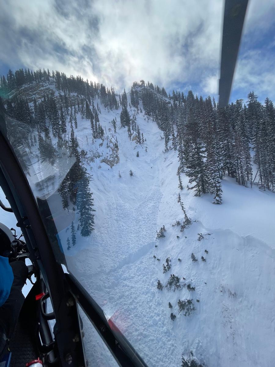
We are deeply saddened to confirm two avalanche fatalities. The first involved a 38 year old man in Main Porter Fork of Mill Creek Canyon who went missing on Saturday. The second avalanche fatality occurred Tuesday that involved a 54 year old man off Davenport Hill into Silver Fork of BCC. Both individuals were traveling alone in the backcountry. Our condolences go out to to the family and friends of the victims.
Many thanks to those who responded to these accidents: search and rescue teams from AirMed, LifeFlight, Utah Dept Public Safety, Utah Department of Transportation, Salt Lake County Search and Rescue, Wasatch Backcountry Rescue, Alta Ski Area, and members of the Utah Avalanche Center.
Main Porter Preliminary Accident Report (1st photo - SL County SAR) Original avalanche obscured by recent snow/wind. Avalanches in photo are from explosives to protect rescuers.
Davenport Hill Preliminary Accident Report (2nd photo - Wasatch Backcountry Rescue) The victim was buried 20 feet deep.


Weather and Snow
6 am: Temperatures have been on the rise overnight and are in the upper 20's F. Winds are from the south/southwest and have also increased overnight, averaging in the teens with gusts in the mid 20's mph along exposed ridgelines above 9,500' with 11,000' wind speeds averaging in the 30's with gusts in the 50's mph.
24-hour snowfall totals in the Cottonwoods and Park City ridgeline are 7-9 inches containing 0.7 - 1.5 inches of water.
Today: Mostly sunny this morning, with clouds filling in during the afternoon. Temperatures will rise into the upper 30's F. Winds will be from the southwest and will average in the teens with gusts in the 20's mph up to 10,500' with 11,000' winds averaging in the upper 20's mph with gusts around 50 mph.

This Weekend: Increasing winds this evening with snowfall beginning overnight. A cold front arrives around dawn on Saturday, with heavy snowfall on a cold northwest flow. Snowfall totals are likely to exceed a foot.

Our Week in Review where we highlight significant avalanche and weather events has been published.
Recent Avalanches
Three avalanches were reported from the backcountry on Thursday:
The first two were on northeast aspects at 9,800' and avalanched naturally, likely due to wind-loading. Both failed on facets:
1. Wilson Chutes along the Big Cottonwood/Millcreek ridgeline. It was up to 3 feet deep and 200 feet wide.
2. Upper Dutch Draw along the Park City ridgeline. It was up to 2 feet deep and 50 feet wide.
The third avalanche caught my attention as it occurred on a southerly aspect:
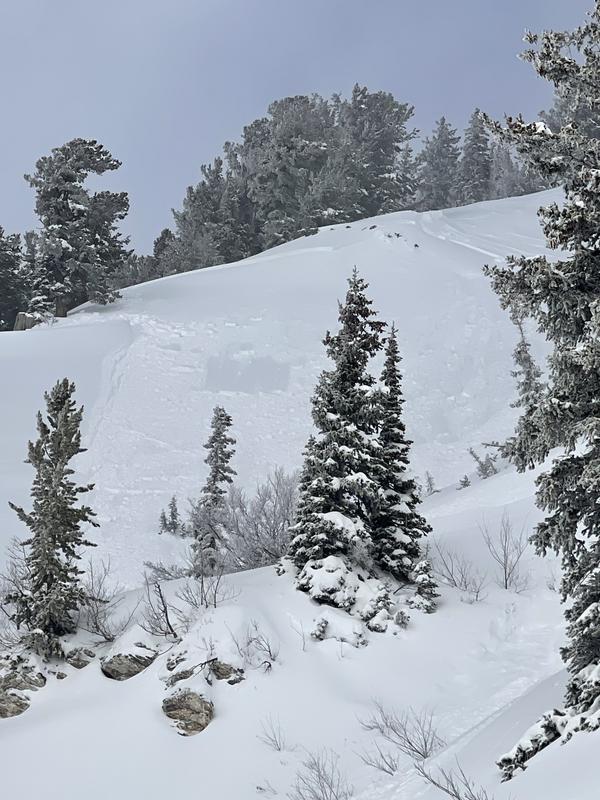
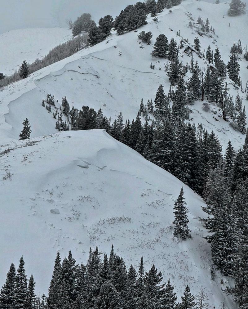
3. Emma Ridges in upper Little Cottonwood where the rider was briefly caught and carried. The avalanche was up to 8 inches deep and 30 feet wide at 9,500'. It failed on a sun crust that formed on Tuesday. (Photo below)

Reminder: Please call Alta Central (801-742-2033) or your closest ski patrol dispatch (INFO) if you happen to witness a new avalanche near a ski area and are sure there is no one involved. This allows rescue teams to stand down and not stick their necks out if they're not needed. Thank you -
For detailed observations and reports, check out all avalanche observations HERE.
Ad
Avalanche Problem #1
Persistent Weak Layer
Type
Location
Likelihood
Size
Description
Thursday's wind and storm snow stressed the persistent weak layer (PWL) with two natural avalanches reported, plus continued reports of collapsing and cracking. Today's south/southwest winds will drift snow onto the aspects where the PWL exists: mid and upper-elevation slopes facing west through north and east, (including upper-elevation slopes facing southeast) where human-triggered avalanches are likely and natural avalanches possible, similar to what we saw on Wilson Chutes yesterday (photo below from Mark White). Any avalanche failing on the PWL will be 2-4 feet deep and up to hundreds of feet wide.
It's Simple -> Do not travel on, underneath, or adjacent to slopes 30° or steeper on aspects facing west/north/east at the mid and upper elevations.
Avalanche Problem #2
Wind Drifted Snow
Type
Location
Likelihood
Size
Description
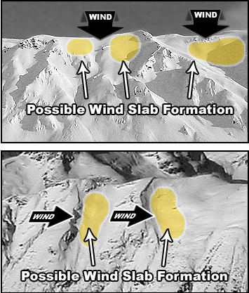
Soft slabs of dense storm snow and wind-drifted snow 12-18 inches thick can be found on all aspects at the mid and upper elevations. These soft slabs may fail on different layers, including crusts on southerly aspects. On aspects facing west, north, and east, any avalanche may break down to the deeply-buried PWL. The graphic below demonstrates the aspects where you can find wind-drifted snow based on the direction the wind is blowing from.
Additional Information
Researchers Ian McCammon and Kelly McNeil looked into safety habits that markedly increase our margins of safety. Please take a moment to look over these and recalibrate your safety habits: Six Tips That Could Save Your Life (Recent updates to Safety Messaging)
General Announcements
This information does not apply to developed ski areas or highways where avalanche control is normally done. This forecast is from the U.S.D.A. Forest Service, which is solely responsible for its content. This forecast describes general avalanche conditions and local variations always occur.