Currently: Mountain temperatures are a few degrees on either side of 20 F and winds are out of the west/southwest and very light, < 10 mph, with gusts in the teens along the upper-most ridgelines. The mountains received another 1-3" of dense snowfall Thursday morning, with
riming at the surface noted in some places. Since Tuesday, snowfall amounts are 14-18" (containing 1.5 - 2.24" water) in the upper Cottonwoods and about 8" (containing 0.7" water) along the Park City ridgeline.
For Today: Increasing clouds with light snow possible this afternoon. We'll likely squeeze a few inches out of this system. Winds will be out of the west/southwest and remain light, with gusts in the teens at the upper-most elevations. Temperatures will remain mild, rising above freezing to about 8500', and in the 20's above that.
This weekend: Dirty ridging in place with periods of mid and high clouds. Winds will remain light and temperatures mild, generally in the 20's. Another weak system expected later on Sunday.
Our
Week in Review which summarizes significant avalanche and weather events from this past week has been published. Click
HERE.
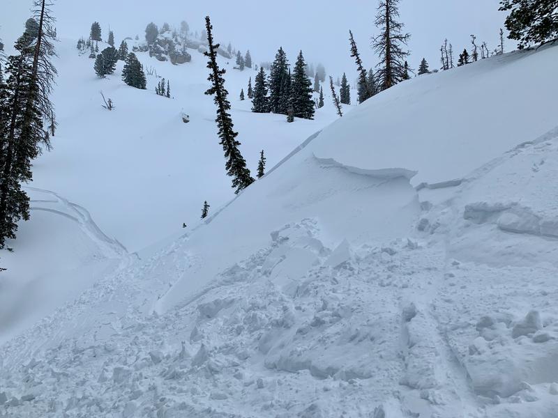
Control work at resorts reported small soft slabs and dense wind drifts. In the backcountry, most observers noted instabilities of storm snow and wind drifts had largely settled out, but a few slides were reported including a 60' wide and 2' deep soft slab in upper Dry Fork (
Observation) (pic: Jessie W)
Other avalanches in wind-drifted snow included Tuscarora (
observation) and the South Face of Mount Superior (
observation), the latter which may have run several hundred feet.
Warm temperatures yesterday led to damp snow with some wet roller balls below about 8,000'
Click
here to read all observations for the Salt Lake area mountains.


