Forecast for the Salt Lake Area Mountains

Evelyn Lees
Issued by Evelyn Lees for
Sunday, January 20, 2019
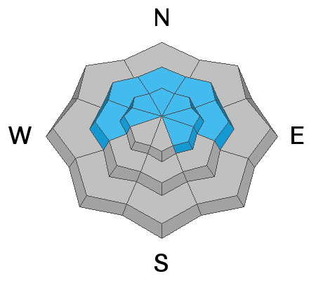
The Avalanche Danger is CONSIDERABLE on all mid and upper elevation slopes and MODERATE on all low elevation slopes. Human triggered avalanches are likely on steep slopes. Avoid travel in avalanche terrain - which includes slopes steeper than about 30 degrees as well as travel below steep slopes and in avalanche runout zones. Wet loose sluffs can be triggered on steep low to mid elevation slopes of all aspects as the day heats up or the sun comes out.
Those with excellent avalanche and route finding skills will find great turning and riding conditions in supportable settled powder on low angle, wind sheltered slopes.
Low
Moderate
Considerable
High
Extreme
Learn how to read the forecast here
Avalanche Warning
A BACKCOUNTRY AVALANCHE WARNING CONTINUES THROUGH 530 AM MST MONDAY FOR THE MOUNTAINS OF NORTHERN UTAH INCLUDING THE BEAR RIVER RANGE AND ALL OF THE WASATCH RANGE. THE AVALANCHE DANGER IS CONSIDERABLE IN THE BEAR RIVER AND WASATCH MOUNTAIN RANGES. HUMAN TRIGGERED AVALANCHES ARE LIKELY ON ALL STEEP WIND DRIFTED SLOPES. DANGEROUS AVALANCHE CONDITIONS CONTINUE...CREATED BY THE SNOW AND WIND FROM PREVIOUS STORMS. AVOID BEING ON OR UNDERNEATH STEEP SLOPES.
Special Announcements
Sadly yesterday, the body of a backcountry skier was recovered from an avalanche near Electric Lake, on the Manti/Skyline Plateau. Our condolences to their family and friends. The accident report was updated last night, with many more details and photos of this sad accident.
Weather and Snow
Yesterday, small amounts of rain, drizzle, rime and snow occurred - details varying from drainage to drainage, and by elevation. Upper elevations is where the creamy, supportable powder is. Mid to lower elevations will have crusts to damp to wet snow.
Today and tonight will be a 24 hour break of cloudy, warm and windy weather. Temperatures are the twenties this morning, and will warm again into the 30s. The southwesterly winds are averaging 10 to 15 mph, with the high ridges 25 to 30 mph. Speeds could increase along the high ridges at times, gusting to 50 mph.
Another storm is on tap for Monday into Monday night, with strong winds and 1 to 2 feet of snow.
Recent Avalanches
There were two widespread natural avalanche cycles on Thursday and Thursday night, but the crowns and debris hidden beneath the last of the storm snow. People are sloly identifying slides - check the avalanche list here.
Notable backcountry avalanches yesterday included one yesterday afternoon on the NW face of Gobblers, few details, and a remotely snowmobile triggered slide on Grandview (not caught) on a south east facing slope, 8,200’. Two slides on southeast facing slopes were noted in Snake Creek. There were many reports of collapsing. Explosive work at the resorts was able to produce large hard slab avalanches.
Grandview, Kyle Anderson photo.
Ad
Avalanche Problem #1
Wind Drifted Snow
Type
Location
Likelihood
Size
Description
Multiple avalanche cycles have left a patchwork of slopes that have slid, and those that haven’t, and much of the evidence is hidden beneath the newest snow and wind slabs. This make stability evaluation very difficult.
Today, the southwesterly winds will again be strong enough at times to drift some snow at the higher elevations into another layer of sensitive wind slabs. The old, but still dangerous wind drifts from Thursday are now hidden, but could still produce large, hard slab avalanches 2 to 3 feet deep, mostly at the upper elevations. Drifts are to the lee of ridge lines and cross-loaded into couloirs and gullies and may be triggered at a distance or break above you.
Avoidance continues to be key and sticking to low angle terrain (less than 30°) with nothing steep above or adjacent to you is the only tool in the tool box for safety.
Avalanche Problem #2
Persistent Weak Layer
Type
Location
Likelihood
Size
Description
While the faceted weak layers in the snowpack are slowly adjusting to the new load, there has been so much heavy snow and wind drifting they can’t be trusted yet. You can trigger a deep slide on one of the buried facet layers on a steep slope, especially in areas with a shallow snowpack, including slopes that have slid one or more times this year and some mid elevation slopes. Any shallower, new snow slide or triggered wind drift may “step down”, breaking on one of these deeper weak layer, resulting in a large, dangerous slide.
Avalanche Problem #3
Wet Snow
Type
Location
Likelihood
Size
Description
With another day of warm temperatures and possible sun, wet loose sluffs are possible on low elevation slopes of all aspects. Avoid small terrain traps such as creek beds and road banks. If the sun really comes out where you are, the snow on steep, sunny mid and upper elevation slopes may also become damp and sluff
Additional Information
General Announcements
This information does not apply to developed ski areas or highways where avalanche control is normally done. This forecast is from the U.S.D.A. Forest Service, which is solely responsible for its content. This forecast describes general avalanche conditions and local variations always occur.