Forecast for the Provo Area Mountains

Drew Hardesty
Issued by Drew Hardesty for
Monday, March 6, 2023
A CONSIDERABLE avalanche danger exists on all aspects of the upper elevations. Human triggered avalanches are likely. Soft slabs and sluffs in the new snow are to be expected and not limited to usual starting zones...
Low
Moderate
Considerable
High
Extreme
Learn how to read the forecast here
Special Announcements
To help you safely enjoy the backcountry, the UAC team is constantly evaluating and implementing new programs and technologies. Donate to the Spring Campaign to help our team implement innovative tools and better provide you with the information you rely on.
Thank You!
Weather and Snow
Come, let's go
Snow-viewing
Til we're buried.
--- Matsuo Bashō (1644-1694)

We are still living in a snow globe.
Overnight snow totals are 3-5" with storm totals of 8-12". Amazing that the Bunnells snow stake has nearly 150" on the ground.
Mountain temperatures are in the teens. Winds were reportedly moderate to strong from the southwest overnight but have lost steam in the past few hours.

For today, we'll see light snowfall that may add up to another 1-3" of fairy dust. Temperatures will be in the teens and low 20s. Winds will remain light from the west.

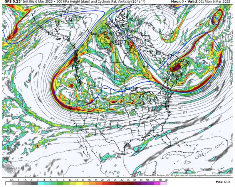
We (the intermountain west) are buried beneath a long wave trough that will continue to keep at least light snowfall going off and on through Wednesday evening. We stay relatively cool with generally light to moderate wind. The next series of storms fire up on Friday. The image below - you can see we're nested in the cradle of storms.
Recent Avalanches
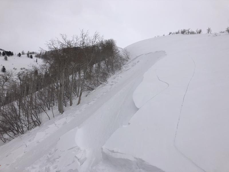
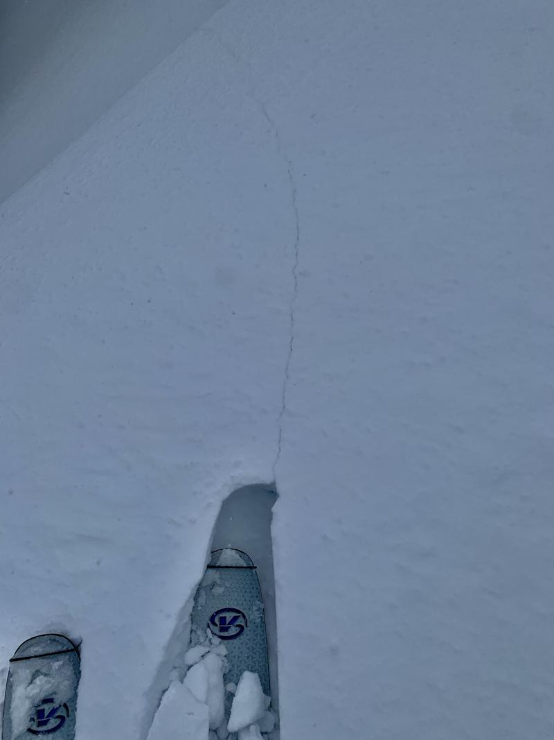
We did not hear of any avalanches from the Provo mountains yesterday, but fresh wind drifts (photo) have been triggered by backcountry observers Friday and Saturday. Dave Jarvis was in Rock Canyon yesterday. Report HERE.

Check recent observations from the backcountry in the menu bar above.
Ad
Avalanche Problem #1
New Snow
Type
Location
Likelihood
Size
Description
You will be able to trigger new snow avalanches big enough to kill you in steep terrain today. Both soft slab avalanches and loose snow sluffs are likely on a variety of aspects and elevations.
I would approach any steep terrain with caution today. Ski cuts on test slopes and cornice drops should give some information on stability. Shooting cracks indicate instability as well. (photo below)
Avalanche Problem #2
Wind Drifted Snow
Type
Location
Likelihood
Size
Description
Sensitive soft slabs of wind drifted snow are most likely to be found in the mid and upper elevations. Look for and avoid pillows of wind drifted snow. Shooting cracks are a good indicator of instability.
Additional Information
Forecaster's Corner:
Local Wasatch resident Ian McCammon holds a PhD in robotics but can tell us a lot about human behavior. His research into avalanche accidents led him to an algorithm called ALPTRUTH.

The TAKE HOME here is that you already have three checked boxes before you even leave the house.
The terrain choice is yours.
General Announcements
This information does not apply to developed ski areas or highways where avalanche control is normally done. This forecast is from the U.S.D.A. Forest Service, which is solely responsible for its content. This forecast describes general avalanche conditions and local variations always occur.