Forecast for the Provo Area Mountains

Drew Hardesty
Issued by Drew Hardesty for
Tuesday, March 7, 2023
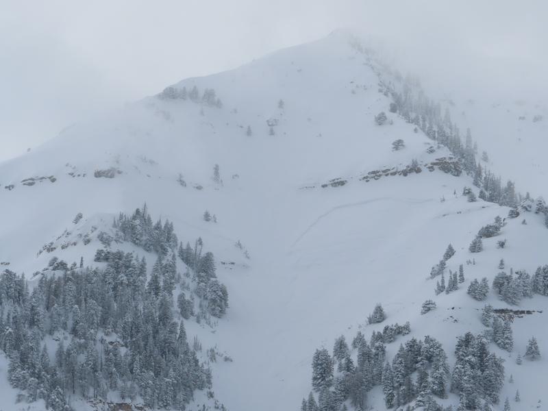
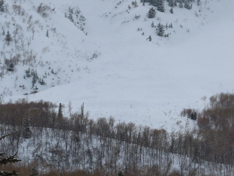
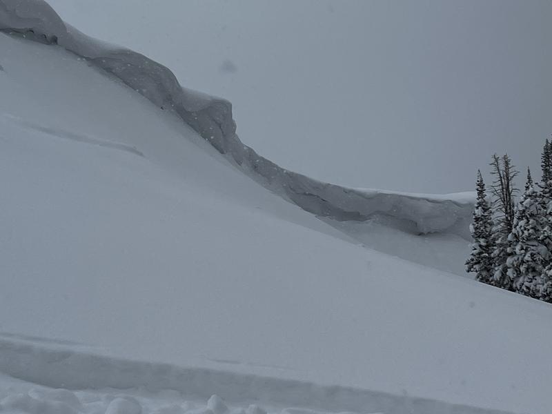
Areas of CONSIDERABLE avalanche danger exist in the mid and upper elevations. You can trigger a 1-3' deep and 300' wide avalanche today. IF the sun comes out for any lengthy period of time, the danger will spike and long running natural avalanches will be possible.
***Cautious route finding and conservative decision making today is essential.***
I am keeping my slope angles low for another day or so.
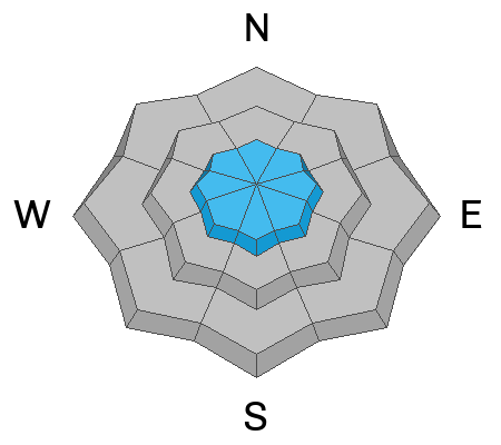
Low
Moderate
Considerable
High
Extreme
Learn how to read the forecast here
Special Announcements
To help you safely enjoy the backcountry, the UAC team is constantly evaluating and implementing new programs and technologies. Donate to the Spring Campaign to help our team implement innovative tools and better provide you with the information you rely on.
Thank You!
Weather and Snow
The moon glows the same
It is the drifting cloud forms
make it seem to change.
--- Matsuo Bashō (1644-1694)

Under the full moon, we have mostly cloudy skies.
Mountain temperatures are in the teens. Winds, again mercifully, are light from the west. Only the highest ridgelines are experiencing gusts of 25mph. The mountains squeezed another trace to 1" overnight.

For today, we'll see intermittent snow showers with narrow windows of filtered sun. Hopefully very narrow. Temperatures will be in the mid 20s. Winds will be light from the west-southwest.
We'll see another burst of snowfall Wednesday (perhaps 2-5") with Thursday providing something of a day of rest. We'll need it, for Friday ushers in a well advertised wet, warm, and windy atmospheric river event from the west/southwest. The view from here is 10-18" of heavy dense snow with an initial rain/snow line as high as 8000', possibly higher.
Recent Avalanches
The Provo mountains experienced a large and catastrophic avalanche cycle Sunday night into very early Monday morning. Observers noted some avalanches on Timpanogos that haven't run as far since 1993. Photos (UDOT Provo)
Ad
Avalanche Problem #1
New Snow
Type
Location
Likelihood
Size
Description
You will be able to trigger new snow avalanches big enough to kill you in steep terrain today.
Both soft slab avalanches and loose snow sluffs are likely on a variety of aspects and elevations, but the most dangerous and unpredictable avalanches in the central Wasatch have been on mid and upper elevation slopes with a buried crust 1-3' down. These crusts may be found on east to south to west facing aspects, but all the avalanches have been (so far) on east and southeast facing aspects. THIS IS BULLS-EYE INFORMATION.
Snow tests have been inconsistent in showing a guilty snowpack, but this leads to more uncertainty and more caution.
I would approach any steep terrain with caution today.
Note that avalanches will release well off the ridgelines and not in usual starting zones.
In your decision making today, ask yourself and your partners, "Is this slope safe?" and Why...
Avalanche Problem #2
Wind Drifted Snow
Type
Location
Likelihood
Size
Description
Soft slabs of wind blown snow may be most prevalent along the highest, highest ridgelines. Note as well that this season, the CORNICES are ENORMOUS. Give these yawning waves a very wide berth along the ridgelines.
Additional Information
General Announcements
This information does not apply to developed ski areas or highways where avalanche control is normally done. This forecast is from the U.S.D.A. Forest Service, which is solely responsible for its content. This forecast describes general avalanche conditions and local variations always occur.