To help you safely enjoy the backcountry, the UAC team is constantly evaluating and implementing new programs and technologies.
Donate to the Spring Campaign to help our team implement innovative tools and better provide you with the information you rely on. Thank You!
Overview: The storms continue as quick moving trough of low pressure moves over the area late tonight with strong convection that could cause some lightning. It will bring snowfall late this afternoon and this evening. There is a break Thursday before a warm and wet storm arrives late Friday and lasts through the weekend. According to NWS forecasters "this storm will be fed by a warmer inland penetrating atmospheric river with denser snow and higher snow levels." Another brief break is possible Monday before another storm may come on Tuesday. NOTE, if you're looking for a day with some sunshine to get out, consider planning on tomorrow (Thursday) as the weather will be a wild ride through the weekend (Read more about it from Jim Steenburgh
HERE)
Temperatures this morning at most elevations are hovering around 20° F. Today they should warm into the upper 20s F.
Winds from the south and southwest are averaging 7-14 mph gusting 20 mph. They shouldn't do much until this afternoon ahead of the approaching trough when southwest winds could become quite gusty reaching 40-60 mph.
Snowfall yesterday was limited to some snowflakes dancing in the air without any accumulation. Light snowfall should start around midday with high snowfall rates sometime around the end of today and this evening when some lightning will be possible. By tomorrow morning there should be 2-5" of new snow with higher amounts of 10" in some areas.
Snow conditions are fantastic with great powder riding. Southerly facing slopes received just enough sunshine yesterday to have a soft crust on them this morning. Total snow depths are 8-10' in the Provo area mountains, and even places like Aspen Grove have 8 feet of snow on the ground - amazing!
Recent avalanche activity is worth paying attention to. There were avalanches mostly on Sunday and Monday 1-3' deep and 50-300' wide on E and SE aspects between 8300' and 10,600' on a crust that formed during sunshine last Thursday. Some of these were triggered remotely. There were also some very large natural avalanches in the Provo area mountains like one of the biggest slides in recent memory in the east chute of Elk Point. Take a look at the massive pile of debris if you're driving to Aspen Grove.
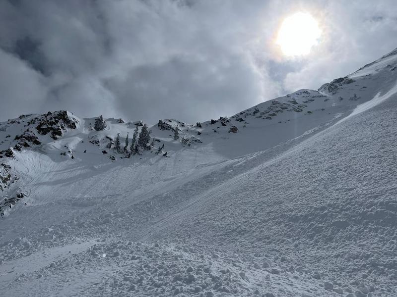
Additionally, there have been some artificially triggered slides in unskied terrain in Little Cottonwood Canyon on an old rime crust on slopes facing SW, W, and NW. One yesterday at 10,800 feet is a good example (photo below). See all the recent slides
HERE.
In most cases, it seems these avalanches have simply been breaking on a softer layer of low density snow on top of these crusts, but there is always a bit of uncertainty with snow.
Photo of artificially triggered slide in LCC in unskied terrain at 10,800 on a WNW facing slope.
A note about explosive triggered avalanches: Explosives are a great tool to trigger avalanches but in many cases, a single explosive placed in the snow does not impact the snowpack much more than a person would. We pay close attention to all triggered avalanches regardless of how they were triggered.