Forecast for the Provo Area Mountains

Trent Meisenheimer
Issued by Trent Meisenheimer for
Sunday, March 31, 2019
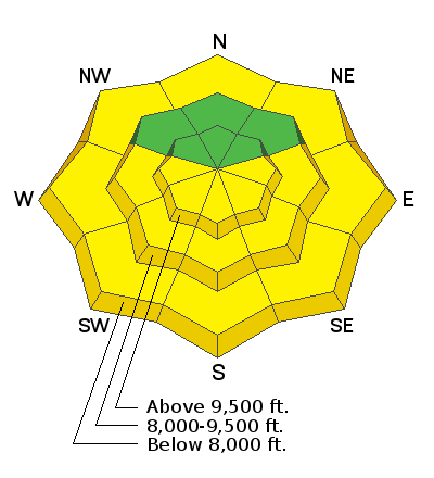
This morning the avalanche danger is LOW. By mid morning and early afternoon the avalanche danger will quickly rise to MODERATE or higher in the steep sunlit terrain due to strong sun and warming temperatures. Human and natural wet loose avalanches will be possible.

The mid and upper elevation northwest through northeast facing terrain has a LOW danger, where there is an isolated chance of triggering a shallow new snow soft slab avalanche.
Low
Moderate
Considerable
High
Extreme
Learn how to read the forecast here
Special Announcements
Utah has a rich history of avalanches. From the earlier mining days of Alta to the start of avalanche research and snow science in the US in Little Cottonwood Canyon in 1939. Snowpack and weather data has been collected from the Alta Guard Station every year since making it the longest snow plot history in the US. These roots made the UAC an early leader in avalanche education and forecasting.
Weather and Snow
Under clear skies the overnight mountain temperatures dropped into the teens °F at the mid and upper elevations leading to a solid re-freeze of the snow surface. Winds are from the northerly direction blowing 5-10 mph across the upper elevations. Today will be a beautiful sunny day with temperatures rising into the 30's & 40's at 7,000'. By the afternoon the 10,000' temperatures will rise into the mid to upper 20's °F. Winds will be from the northerly direction and they will remain calm throughout the day.
Yesterday's sun and warm temperatures cooked many if not all the steep sunlit slopes. The snow became wet and soggy on all aspects below about 7,500' by late afternoon. This morning those aspects and elevations will have a supportable crust that will quickly soften by mid morning. The northwest, north and northeast facing slopes above about 8,500' in elevation has excellent dry cold powder snow.
Recent Avalanches
Yesterday, the mountains went through a natural wet loose avalanche cycle beginning about 11:00 am. Most of these slides were small, starting at and point and fanning out 50' feet wide before stopping in the lower angled terrain. However, one wet loose avalanche was triggered off Mt. Superior in Little Cottonwood Canyon from skiers descended late in the day. The wet debris ran for 1,500' vertical feet down the slope and left a large enough debris pile to bury a human. There were two reports of skiers getting tangled up in small loose wet avalanches yesterday taking very short rides with no injuries.
Ad
Avalanche Problem #1
Wet Snow
Type
Location
Likelihood
Size
Description
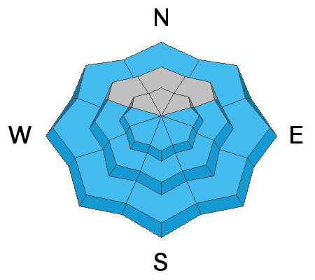
Strong sun and warming temperatures will be the main issue today. The good news: this problem is predictable and avoidable. As the day heats up the east facing terrain will be the first to become wet and soggy, followed by the south, southwest and finally the west aspects later in the day. As the snow surface becomes damp, wet and soggy it's time to get off of and out from under any steep sunlit terrain. This wet snow could pack a punch if gets warm enough today as there are slick crusts 10-15" down for the wet snow to run fast and far on.
Think about your exit strategy today. If you're riding out one of the many steep drainages remember, there are steep slopes way above you where wet debris could travel a long distance from above. This afternoon would not be a good day to snowshoe or be walking underneath any of the steep slopes above the Aspen Grove parking lot as wet avalanches can travel long distances from above.
General Announcements
This information does not apply to developed ski areas or highways where avalanche control is normally done. This forecast is from the U.S.D.A. Forest Service, which is solely responsible for its content. This forecast describes general avalanche conditions and local variations always occur.