Forecast for the Provo Area Mountains

Drew Hardesty
Issued by Drew Hardesty for
Monday, April 1, 2019
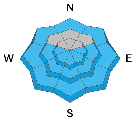
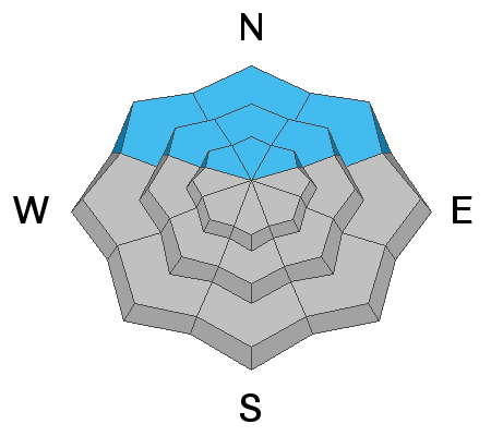
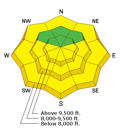
The avalanche danger starts out at LOW this morning. By mid morning and early afternoon, the avalanche danger for wet avalanches will quickly rise to MODERATE or higher in the steep sunlit terrain due to strong sun and warming temperatures. Natural and wet loose avalanches will be possible. With advancing clouds, low to mid elevation northerly slopes may become damp and unstable as well.
The mid and upper elevation northwest through northeast facing terrain has a LOW danger, where there is an isolated chance of triggering a shallow new snow soft slab avalanche.
Low
Moderate
Considerable
High
Extreme
Learn how to read the forecast here
Special Announcements
Utah has a rich history of avalanches. From the earlier mining days of Alta to the start of avalanche research and snow science in the US in Little Cottonwood Canyon in 1939. Snowpack and weather data has been collected from the Alta Guard Station every year since making it the longest snow plot history in the US. These roots made the UAC an early leader in avalanche education and forecasting.
Weather and Snow
Under mostly clear skies, temps are in the mid to upper 20s. Winds are generally light. East to south to west aspects will be crusted this morning but will soften earlier than the last two mornings.
Recent Avalanches
No activity reported from yesterday but wet loose slides were likely with daytime warming.
Ad
Avalanche Problem #1
Wet Snow
Type
Location
Likelihood
Size
Description
Wet loose avalanches will again be the main issue today. The good news: this problem is predictable and avoidable. As the day heats up the east facing terrain will be the first to become wet and soggy, followed by the south, southwest and finally the west aspects later in the day. As the snow surface becomes damp, wet and soggy it's time to get off of and out from under any steep sunlit terrain. This wet snow could pack a punch if gets warm enough today as there are slick crusts 10-15" down for the wet snow to run fast and far on.
The fine print: Increasing clouds today may either offset or accentuate the wet activity today by either blotting out the sun OR promoting greenhousing (trapping and adding heat to even low and mid-elevation northerly slopes). Similarly, the winds shouldn't be a factor until overnight, but...if they kick in earlier, they'll help offset the heating issues. The key will be to recognizing how the snow is behaving and adjusting your terrain selection accordingly.
Avalanche Problem #2
Normal Caution
Type
Location
Likelihood
Size
Description
The Provo mountains has a great deal of high alpine terrain with great exposure and spatial variability in the snowpack. Yesterday my partner and I backed off a steep wind loaded slope where the older drift felt punchy and 'upside down' over some faceted graupel (pellet snow). Tests hinted at instability and we made the conservative decision to depart. This was on the north side of Timpanogos at 9800'. Observation here.
General Announcements
This information does not apply to developed ski areas or highways where avalanche control is normally done. This forecast is from the U.S.D.A. Forest Service, which is solely responsible for its content. This forecast describes general avalanche conditions and local variations always occur.