A new version of the UAC's mobile app has been released with many new features and performance improvements. Download our app today, available on iPhone and Android. Learn more HERE.
Overnight, temperatures dropped below freezing for the first time in 10 days, to the low 30s °F. Skies remained mostly clear until early morning, when incoming clouds caused a slight temperature rebound. At upper elevations, north winds blew at 10–20 mph with gusts in the 20s, shifting east by early morning.
Today, skies will be partly sunny with mountain temperatures rising into the 50s °F. Winds continue to veer south and blow 10-25 mph with gusts into the 30s along upper elevation ridges.
Outlook: Stormy weather returns next week, but sadly, models have trended down, and the storm doesn't look as significant as it once did. Stay tuned.
There were no avalanches reported yesterday from the Southern Wasatch. Access is becoming increasingly challenging as low and mid-elevation snow melts.
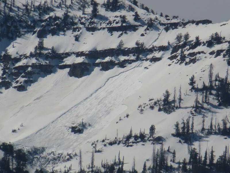
Over the last week, many wet snow avalanches have occurred and have been documented from Mill Canyon Peak, Box Elder Peak and along the Cascade Ridge. Big thanks to Trevor, Nikki, and UDOT Provo for getting out and recording the avalanche activity and sharing excellent photos.
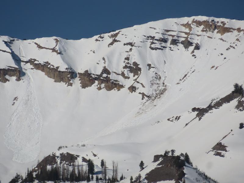
Wet-loose and Wet-Slab activity from Cascade (UDOT)