Forecast for the Provo Area Mountains

Greg Gagne
Issued by Greg Gagne for
Wednesday, February 6, 2019
The avalanche danger is HIGH at upper elevations, CONSIDERABLE at mid elevations, and MODERATE at low elevations. Several days of wind and snowfall have created dangerous avalanche conditions, especially in the mid and upper elevations which have been wind-loaded. Avoid being on or underneath avalanche terrain which is any slope steeper than 30 degrees. Cornices are large and sensitive, so avoid traveling close to the edges of corniced ridges.
Low
Moderate
Considerable
High
Extreme
Learn how to read the forecast here
Avalanche Warning
THE UAC HAS ISSUED AN AVALANCHE WARNING THIS MORNING THROUGH 6 AM MST THURSDAY
FOR THE WASATCH MOUNTAINS SOUTH OF I-80, WESTERN UINTAS, AND MANTI SKYLINE.
THE AVALANCHE DANGER IS HIGH TODAY.
HEAVY SNOW AND STRONG WINDS ARE CREATING WIDESPREAD AREAS OF UNSTABLE SNOW AT MID AND UPPER ELEVATIONS. HUMAN TRIGGERED AND NATURAL AVALANCHES ARE LIKELY. STAY OFF OF AND OUT FROM UNDER SLOPES STEEPER THAN 30 DEGREES. TRAVELING IN AVALANCHE TERRAIN IS NOT RECOMMENDED.
Special Announcements
Check out the latest podcast - The Risks and Rewards of Ski Patrol - A Conversation with Jake Hutchinson.
Weather and Snow
Overnight snowfall totals are 1-2" and winds are out of the northwest, gusting in the 20's Temperatures are in the low to mid teens and it is snowing lightly.
Since the storm began on Sunday, the Provo mountains have recorded 2' of snow and nearly 4" of water. Moderate to strong winds, mostly along ridgetops but occasionally getting into mid elevation terrain, have also added stress to the snowpack. These are significant loading events.
For today, light snowfall is forecasted with another 3-6" expected by sundown. Winds will be from the northwest, gusting into the 20's and low 30's along upper elevation ridgelines. Occasional periods of light to moderate snowfall can be expected throughout the day.
Recent Avalanches
No avalanche activity was reported from the Provo mountains on Tuesday. In the Salt Lake mountains, a couple of significant natural avalanches occurred on Tuesday along the Park City ridgeline. These were on northeast aspects that were wind-loaded from the sustained period of strong southwest winds. These avalanches were likely triggered from natural cornice falls, and were on slopes that have previously avalanched this season (known as "repeaters"). These slides included Scott's Peak (observation), but the attention-getter was South Monitor which had a crown up to 8' thick and ran over 1/4 mile wide. You can read Mark White's usual excellent writeup and photos on this observation.
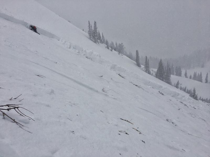
Photo below showing the crown on South Monitor [Mark White photo]
Control work from UDOT in Little Cottonwood Canyon also produced impressive results (link to UDOT Instagram).
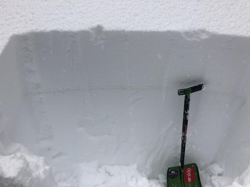
Although much less dramatic than what is shown above, yesterday my partner and I noted three different avalanches in Days Draw (observation). These were failing on a density inversion within the storm snow. Slides similar to this may be possible in the Provo mountains today.
Ad
Avalanche Problem #1
New Snow
Type
Location
Likelihood
Size
Description
Although not much snow is expected in the Provo mountains today, any period of heavier precipitation may create shallow, sensitive storm slabs and sluffing in the low-density storm snow.
Avalanche Problem #2
Persistent Weak Layer
Type
Location
Likelihood
Size
Description
There are two persistent weak layers of concern. The most critical is the weak snow down near the ground, and this layer is most likely to produce avalanches on repeater slopes. The large slides along the Park City ridgeline on Tuesday, and the Little Water Peak slide on Monday (observation) highlight this problem. These slides were triggered from cornice falls and were on steep, wind-loaded slopes facing northeast. The photo below from Little Water highlights how large these avalanches can be.
The second layer is weak faceted snow and surface hoar that was preserved underneath the storm snow. This layer is now buried 2-4' deep, but if you dig down you can see a thin, gray stripe in the snowpack. Field observations indicate the presence and reactivity of this layer varies widely. On Monday I was finding this layer very reactive in both Silver Fork as well as the Guardsman Pass/Peak 10,420' area (observation), but yesterday in Days Draw it was difficult to identify. You are most likely to find this layer on slopes above 8000' facing northwest through east. The only way to check for this layer is to dig down 2-4' deep and search for the obvious stripe of faceted snow.
Avalanche Problem #3
Wind Drifted Snow
Type
Location
Likelihood
Size
Description
Moderate to strong winds from the south/southwest persisted for several days, drifting many mid and upper elevation slopes. Storm snow overnight and through today will cover these drifts, but today's winds from the northwest will create fresh drifts, especially at the upper elevations. Any increase in wind speeds will quickly drift the low-density snow that will fall today, creating sensitive slabs.
Additionally, cornices have grown quite large over the past several days, and are breaking back much further than expected. Be sure to give any cornices a very wide berth by not traveling anywhere close to corniced ridges.
General Announcements
This information does not apply to developed ski areas or highways where avalanche control is normally done. This forecast is from the U.S.D.A. Forest Service, which is solely responsible for its content. This forecast describes general avalanche conditions and local variations always occur.