An AVALANCHE WARNING continues for the Western Uintas and the Manti-Skyline Plateau. If you're headed that way or know someone who is, please spread the word and have them check in with that area's forecast.
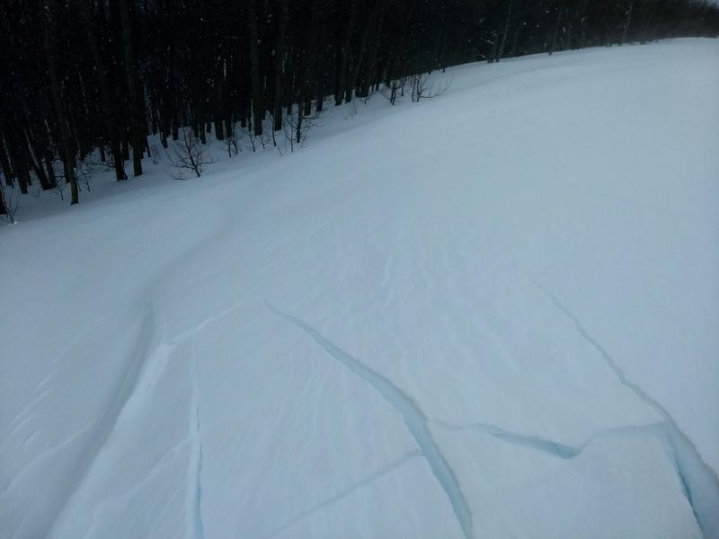
Along a cool west-northwest flow, a trace to 2" fell overnight, pushing storm totals since Saturday night to 34' of snow and 3.65" of water. Moderate to strong winds, mostly along ridgetops but occasionally getting into mid elevation terrain, have also added stress to the snowpack. These are significant loading events. West-northwest winds are generally 15mph with gusts to 25. The highest, most exposed anemometers are averaging 35-40mph with gusts near 60. Temps are in the low single digits on either side of zero.
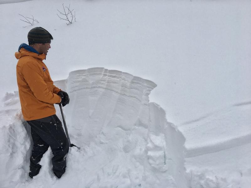
Snow depths are 80-90". Skiing and riding conditions are out of this world. People lives are changed by conditions like these.
Overcast skies and light flurries should fade away by the afternoon toward partial clearing. Mountain temps will be in the single digits up high, the low teens at other elevations. Winds will be west-northwesterly blowing 15mph. I do have some concern that the winds will remain gusty along the highest peaks and ridgelines through early afternoon.
A weak system should produce another 2-4" Saturday/Saturday night with another storm Sunday night into early Tuesday. Perhaps another 5-10"? Another possibly going south for Valentine's Day...and perhaps another after that?...Stay tuned -
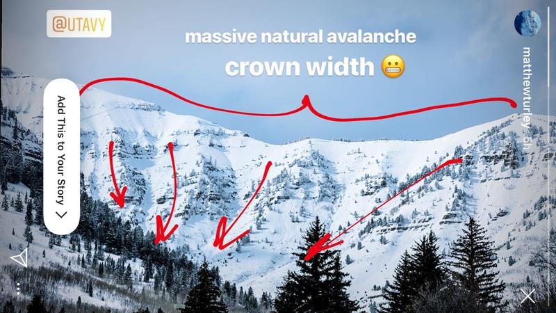
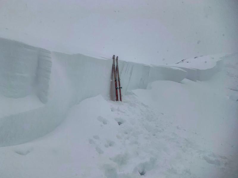
A natural avalanche likely occurred yesterday in upper Primrose Cirque above Aspen Grove on Timpanogos. It was large and destructive and thousands of feet wide. Thanks Matt Turley for the photo below. There was also a very large natural 3-8' deep on the 4th on the southern end of Timp at 8500-9000' elevation (est).