UDOT PLANNED AVALANCHE CLOSURES!!

Forecast for the Provo Area Mountains

Dave Kelly
Issued by Dave Kelly for
Thursday, December 8, 2022
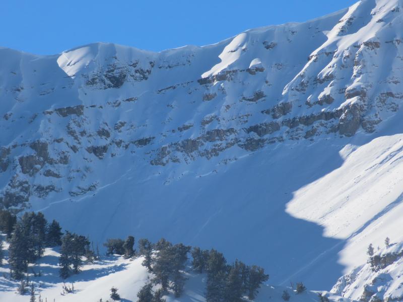
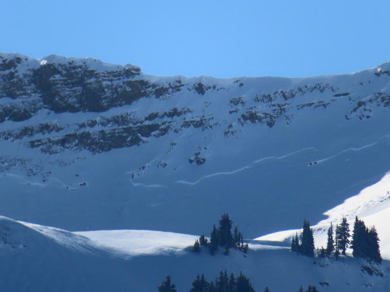
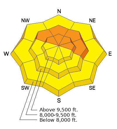
A CONSIDERABLE avalanche danger exists on steep northwest to east facing slopes at the mid and upper elevations. Human triggered avalanches 1-3' deep and up to 300' wide are likely...and may be triggered at a distance.
A MODERATE avalanche danger exists on all southwest-south-southeast facing slopes and in the low elevation bands.

Great skiing can be had on low angle terrain not attached to steeper slopes.
Low
Moderate
Considerable
High
Extreme
Learn how to read the forecast here
Special Announcements
Join the Utah Avalanche Center and the Division of Outdoor Recreation to celebrate the Fourth Annual Avalanche Awareness week, from December 4 - December 11. Click here to view the full list of events for the week. The next event is a - Fireside Chat with Drew Hardesty at Lone Pine Gear Exchange.
Weather and Snow
Under overcast skies the mountain weather stations in the Provo area are reporting a trace to 2" of new snow. Temperatures are in the mid-teens F. Winds are blowing southerly light gusting to moderate.
For today, overcast skies clearing through the day and winds peaking early this morning before decreasing. Winds will be southwesterly 15 gusting to 25 MPH. Temperatures will be 26-30 F.
Snow depths range from 2-3' in the Provo area mountains.

Mark Staples put together a comprehensive Weather and Snow Summary HERE>
Recent Avalanches
The last reported avalanche cycle from the Provo area mountains was reported on Sunday December 6th from Timpanogos. These avalanches likely failed on the buried persistent weak layer.
Photo (UDOT Provo)
Check out the list of avalanche activity HERE.
(Uncertain of locations? Check out the Wasatch Backcountry Skiing map...or app on your phone)
Ad
Avalanche Problem #1
Persistent Weak Layer
Type
Location
Likelihood
Size
Description
The mid-November drought created a very weak layer of facets and patches of buried surface hoar on all aspects and elevations throughout the Wasatch Range. Avalanches have been triggered at this weak interface as well as collapsing and whoomphing. These signs are clear red flags that avalanches could occur today.
Northwest through east facing aspects harbor a layer of weak faceted snow and have also seen the most wind loading and this is why the danger remains considerable on these aspects. On southwest-south-southeast aspects the danger remains moderate because there is less snow on top of the weak faceted layer and there is a lower likelihood of triggering an avalanche on these aspects. Mark Staples explains more about southerly slopes in the video below.
Additional Information
MOST ACCIDENTS AND FATALITIES OCCUR DURING A CONSIDERABLE AVALANCHE DANGER THAT INVOLVES A PERSISTENT WEAK LAYER.
A word to the wise: Don't get fooled.
As avalanches become more stubborn and cracking and cracking become less commonplace, there can be a tendency to believe that conditions are improving faster than they are.
The GOOD NEWS is that riding conditions are 5 STAR on shady low angle slopes. Choose low angle terrain with nothing steep above you.
General Announcements

This information does not apply to developed ski areas or highways where avalanche control is normally done. This forecast is from the U.S.D.A. Forest Service, which is solely responsible for its content. This forecast describes general avalanche conditions and local variations always occur.