Forecast for the Provo Area Mountains

Drew Hardesty
Issued by Drew Hardesty for
Wednesday, December 7, 2022
TRICKY AND DANGEROUS
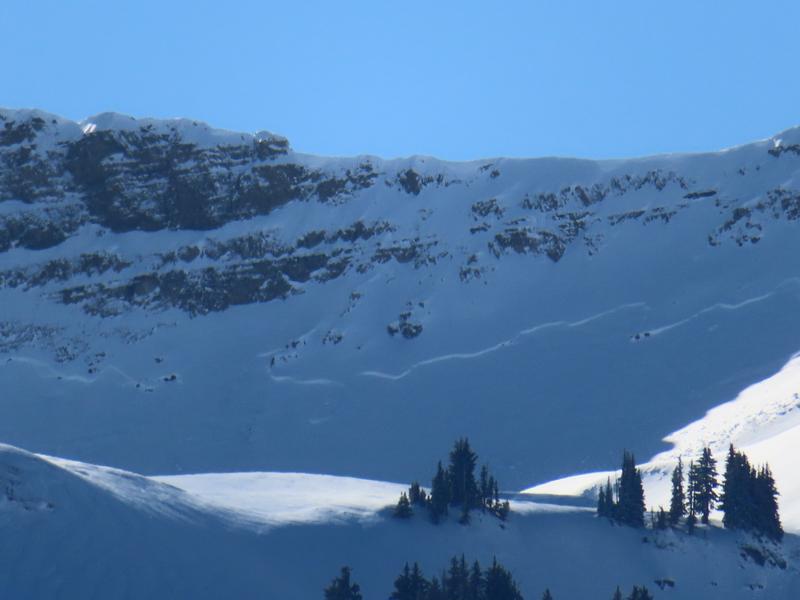
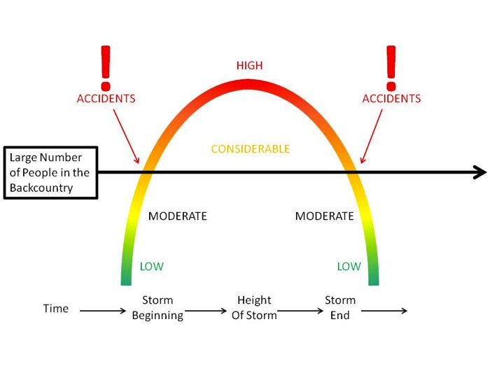
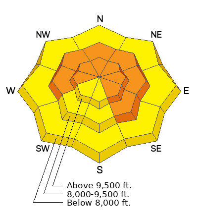
A CONSIDERABLE avalanche danger exists on steep west to north to southeast facing slopes at the mid and upper elevations. Human triggered avalanches 1-3' deep and up to 400' wide are likely...and may be triggered at a distance. A MODERATE avalanche danger exists on all south and southwest facing slopes and in the low elevation bands.
NOTE that loose dry new snow avalanches are possible in steep northerly terrain again today.
Travel Advice: Choose low angle terrain with nothing steep above.
Low
Moderate
Considerable
High
Extreme
Learn how to read the forecast here
Special Announcements
Join the Utah Avalanche Center and the Division of Outdoor Recreation to celebrate the Fourth Annual Avalanche Awareness week, from December 4 - December 11. Click here to view the full list of events for the week. A few of note below:
Weather and Snow
Cold, full winter moon.
Split flow. Clouds, light snow streaming
from the south. Evening.

Skies are partly cloudy. Winds are hardly a whisper. Mountain temperatures are in the teens and low 20s.
Riding conditions remain excellent although solar aspects will host a breakable sun crust this morning.
Snow depths are 30-40" in the mid and upper elevations and travel is fast and easy. It's been a banner early winter thus far and we sit at 154% of normal for the state. (More INFO)
(USDA NRCS)

For today, we'll see increasing clouds and light snowfall this evening streaming in from the south. 2-4" can be expeected for the Provo mountains. Winds will be light from the southeast. Temps will remain cool - in the low 20s.
OUTLOOK: An active weather pattern continues. We'll see a break Thursday with a quick hitting storm for Friday that may produce another 3-6" of snow. Winds will increase from the south ahead of another set of storm for late weekend into early next week. Whatever snow dance or jig you guys are doing out there...keep going.

Mark Staples put together a comprehensive Weather and Snow Summary HERE>
Recent Avalanches
The Provo area mountains experienced a widespread avalanche cycle late weekend into early Monday. Enough snowfall (1-1.30"SWE) and wind tipped to balance to produce numerous soft and hard slab avalanches failing 1-3' deep on our November PWL (persistent weak layer) of weak sugary facets. These avalanches were primarily in the upper elevations on north through east aspects. Thanks much to UDOT Provo canyon for the photos from the UFO Bowls and high on Timpanogos.
Ad
Avalanche Problem #1
Persistent Weak Layer
Type
Location
Likelihood
Size
Description
The mid-November drought created a very weak snow surface composed of facets and patches of surface hoar on all aspects and elevations throughout the Wasatch Range. Avalanches have been triggered at this weak interface nearly every day in the Central Wasatch since November 29th..with an extensive avalanche cycle occurring in Provo on this layering late weekend. North and East facing aspects harbored some of the weaker faceted snow and have also seen the most wind loading (primarily last Wednesday and Thursday). Not surprisingly, the bulk of the natural and human triggered avalanches have occurred on these aspects.
These soft and hard slab avalanches are failing on this weak PWL (persistent weak layer) 1-4' deep and up to 400' wide. These avalanches are sometimes accompanied by audible whumphs or collapses...with many of them triggered at a distance. It should be noted that collapsing and cracking exist in the low elevations as well, although there is not as much of a well developed slab there as in higher terrain.
If you dig down into the snow, you can easily see the poor snow structure that is causing avalanches, particularly on wind loaded slopes.
November's low sun angle and colder than normal temperatures led to a poor snowpack structure on south and west facing aspects and backcountry observers have experienced cracking and collapsing in this terrain. This is unusual. Although these "off aspects" have a more complicated snow structure and have experienced less loading (in fact some scouring away of snow), I am not ready to trust these aspects just yet.
TREND: STEADY
Additional Information
MOST ACCIDENTS AND FATALITIES OCCUR DURING A CONSIDERABLE AVALANCHE DANGER THAT INVOLVES A PERSISTENT WEAK LAYER.
A word to the wise: Don't get fooled.
As avalanches become more stubborn and cracking and cracking become less commonplace, there can be a tendency to believe that conditions are improving faster than they are.
The GOOD NEWS is that riding conditions are 5 STAR on shady low angle slopes. Choose low angle terrain with nothing steep above you.
General Announcements

This information does not apply to developed ski areas or highways where avalanche control is normally done. This forecast is from the U.S.D.A. Forest Service, which is solely responsible for its content. This forecast describes general avalanche conditions and local variations always occur.