Forecast for the Provo Area Mountains

Drew Hardesty
Issued by Drew Hardesty for
Sunday, December 3, 2023
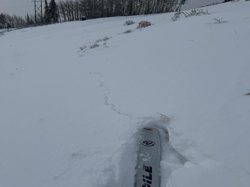
AVALANCHES ARE OCCURRING NOW.
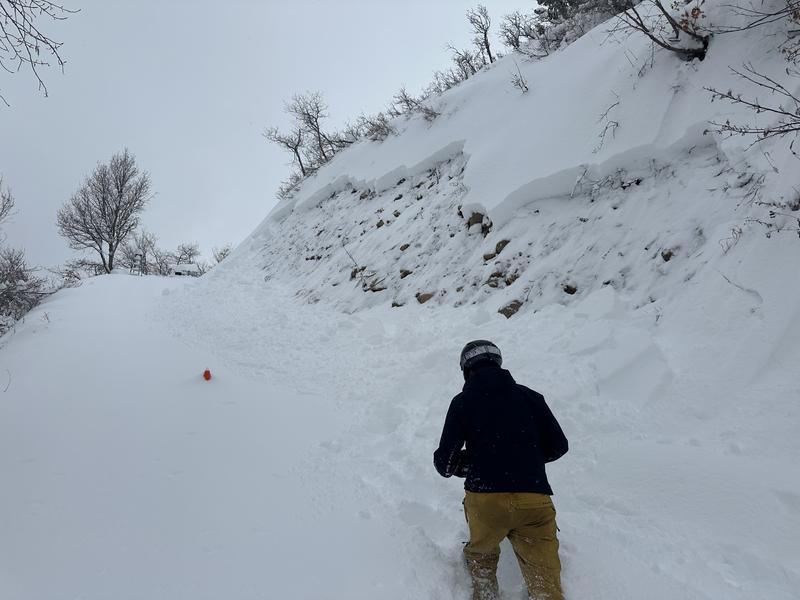
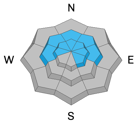
The avalanche danger is HIGH on many slopes of the mid and upper elevations. The danger is CONSIDERABLE on many slopes down low.
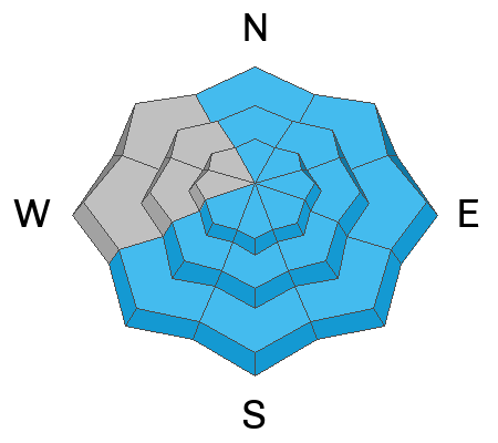
Avalanches can be triggered at a distance and trigger other avalanches in adjacent terrain.
The TRAVEL ADVICE is easy today: Travel in avalanche terrain is not recommended. This includes below avalanche terrain. Remember that traumatic injury is likely with any avalanche involvement this early season.
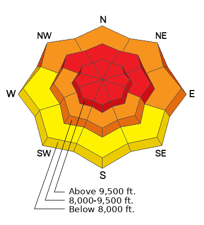
Low
Moderate
Considerable
High
Extreme
Learn how to read the forecast here
Special Announcements
The 5th Annual Avalanche Awareness Week is December 3-10. The week's goal is to save lives through activities that promote avalanche awareness, education, and safety. We have a variety of events around the state. Find an event near you.
Weather and Snow
The Winter Storm Warning continues through Monday morning.

Could a decaying atmospheric river be denied?
It's been a powerhouse: strong wind, heavy dense snowfall, blowing and drifting snow, rising temperatures. And the storm rages on.
Overnight snow and water numbers are 6-12" (2.21" snow water equivalent). Storm totals are 30"/3.57" snow-water-equivalent at Sundance and half-to two-thirds that elsewhere in Provo.
Aside from all the snow, winds from the west-northwest have been merciless and punishing at all elevations. At 11,000', another violent gust just after midnight hit 109mph and even the low/mid elevation anemometers are spinning 25mph gusting 45mph. Mountain temperatures have climbed into the mid to upper 20s.

For today, we'll see continued, albeit diminished, snowfall rates with moderate to strong winds from the west-northwest. Temperatures will be in the mid to upper 20s. I expect an additional 5-10" of snow through tomorrow morning, where the winds, finally, start to lose steam. We start to clear by Monday afternoon with a warming trend pushing mountain temperatures into the upper 30s to upper 40s (mid-elevations) by Tuesday. A weak system follows for Thursday.
Recent Avalanches
Widespread cracking and collapsing were key clues to instability yesterday. One observer in the left hand fork of Hobble Creek noted a good avalanche on a road-cut that pulled out to the ground. Estimates are 2' deep and 50' wide. THIS is a key observation the confirms very dangerous avalanche conditions on (and below) steep terrain.
Ad
Avalanche Problem #1
Persistent Weak Layer
Type
Location
Likelihood
Size
Description
You will be able to trigger large and dangerous avalanches at a distance today that fracture down into the old weak snow from October/November. This weak basal stack of cards exists primarily on westerly to northerly to easterly aspects at the mid and upper elevations. These avalanches may be 2-4' deep and hundreds of feet wide. They are not to be messed with. Cracking and collapsing state the obvious, as it were, but the only prudent terrain choices are on low angle terrain today.
Avalanche Problem #2
Wind Drifted Snow
Type
Location
Likelihood
Size
Description
You'll find an endless supply of soft slabs of wind drifted snow in a variety of encatchment areas, both along the ridgelines and well below. These large smooth pillows may be up to 4' deep or more in exposed terrain and will also be sensitive to the weight of a backcountry traveler. Be aware that the cornices are growing and becoming unstable - any cornice fall is likely to trigger an avalanche below.
Avalanche Problem #3
New Snow
Type
Location
Likelihood
Size
Description
Heavy dense snowfall is coming in on a warming trend and is "upside-down"; that is - higher density snow falling on lower density snow - and it's a recipe for trouble. Similarly, rain on snow at the lowest elevations will lead to unstable wet snow conditions. Shooting cracks are a clear sign of instability (Brackelsberg photo)
Additional Information

Forecaster's Corner:
Matsuo Bashō lived in Japan from 1644-1694 and is often viewed as the the avalanche hunter's favorite poet. His most famous haiku, below.
❄️
Come, let's go
Snow-viewing
Til we're buried.
General Announcements
This information does not apply to developed ski areas or highways where avalanche control is normally done. This forecast is from the U.S.D.A. Forest Service, which is solely responsible for its content. This forecast describes general avalanche conditions and local variations always occur.