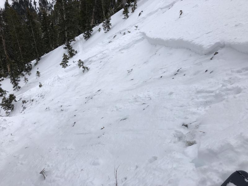
We had hoped our persistent weak layer of weak, faceted snow down near the ground had settled down for a long winter's nap, but
Saturday's Days Draw avalanche was a reminder that this problem still exists on very isolated slopes at the upper elevations, facing primarily north and northeast, but I also am suspicious about east as well. On slopes where the snowpack is deep (3-4'), this weak layer has adjusted to the load and the slab on top is strong. However, in thinner snowpack areas (1-3') this layer is still weak. The average depth of the Days Draw avalanche was 12-24".
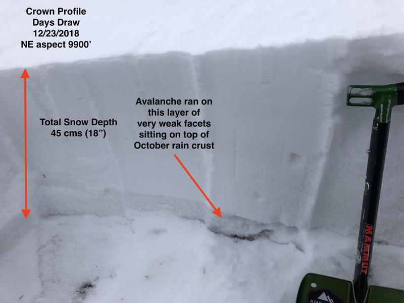
There are two reasons some slopes have a thinner snowpack: they avalanched previously (known as "repeaters") or they are in areas that have received less snow this month. The slope in Days Draw appeared to have been a repeater from late November. The photo below shows the snowpack structure of the crown on the Days Draw avalanche, where the very weak layer of faceted snow down near the ground is clearly visible.
When I visited the Days Draw avalanche yesterday, I was expecting to find the northeast facing slope wind-loaded from recent westerly winds. But there was no wind loading. Other slopes that have this poor structure on a thin snowpack have likely been wind-loaded, adding additional stress to the weak layers below, and are just waiting for the unexpecting rider to hit the sweet spot.
What to do? There were many tracks on the slopes adjacent to the Days Draw avalanche, so tracks are not an indication of stability. However we do know this weak structure exists on slopes with a snowpack less than about 3' deep on slopes facing north through northeast above about 9500'. Avoid these slopes and you avoid the problem.


