Forecast for the Provo Area Mountains

Greg Gagne
Issued by Greg Gagne for
Friday, December 15, 2023
The avalanche danger is LOW and triggering an avalanche is unlikely.

You must continually evaluate the stability of the snowpack when traveling in steep terrain on slopes facing west, north, and east where a persistent weak layer buried 2-3' deep exists.
Low
Moderate
Considerable
High
Extreme
Learn how to read the forecast here
Weather and Snow
6 am: Skies are clear and winds are from the west/northwest and generally light, gusting into the teens along some mid-elevation ridges and into the 20s mph at the uppermost elevations. Temperatures range through the 20s F.
Today: Clear skies with a few high, thin clouds occasionally streaming by. Temperatures will rise into the 30s F and the west/northwest winds will slowly decrease, with gusts into the 20s mph along exposed peaks and ridges at the upper elevations.
Extended Forecast: Unpromising. High pressure dominates our weather into the coming week with a few clouds possible by midweek. The most optimistic outlook for snowfall is after December 25.

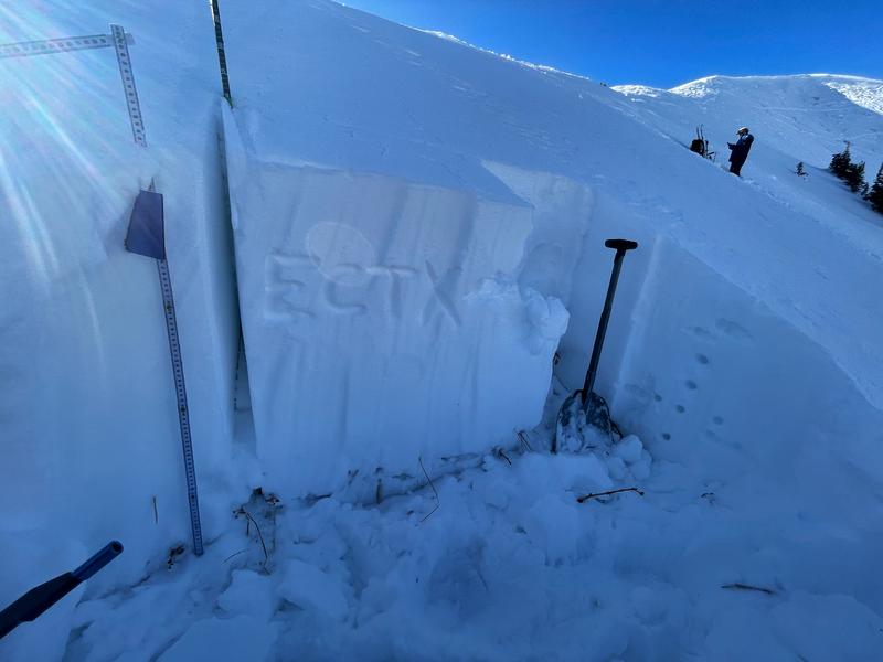
The current weather may make it seem nothing is going on with the snowpack, but clear skies combined with cold temperatures conspire to weaken the snow at the surface and the entire snowpack in areas with shallower snow. Trent explains more in this video. For now, this is not a problem and the weakening of the snow surface is helping keep the snow soft, but it will become a problem once it snows or there is wind drifting.
Recent Avalanches
The most recent avalanche activity reported from the Provo mountains was the natural avalanche cycle from early December. In the Salt Lake mountains, the most recent backcountry avalanche occurred on Saturday, December 9 in the Wilson Chutes. On Thursday, control work from one Cottonwood resort pulled out an avalanche on a steep northerly slope that was over 3' deep and 300' wide.

Mark and Trent were in Big Cottonwood in the Salt Lake mountains yesterday and have a detailed observation of what they found.
Ad
Avalanche Problem #1
Persistent Weak Layer
Type
Location
Likelihood
Size
Description
The buried persistent weak layer (PWL) has become dormant and triggering an avalanche that fails on this layer is unlikely. However, you could still trigger an avalanche in isolated areas, especially where there is a thinner snowpack. If you do trigger an avalanche, it could be 2-4' deep and over a few hundred feet wide.
If you are getting into big terrain where this PWL exists, you will have to continually evaluate the snowpack looking for the dangerous structure of strong snow over weak snow (see photo below). Despite the unlikelihood of triggering an avalanche, I will continue to back off of steep slopes where this dangerous structure exists.

This photo illustrates the structure of strong snow on top of weak snow down near the ground.
General Announcements
This information does not apply to developed ski areas or highways where avalanche control is normally done. This forecast is from the U.S.D.A. Forest Service, which is solely responsible for its content. This forecast describes general avalanche conditions and local variations always occur.