UDOT PLANNED AVALANCHE CLOSURES!!

Forecast for the Provo Area Mountains

Drew Hardesty
Issued by Drew Hardesty for
Wednesday, November 28, 2018
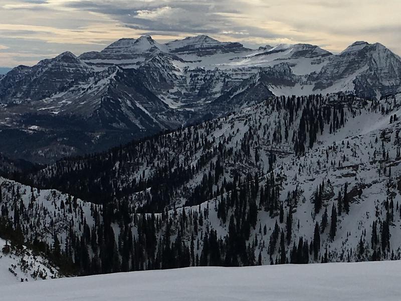
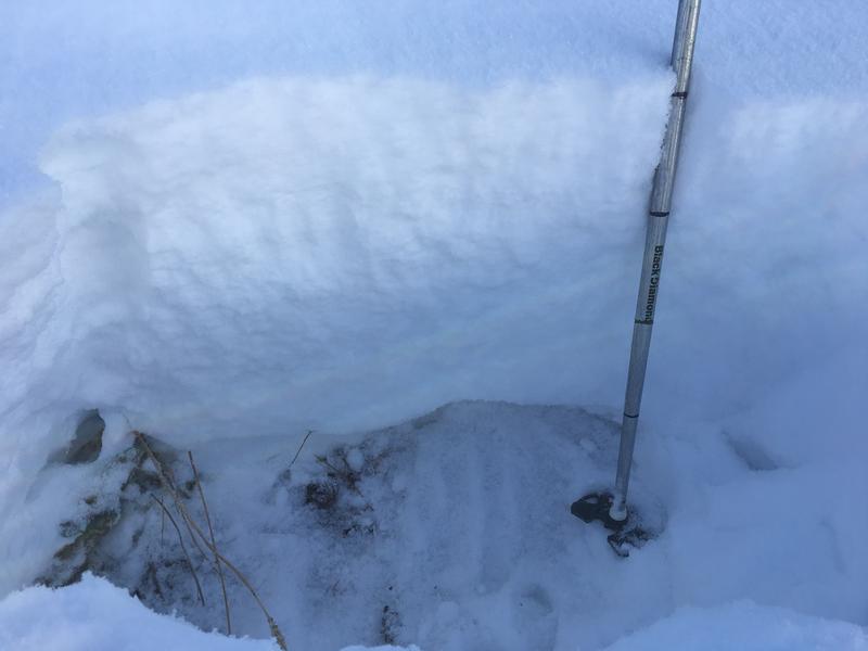
Areas of CONSIDERABLE danger exist on steep mid and upper elevation northwest to easterly facing slopes. The danger is more pockety on west and southeasterly aspects, but the danger is the same. Remember these slides may be triggered at a distance, even from the flats below.
The danger is LOW on south and southwesterly facing slopes where the new snow landed on bare ground.
Low
Moderate
Considerable
High
Extreme
Learn how to read the forecast here
Weather and Snow
Skies are mostly cloudy with temps in the mid to low 30s. Winds are west to southwest, blowing 20mph. Roughly 1-3' of snow exists in the Provo area mountains and early season conditions exist.
We can expect a couple inches overnight with a stronger storm Thursday night to Saturday.
I was in the Provo area mountains Sunday, and here are some photos showing snow coverage. Here's the full observation.
Yesterday's photo of the north side of Timpanogos below (pc:Lees)
Recent Avalanches
No avalanches reported from the Provo area mountains. However, conditions at the mid and upper elevations are probably similar the the Salt Lake area mountains to the north, where there is easier access to the higher elevations and numerous avalanches being triggered. Check the Salt Lake forecast and the avalanche list for an idea of what the mid and upper elevations in the Provo area mountains may be like.
Ad
Avalanche Problem #1
Persistent Weak Layer
Type
Location
Likelihood
Size
Description
It is very simple – steep slopes with old snow are dangerous. Any slope that was white with snow before Thanksgiving has weak, sugary facets near the ground. And now these slopes are loaded with new snow, they are continuing to produce avalanches 1 to 3 feet deep. Slides are being triggered from a distance and from on slope. Unfortunately, most slides are running in the upper layer of the facets, above the October rain crust, and not cleaning out lower facets or crusts.
These old faceted snow layers will remain a dangerous weak layer all week and will become even more reactive the next time it snows.
Here's a look of the snowpack at 8,500' on a north facing slope in the Provo area mountains, with the facets at the bottom. The weak facet layer depth will increase with elevation.
Additional Information
Forecaster's Corner:
Clear, cold, and calm days are great days to be in the mountains but they're also the days that do the devil's business in the snowpack, particularly at and just below the snow surface. These were exactly the conditions during Sunday/Monday's high pressure (clear, cold, calm) that fostered the development of both surface hoar (wintertime equivalent of dew) and what we call diurnal recrystallized snow AKA near-surface faceting. Makes for great skiing and riding as the snow surface remains soft and turn-able, but problematic once buried. The question now lies in whether the pendulum has swung the other direction with the last 36 hours of warm, overcast, and some wind. Have the last 36 hours atmospheric conditions destroyed the surface hoar and rounded off the sharp edges from Sunday/Monday? Probably.
How to tell? Snow loupes can offer some insight into the evolution of the snow crystal metamorphism. Or simply being aware of the presence (or lack thereof) of surface hoar. When today's snow surface is slightly buried by a few inches of snow, the various shovel-tilt tests can reveal a lot.
Resources: Birkeland, Johnson, and Schmidt's seminal paper from the mid-90s on near surface faceting is very readable here.
How to Do a Shovel-Tilt test here.