Forecast for the Provo Area Mountains

Mark Staples
Issued by Mark Staples for
Thursday, November 29, 2018
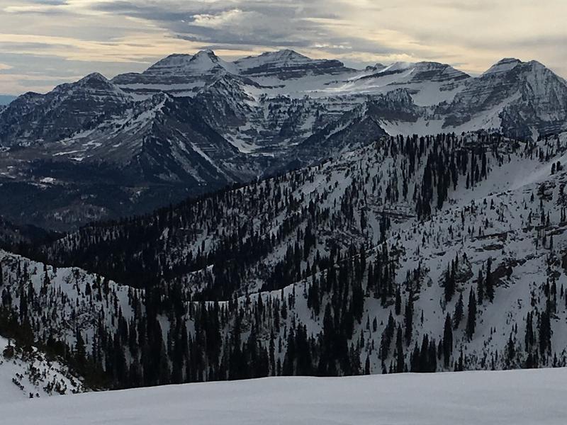
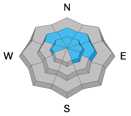
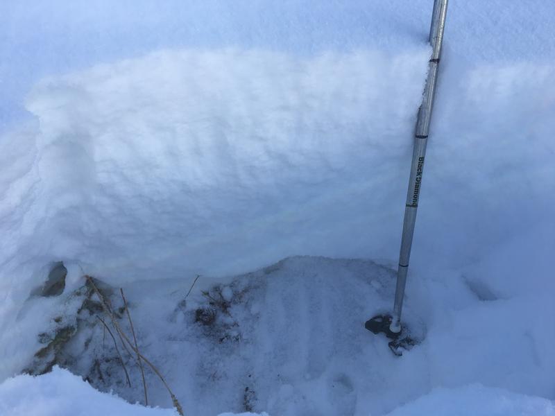
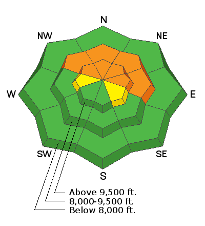
Human triggered avalanches are likely on slopes facing the northern half of the compass at mid and upper elevations where the avalanche danger is CONSIDERABLE. These slopes have old snow from October that weakened and has become a persistent weak layer. This old snow also exists on upper elevation slopes facing W and SE but it is not as widespread thus a MODERATE danger exists on these slopes.
Before Thanksgiving, all other slopes were bare ground and they lack this layer of weak, old snow. With only the new snow from the last week, the danger on these slopes is LOW. The snowpack remains thin on these slopes and there is a greater danger of hitting rocks, stumps and logs. These obstacles will be harder to see with new snow that fell overnight and more falling this afternoon.
Low
Moderate
Considerable
High
Extreme
Learn how to read the forecast here
Special Announcements
The UAC IOS App is not compatible with the new UAC website. We are working to release an updated version of the app as soon as possible. Please bear with us as we get the new app completed and released.
Weather and Snow
Since yesterday the Provo area mountains received 4-6 inches of warm, dense snow (0.5-0.8" of water).
Winds were a little stronger overnight, but are light this morning blowing 5-10 mph from the W and SW.
Temperatures are near 30 degrees F at many trailhead locations. Near ridgetops, temperatures are in the low 20s and upper teens F.
Overall the snowpack is supportable and travel on skis has become much easier.
Today there will be a lull in snowfall but more is on its way this afternoon and tonight. Winds should remain light but increase this afternoon and shift to the SW and S blowing 20-30 mph. Temperatures should warm into the low 30s at 8000 feet. A few inches of snow should accumulate by the end of the day. By tomorrow morning I expect a total of 6-10 inches of snow. Snowfall will continue Friday.
Photo of the north side of Timpanogos from Tuesday below (pc:Lees)
Recent Avalanches
No avalanches reported from the Provo area mountains. However, conditions at the mid and upper elevations are probably similar the the Salt Lake area mountains to the north, where there is easier access to the higher elevations and numerous avalanches being triggered. Check the Salt Lake forecast and the avalanche list for an idea of what the mid and upper elevations in the Provo area mountains may be like.
Ad
Avalanche Problem #1
Persistent Weak Layer
Type
Location
Likelihood
Size
Description
Any slope harboring old snow that fell in October should be avoided because it will likely produce an avalanche. The old October snow became weak and faceted. It is now a persistent weak layer on which many avalanches have occurred. Yesterday this layer was collapsing and whumpfing as Trent and I skied in Big Cottonwood Canyon. I think similar conditions exist in the Provo area mountains.
With 4-6 inches of heavy, new snow this morning, this layer will likely produce avalanches today if you get on a slope steeper than 30 degrees.
HEADS UP - More snow and increased S/SW winds will come this afternoon. These southerly winds will drift snow onto northerly facing slopes which are ones with the weakest and most unstable snow. Depending on how much snow falls tonight, avalanches could occur naturally tomorrow. I would also expect that you could trigger them remotely which means you can trigger them from some distance away.
Below is a photo of the snowpack at 8,500' on a north facing slope in the Provo area mountains, with the facets at the bottom. The weak facet layer depth will increase with elevation.
Additional Information
General Announcements
This information does not apply to developed ski areas or highways where avalanche control is normally done. This advisory is from the U.S.D.A. Forest Service, which is solely responsible for its content. This advisory describes general avalanche conditions and local variations always occur.