Forecast for the Provo Area Mountains

Drew Hardesty
Issued by Drew Hardesty for
Thursday, November 16, 2023
Thanks for checking the forecast, and stay tuned.
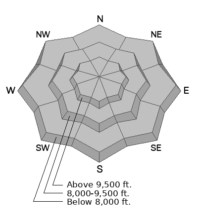
The high elevation shady aspects are holding old snow and are the places where you could run into an avalanche problem. Any new snow may not bond well with old slick crusts or areas of weak sugary faceted snow. The new snow may be sensitive, particularly in steep wind drifted terrain. Remember the old adage - Enough snow to ski or ride means there’s enough snow to slide.

We’ll issue updates as conditions change.
Low
Moderate
Considerable
High
Extreme
Learn how to read the forecast here
Special Announcements
Check out the ski areas uphill travel policies before you head up to their terrain.
Weather and Snow
A quick hitting but warm and wet storm system from the southwest is currently overhead, bringing additional rain and snow to the mountains.
As of 6am, the rain/snow line appears to be at or above 9000' with heavy dense snow reported across the Wasatch. Mountain temperatures are in the mid-to-upper 30s; winds are from the southwest, blowing 20mph with gusts to 35. The highest elevations are gusting to 40mph.
The firehose has its sights set squarely on the Provo area mountains - upwards of 1.25"-1.75" of precipitation has been recorded already near Sundance resort on Timpanogos with at-times hourly rates of 0.41" liquid water per hour. In the highest elevations, you might find 8-12" of dense snow, but you'd have to suffer through heavy rain to get there.
For today, expect rain and snowfall to peak this morning with showers and flurries possibly continuing through early afternoon. The rain/snow line will gently drop to 8500' or so. The next storm arrives this weekend that will bring another good round of snow.

Prior to this storm, most of the southerly and westerly aspects were bone dry. The mid and upper elevation northerly aspects, however, held a mess of 12-18" of wind and temperature crusts interspersed with weak sugary snow. I would view this as a poor basal structure for a snowpack. Remember, anytime there is enough snow to ride, there is enough snow to slide.
I went up to near 10,000' on Timpanogos yesterday.
Recent Avalanches
We have had a few snow and avalanche observations trickle in as people have been getting out and about. Check them out HERE.
If you find something interesting submit it to the UAC HERE.

Check out the ski areas uphill travel policies if you're thinking of taking an early season lap in ski area terrain.
Ad
Additional Information
It’s never too early to start thinking about avalanches. Here are a few things to consider doing:
  • Learn online. We have over 5 hours of free online learning at the Know Before You Go Website
  • Check out the upcoming in-person Know Before You Go events HERE
  • Sign up for an on-snow class
  • Check out the UAC's education progression HERE
  • Get your avalanche rescue gear ready for winter. Put fresh batteries in your transceiver and update the firmware. Inspect your shovel and probe. Get your airbag backpack ready by possibly doing a test deployment and updating the firmware if it is an electric version or getting your canister refilled if it's not electronic.