Join us at our 2nd Annual Blizzard Ball

Forecast for the Provo Area Mountains

Evelyn Lees
Issued by Evelyn Lees on
Tuesday morning, January 8, 2019
AVALANCHE WARNING Today the avalanche danger is HIGH on all mid and upper elevation slopes. The avalanche danger is CONDSIDERABLE at low elevations. Avoid all avalanche terrain and avoid being under or near any steep slope. Even very small slopes can bury a person.
Strong south winds combined with over 3 feet of new snow have created very dangerous avalanche conditions.
ANYBODY going into or near the mountains today whether its skiing, snowshoeing, running, sledding, etc. should avoid being near or under any steep slope.
Low
Moderate
Considerable
High
Extreme
Learn how to read the forecast here
Avalanche Warning
THE FOREST SERVICE UTAH AVALANCHE CENTER IN SALT LAKE CITY HAS CONTINUED A BACKCOUNTRY AVALANCHE WARNING.
TIMING...IN EFFECT FROM 6 AM MST THIS MORNING TO 6 AM MST WEDNESDAY
AFFECTED AREA: FOR THE BEAR RIVER RANGE...UINTA MOUNTAINS...AND PROVO AREA MOUNTAINS OF NORTHERN UTAH.
THE AVALANCHE DANGER FOR THE WARNING AREA IS HIGH TODAY.
VERY DANGEROUS AVALANCHE CONDITIONS EXIST. HEAVY SNOW COMBINED WITH WIND HAS CREATED WIDESPREAD AREAS OF UNSTABLE SNOW. BOTH HUMAN TRIGGERED AND NATURAL AVALANCHES ARE LIKELY. STAY OFF OF AND OUT FROM UNDERNEATH SLOPES STEEPER THAN 30 DEGREES.
Weather and Snow
Whew! It’s been a wild 48 hours of snow and wind in the Provo area mountains - 2 to 4 feet of snow, up to 5 inches of water.
There were significant southwest winds Monday: Ridgeline speeds averaging 30 to 40 mph, with gusts in 60s. Mid and lower elevation winds averaged 15 to 25, with gusts to 40.
This morning, under partly cloudy skies, temperatures are in the 20s, with a few teens at the high elevations. Winds are from the northwest, averaging 5 to 10 mph with the highest peaks averaging 20 mph, with gusts to 30. The snow is “upside down” - denser and wind blown snow is sitting on top of light density snow. So trail breaking is tough and turns punchy.
Recent Avalanches
One very large natural avalanche on Mt Timpanogos in the backcountry terrain near Sundance was reported. It ran the full path and crossed a large flat area.
Drew, Trent and Zinnia had widespread cracking and collapsing, with small test slopes easily releasing.
Ad
Avalanche Problem #1
Wind Drifted Snow
Type
Location
Likelihood
Size
Description
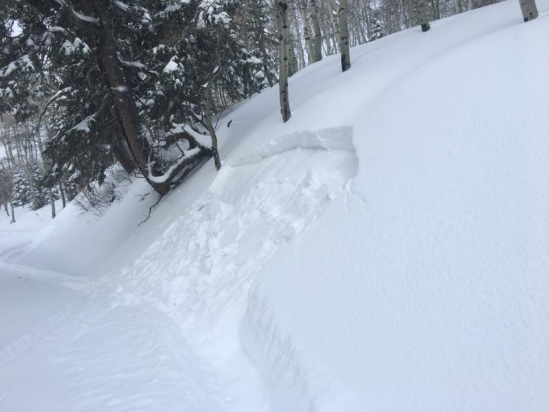
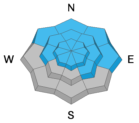
Yesterday’s winds were drifting snow at all elevations and on all aspects - high ridge lines, mid elevations bowls and subridges and even into the low elevations. Avoid the dense and cakey slabs of wind drifted snow on steep slopes and watch for these smooth, rounded drifts in unusual spots at the mid and lower elevations. Instead, head for very wind sheltered terrain.
Avalanche Problem #2
Persistent Weak Layer
Type
Location
Likelihood
Size
Description
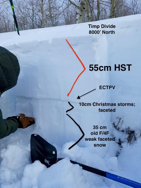
With the current load of snow which will be approaching 5 inches of water weight, all bets are off as to how the snowpack will react. There are persistent weak layers of sugary, faceted snow crystals near the ground and also buried 2-4 feet deep just under the new snow. These weak layers can produce large slab avalanches that can be triggered from some distance away or even from flat terrain under a steep slope.
Avalanche Problem #3
Wet Snow
Type
Location
Likelihood
Size
Description
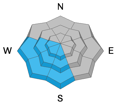
Much warmer temperatures today and the possibility of direct sun may heat the snow surface on steep sunny slopes, and wet loose sluffs will become possible. Look for teltale signs of heating snow - the snow is getting heavy, damp or sticky, rollar balls or small wet loose sluffs starting to run. This means it’s time to get off of and out from under the steep sunny slopes that are heating.
Additional Information
Ice climbers: Sizable sluffs are likely to run on the north facing ice climbs in Provo Canyon. Many of the Provo Canyon ice climbs are in avalanche run outs - be aware of what terrain is above you.
General Announcements
This information does not apply to developed ski areas or highways where avalanche control is normally done. This forecast is from the U.S.D.A. Forest Service, which is solely responsible for its content. This forecast describes general avalanche conditions and local variations always occur.