Forecast for the Provo Area Mountains

Evelyn Lees
Issued by Evelyn Lees for
Wednesday, January 9, 2019
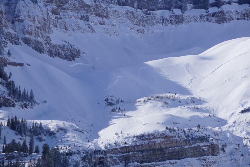
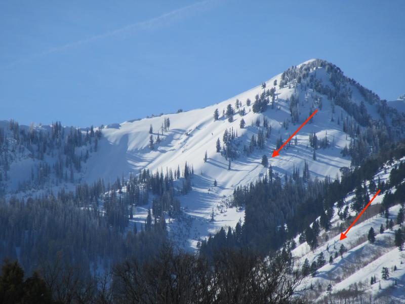
Today the avalanche danger is CONSIDERABLE on steep mid and upper elevation slopes for triggering new drifts of wind blown snow, which will be most widespread on the north 1/2 of the compass and for triggering new snow slides breaking on the old snow surface. There is also a MODERATE danger for wet loose sluffs, on both southerly and northerly facing slopes.
In isolated locations with a thin snowpack avalanches could break near the ground, mostly likely where they have a new load of wind drifted snow.
Low
Moderate
Considerable
High
Extreme
Learn how to read the forecast here
Special Announcements
Check out the improved weather links, road conditions, and weather links for each forecast region on the new UAC IOS App. Do you use the NOAA point forecast? If so, now you can bookmark your favorite weather locations in "My Weather" in the App.
Weather and Snow
Under partly cloudy skies, it’s warm and breezy this morning - temperatures are in the upper 20s to mid 30s in the Provo area mountains. Winds are from southeast to southwesterly, averaging 20 mph, with gusts 25. Speeds were faster across the high peaks overnight. Today, temperatures will warm to near 40 at the mid elevations, with periods of high, thin clouds and wind speeds slowly diminishing throughout the day. The snow is slowly settling and becoming less punchy, especially in wind sheltered areas. Sunny slopes are crusted, but will soften later today.
Recent Avalanches
Clearing skies made for good views, with widespread natural avalanche activity noted in the Provo area mountains, especially on the Timp massif, suspected to be new snow only. A large natural occurred 10 am yesterday morning in Cascade Cirque on Timp.
Cascade Cirque, Carey Pierce photo
Debris at the base of the Fang ice climb, Provo Canyon, photo by Woody
Ad
Avalanche Problem #1
Wind Drifted Snow
Type
Location
Likelihood
Size
Description
The overnight southerly winds will have created a new batch of drifts, mostly on upper elevation slopes facing the north 1/2 of the compass and along ridge lines. The new surface wind drifts will be rounded and smooth, and there may be new cornices to avoid along the ridge lines. Previous wind events in the last week has left a string of stubborn, scattered, old drifts at upper and mid elevations, some buried deeper beneath the new snow.
Avalanche Problem #2
Persistent Weak Layer
Type
Location
Likelihood
Size
Description
It's a complicated - there is weak, sugary faceted snow mid snowpack and near the ground. You are most likely to trigger a slide on the mid-pack faceted weak that formed early January, especially where they are sheltered beneath the Jan 5th winds slabs. But the sensitivity is very variable. The solution is to avoid travel on and below steep slopes for a while. Widespread natural avalanches occurred in the Provo area mountains the last 2 days, on many aspects and elevations, including mid and low elevations.
Avalanche Problem #3
Wet Snow
Type
Location
Likelihood
Size
Description
Small, wet loose sluffs may occur again today on steep sunny slopes and on all low elevation slopes, including shady, northerly facing slopes. When the snow gets damp where you are, move off steep slopes. Avoid travel beneath snow loaded roofs of mountain buildings, which may slide.
General Announcements
This information does not apply to developed ski areas or highways where avalanche control is normally done. This forecast is from the U.S.D.A. Forest Service, which is solely responsible for its content. This forecast describes general avalanche conditions and local variations always occur.