Yesterday brought a trace amount of snow to the mountains, overcast skies and high temperatures in the mid-20s F to low 30s F. Winds stayed westerly averaging in the mid-teens with gusts up to 30 mph at the ridgetops. The uppermost elevations, above 11,000' feet, saw some gusts above 50 mph.
This morning, snow has just begun to fall with a trace in the mountains, temperatures are currently in the mid-teens F at trailheads and low-teens F at ridgetops. Westerly winds are averaging in the single digits to low teens with gusts near 10-15 mph.
Today, yet another weak system will impact the area this morning into the early afternoon. The mountains could pick up another 1-3 inches of snow, with temperatures in the low 20s F to upper 20s. The winds will switch back to northwesterly and average in the teens and gusts into the 20s mph.
Looking down the road, weekend ridgetop temperatures may reach into the mid-40s F! The heatwave should be brief; however, the models do bring a strong cold front on Monday.
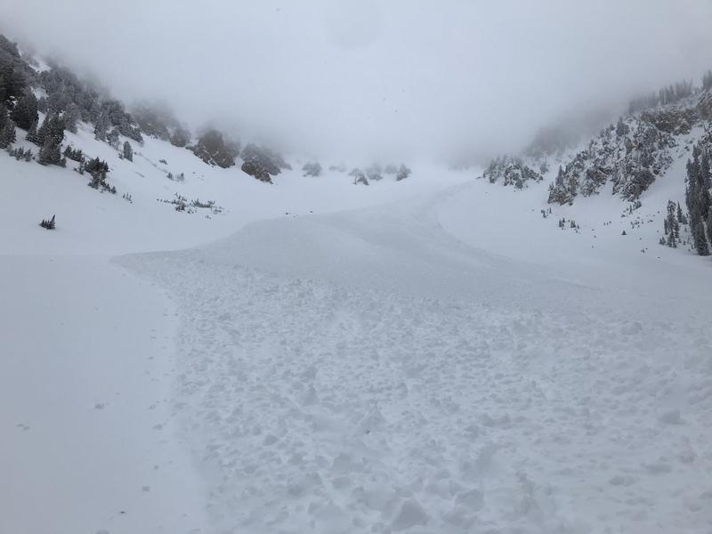
Yesterday, a sizeable avalanche was noted in Northwest Couloir near Mount Nebo. This was avalanche ran all the way down the bowl and reached the flats below, leaving damaged small pine trees and a large debris pile. This avalanche looked to occur in the wind drifted snow and most likely occurred sometime Monday naturally.
Below is the photo of the sizeable avalanche in Northwest Couloir, see full observation
HERE.
One outlier avalanche reported in the Central Wasatch, was a
wet slab avalanche that occurred on Monday on Mount Olympus likely during the very early morning hours of Monday when warm precipitation had saturated the entirety of snow stuck to the steep rock slabs and released fully. This avalanche was 400 feet wide on a north aspect, at 7,500 feet, and ran for 500 feet. You can find the full observation
HERE.
Across the board, the loose snow is reported as easy to trigger in steep terrain.