Forecast for the Provo Area Mountains

Greg Gagne
Issued by Greg Gagne for
Friday, January 26, 2024
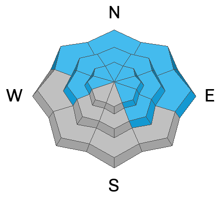
The avalanche danger is CONSIDERABLE on all slopes facing northwest through north and east, and mid and upper elevation slopes facing west and southeast. All other slopes have a MODERATE avalanche danger.
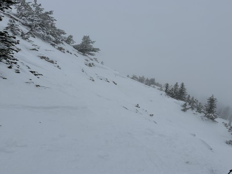
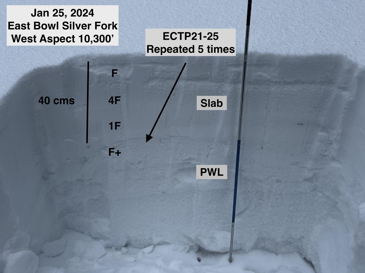
Soft and hard slab avalanches may fail in a persistent weak layer buried 2-5' deep, particularly in areas with a thinner snowpack.
Low
Moderate
Considerable
High
Extreme
Learn how to read the forecast here
Special Announcements
Weather and Snow
This Morning: Temperatures are in the 20's F and winds are from the northwest and light, less than 10 mph, gusting into the teens at the upper-most elevations. Thursday's "storm" under-produced, with 1-5" of dense snow; the highest amounts reported near Sundance. Although new snow totals are meager, the dense snow did provide a decent refresh with good travel and riding conditions.
For Today: A pleasant late-January day with partly-sunny skies and temperatures in the 20's F. Winds will be from the northwest and remain light, gusting near 20 mph along the highest ridges and peaks.
This Weekend (and Beyond): A warming trend with sunny skies. Temperatures will peak early this coming week, with signals indicating a return to snowier weather by late week.
Recent Avalanches
The last avalanche reported from the Provo mountains occurred on Sunday, a huge avalanche at Forest Lake near Mill Canyon Peak. To our north in the Salt Lake mountains, an avalanche occurred in East Bowl of Silver Fork on Wednesday. This was on a west aspect at 10,300' and 16" deep and 60' wide. Although unconfirmed, the slide was likely skier-triggered (possibly remotely) and likely failed on facets. Photo below from CJH.
Click here for all recent observations and avalanches.
Ad
Avalanche Problem #1
Persistent Weak Layer
Type
Location
Likelihood
Size
Description
All signs indicate we are moving in the right direction with the persistent weak layer (PWL) problem: the slab on top of the PWL is strong and in most places, over 3-4' deep; the PWL is also gaining strength. We are seeing fewer collapses and fewer avalanches on the PWL.
What continues to get my attention are thinner snowpack areas where it is easier to trigger an avalanche failing in the PWL (photo below). Wednesday's avalanche in East Bowl of Silver Fork highlights this kind of terrain: steep, rocky, with a thinner snowpack. You can read more on my thoughts of the PWL problem from my field day on Thursday.
If you choose to venture into steeper terrain:
- Continually evaluate the snowpack looking for thinner areas where it is easier to trigger an avalanche in the PWL.
- Avoid steep, rocky slopes where the snowpack is likely to be thinner.
- Back off of steep slopes when red flags are present, such as collapsing or recent avalanches.
Additional Information
General Announcements
This information does not apply to developed ski areas or highways where avalanche control is normally done. This forecast is from the U.S.D.A. Forest Service, which is solely responsible for its content. This forecast describes general avalanche conditions and local variations always occur.