UDOT PLANNED AVALANCHE CLOSURES!!

Forecast for the Provo Area Mountains

Evelyn Lees
Issued by Evelyn Lees for
Wednesday, January 2, 2019
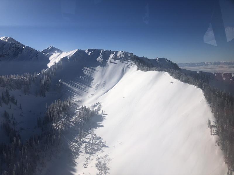
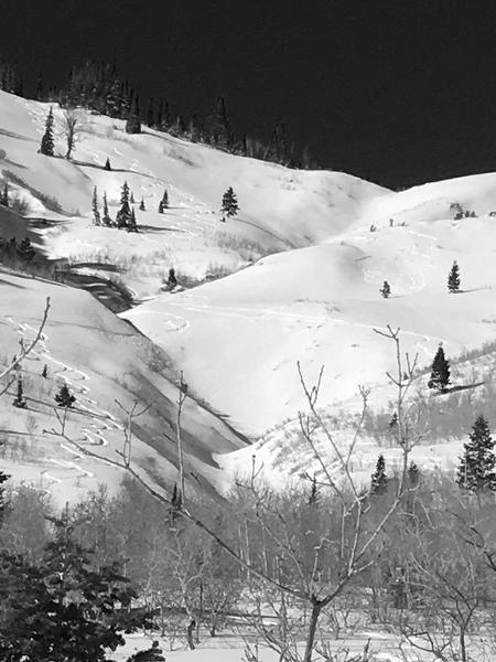
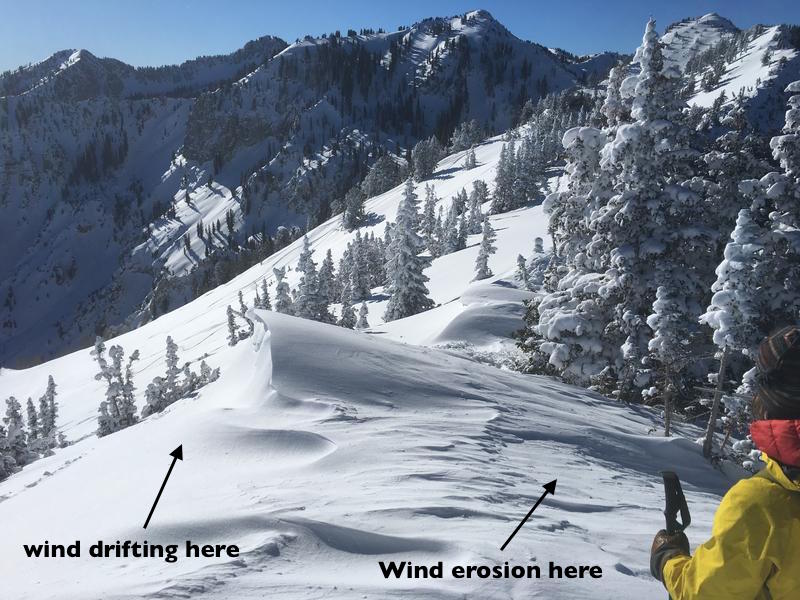
Today the avalanche danger is MODERATE on steep mid and upper elevation slopes where slabs of wind-drifted snow can be found on all aspects because of various wind directions in the past week. The most recent drifts are obvious, but others are hidden beneath the snow. Wind-sheltered slopes have excellent skiing and riding, where the main issue is sluffing of the new snow in steep terrain.
Isolated locations with a thin snowpack could have avalanches that break near the ground, mostly likely where they have a new load of wind drifted snow
Low
Moderate
Considerable
High
Extreme
Learn how to read the forecast here
Weather and Snow
Under clear skies, temperatures are averaging 10 degrees warmer than yesterday morning - in the single digits above zero. Winds remain from the north, but are light, averaging 15 to 20 mph, with gusts to 25 mph. There were reports of excellent powder on wind sheltered slopes at the mid and lower elevations, out of the upper elevation wind zone.
High pressure and steadily warming temperatures will continue through Saturday, with a slight chance for snow from a splitting storm around Sunday or Monday.
Recent Avalanches
There was much less wind loading than expected - perhaps the low density snow sublimated instead of being deposited or can be found in the west desert. A sluff was noted on Mill Canyon peak and a very shallow new snow slide triggered on a southerly facing slope at 8,600'. At resorts to the north, a few hard wind drifts were pried out with explosives. Most people avoided the upper elevation, wind loaded terrain.
Left - loose natural upper Shingle Mill, in the sun/shade line. Right - small. low elevation slide in American Fork
Ad
Avalanche Problem #1
Wind Drifted Snow
Type
Location
Likelihood
Size
Description
To borrow words from the Flathead Avalanche Center, “shifting winds have formed several generations of wind slabs on a variety of aspects”. While cornices and surface drifts from Monday evening's easterly winds are easy to see and avoid, the older drifts are hidden beneath newer snow. Wind drifts are scattered on mid and upper elevation slopes on almost any aspect, cross loading across gullies, well off the ridge lines into open bowls and in unusual spots. Approach the steep slopes with caution - these hard wind drifts can not be ski cut and will break above you.
Below: recent wind effects will be easier to identify. Hardesty/Wilson photo along the Snake Creek ridge line.
Avalanche Problem #2
New Snow
Type
Location
Likelihood
Size
Description
The low density snow will continue to sluff today in wind sheltered areas. Small sluffs can be serious if they take you into trees, off a cliff or for a long ride, so choose your run outs carefully and use slope cuts to minimize the chance of going for a ride.
Long running sluff of new snow and facets in No Name, Mark White photo.
Avalanche Problem #3
Persistent Weak Layer
Type
Location
Likelihood
Size
Description
The last avalanche releasing on the buried persistent weak layer near the ground was December 30th in South Monitor Bowl, along the Park City ridge line. In many places the snowpack is over a meter deep and this layer is not breaking in stability tests. But you could still trigger a slide near the ground in isolated spots - an upper elevation, northerly through easterly facing slope, with a thin snowpack that has recent load of wind drifted snow.
Additional Information
The shallow snowpack at the mid and low elevations is weakening, and a concern for the future. The Mark White video below is of a new snow sluff gouging into and entraining the weak facets as it moves downslope. For a more detailed explanation of the weakening snow pack, check out Trent and Greg’s excellent video in their Dec 31st Broads Fork observation. The Provo area mountains have a shallow snowpack at the mid and lower elevations.
General Announcements
This information does not apply to developed ski areas or highways where avalanche control is normally done. This forecast is from the U.S.D.A. Forest Service, which is solely responsible for its content. This forecast describes general avalanche conditions and local variations always occur.