Join us at our 2nd Annual Blizzard Ball

Forecast for the Provo Area Mountains

Nikki Champion
Issued by Nikki Champion on
Wednesday morning, January 19, 2022
The avalanche danger is LOW on all aspects at all elevations. Natural and human-triggered avalanches are unlikely, but not impossible, and could occur in isolated terrain.

Continue to use safe travel protocol practices when in avalanche terrain - keep a close eye on your partners and expose only one person at a time on a slope.
Low
Moderate
Considerable
High
Extreme
Learn how to read the forecast here
Weather and Snow
This morning, there are a few clouds in the sky and temperatures are in the upper teens and low 20s F. Winds are from the west-southwest and picked up a bit - gusting in the 20s along mid-elevation ridges with gusts in the upper 30s and low 40s mph along the highest peaks.
Today will remain mostly cloudy, temperatures will rise into the upper 20s F and the west-northwesterly winds will remain moderate, gusting in the 20s at mid-elevations and low-30's mph at the highest peaks.
Soft snow and good riding can still be found on shady, wind-sheltered aspects above 8,000'. The snow surface is weakening on these slopes where it has become faceted with some surface hoar.

The next chance for appreciable snowfall looks to come Thursday night into Friday as a system drops south through the area. Given the current trajectory only modest snowfall amounts are expected with this system, between 2-5".
Recent Avalanches
No backcountry avalanches were reported yesterday.

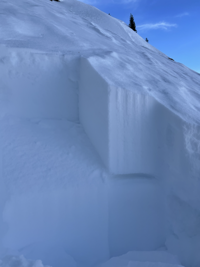
Yesterday, within the Central Wasatch there was one observation from Upper Mill B South, that did get propagation within their pit. It has been a few days since anyone has gotten any obvious signs of instability within a pit. While the snowpit depth was over 3 meters deep and did not propagate within the weak faceted grains at the ground, the observer got propagation within a near-surface facet layer approx 35cm down. This pit was dug on a Northeast aspect at 10,500', and had a firm, wind drifted surface. While these results seemed isolated, it is worth paying attention to the weakening snow surface and any weakening near-surface layers within the shady upper elevation aspects moving into our next precipitation event.
Layer of near surface facets that the ECT and CT failed on 35cm down on a NE Aspect at 10,500'. (Z. Little)
Ad
Avalanche Problem #1
Normal Caution
Type
Location
Likelihood
Size
Description
Normal caution is used when the avalanche danger is LOW and there is no predominant type of avalanche problem. Although avalanches are unlikely, they are not impossible and they could occur in isolated terrains, such as;
  • loose, wet avalanches in steep couloirs and gullies on southerly aspects;
  • small isolated areas of wind drifted snow in upper elevation terrain features that allow for drifting, such as gullies, sub ridges and directly below ridgelines;
  • a larger avalanche breaking down into faceted snow in steep, thin rocky terrain on aspects facing northwest through east at the mid and upper elevations.

Although I am unsure if the small avalanche in Broads Fork is a glide avalanche or not, there is a deep snowpack in drainages where glide avalanches occur, such as Broads Fork and Stairs Gulch. Glide avalanches are notoriously difficult to forecast, but when they do occur they will release the entire season's snowpack down to the ground.
Additional Information
What happened to the Persistent Weak Layer problem? The PWL problem first appeared in the December 12 forecast, and since that time numerous large natural and human-triggered avalanches have occurred, failing on the layer of faceted snow down near the ground on mid and upper elevation aspects facing west, north, and east. This PWL formed from snowfall in October and early November that weakened during the prolonged dry spell through November and early December. Heavy snowfall in December and early January snowfall placed a 3-5' deep slab of strong/dense snow on top of this layer (as shown in this photo by Meredith Johnson) and it is now unlikely a skier or rider could affect this deeply-buried layer. Although we may not have any remaining issues with this PWL this season, for now we are saying the PWL problem has become dormant as it may again become reactive with future storms.
General Announcements
Who's up for some free avalanche training? Get a refresher, become better prepared for an upcoming avalanche class, or just boost your skills. Go to https://learn.kbyg.org/ and scroll down to Step 2 for a series of interactive online avalanche courses produced by the UAC.
This information does not apply to developed ski areas or highways where avalanche control is normally done. This forecast is from the U.S.D.A. Forest Service, which is solely responsible for its content. This forecast describes general avalanche conditions and local variations always occur.