Last night temperatures dropped into the low 20's °F above 9,000', while barely dipping below freezing at lower and mid-elevations. Another night of clear skies allowed for a solid refreeze of the snow surface at all elevations, but likely less deep than we saw yesterday. Winds were generally light and variable at the lower elevations, with moderate speeds from the southwest through northwest at exposed upper elevations.
The overall warming trend continues today, with temperatures several degrees warmer than yesterday: We'll reach mid 30's °F in the upper elevations, and high 40's °F (even into the 50's°F) at 7,000 feet. Winds will remain light to moderate, shifting more to the south around noon. At the same time, cloud cover should begin to develop.
Ski areas reported a shorter window of wet loose avalanching yesterday than the day prior, with the previous night's refreeze keeping activity at bay until late morning. Push-a-lanches and small wet slides were common.
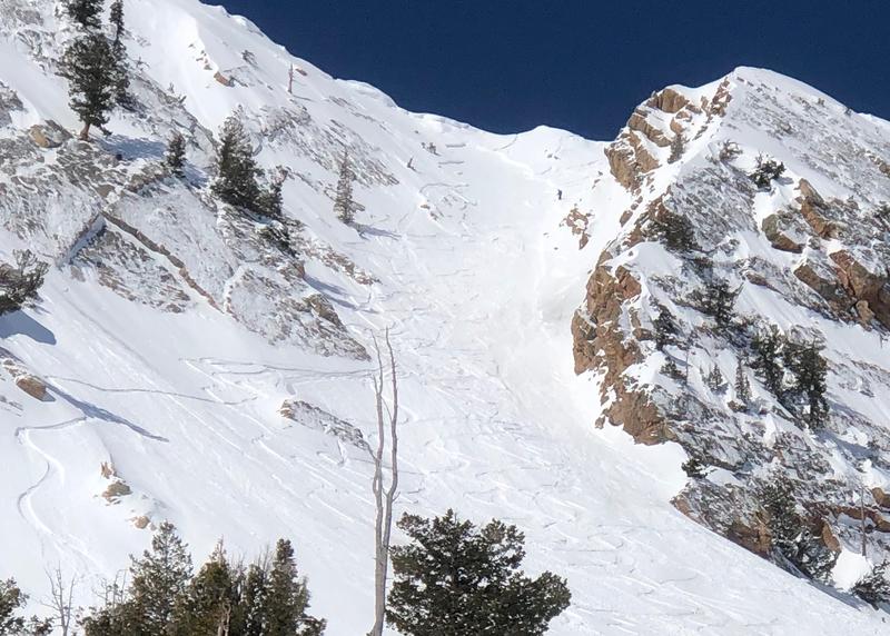
A skier in the Snowbasin backcountry triggered a wind slab in east-facing Mt. Ogden Chute at 9,400', breaking 14" deep and 30' wide (pic below). Two sets of ski tracks were taken out in the slide. On Thunderdome, near Powder Mountain, an intentional ski cut on a north-northeast aspect at 8,200' released a 10" by 100' avalanche that traveled 500' on a knife hard melt freeze crust. Finally, on Francis Peak a soft windslab natural avalanche was reported, deep enough to bury or injure a person.
On Friday an avalanche was triggered on "Scrapies", a steep east-facing slope at 9,100'. Powder Mountain conducted an investigation of the avalanche involvement in their out of bounds terrain
here. This is private property; see video below.