Forecast for the Ogden Area Mountains

Evelyn Lees
Issued by Evelyn Lees for
Thursday, March 7, 2019
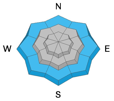
The avalanche danger is CONSIDERABLE on all aspects at upper elevations, especially slopes with wind drifts - triggering a 2 foot deep wind drift is likely. The avalanche danger is MODERATE at the mid and low elevations for triggering a small wind drift, new snow slide, or a wet loose sluff at the lower elevations. Use cautious route finding and conservative decision at the upper elevations in the backcountry today.
Low
Moderate
Considerable
High
Extreme
Learn how to read the forecast here
Weather and Snow
Under a light southwest flow, the Ogden area mountains picked up another 4 to 5” of snow overnight. Storm totals are now 20" with over 2 inches of water at Snowbasin and probably in the Ben Lomond area. (as of 7 am, the Snotel sites haven't updated for 12 hours, so we are missing some data there). The southwesterly winds are light this morning - averaging 5 to 15 mph, with just Mt Ogden averaging 25, and gusting to 35 mph. Temperatures are in the low to upper 20s, finally cooling to below freezing at 6,000'.
Today: continued light to moderate snow, with the cold front arriving this afternoon. Snow through early this afternoon will be heaviest in areas favoring southwest flow, with 4 to 8” possible. The cold front arriving this afternoon will bring a period of heavier snow, continuing into the overnight hours, with an additional 3 to 6” overnight in areas favored by northwest flow.
Winds will remain from the southwest, averaging 10 to 20 mph at times, with gusts to 30. Highest peaks will average 35 mph, with gusts in the 40s at times.
Temperatures will continue their cooling trend, and remain in the twenties today, before dropping into the teens tonight.
Recent Avalanches
No new observations from the Ogden backcountry. The Ogden resorts reported small to medium new snow soft slabs from explosives above about 8,000', some large enough to bury a person and other activity with in the new snow - 6 to 12" deep wind drifts and shallow soft slabs.
Ad
Avalanche Problem #1
Wind Drifted Snow
Type
Location
Likelihood
Size
Description
A few periods of stronger south to southwesterly winds overnight and the past 48 hours created localized drifts, most widespread along the higher ridge lines, but also found mid slope. Identify and avoid the smooth, denser, rounded slabs of wind drifted snow. Large cornices continue to be sensitive with the added weight of the new snow on top. Stay way back from the edges as you travel along ridge lines, and don’t travel beneath them.
Avalanche Problem #2
New Snow
Type
Location
Likelihood
Size
Description
Today, expect new snow soft slabs and sluffs to be easily triggered on steep slopes, especially during any periods of heavier snowfall or increases in wind. The slides failing in the new snow or graupel pools will average 1 to 2 feet deep. Slides can be triggered off the ridge lines, mid slope or in pooled graupel beneath cliff bands.
The new snow will be most sensitive during periods of intense snowfall, probably peaking during the afternoon frontal passage.
Avalanche Problem #3
Wet Snow
Type
Location
Likelihood
Size
Description
The wet snow at lower elevations continues to cool and strengthen, but it may still be possible to trigger a wet loose sluff down low. Even colder temperatures tonight should lock up the snow at these lower elevations.
Additional Information
Thinking of traveling further south to the Provo area mountains or the Mt Nebo area (recent Nebo area ob)? The snowpack is a different than in the Central Wasatch and will much more time to stabilize after this weeks storm or future storms before aiming for big objectives.
General Announcements
This information does not apply to developed ski areas or highways where avalanche control is normally done. This forecast is from the U.S.D.A. Forest Service, which is solely responsible for its content. This forecast describes general avalanche conditions and local variations always occur.