UDOT PLANNED AVALANCHE CLOSURES!!

Forecast for the Ogden Area Mountains

Mark Staples
Issued by Mark Staples for
Wednesday, March 6, 2019
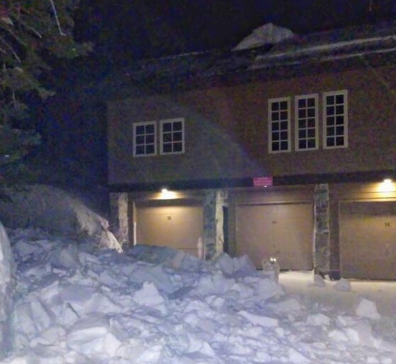
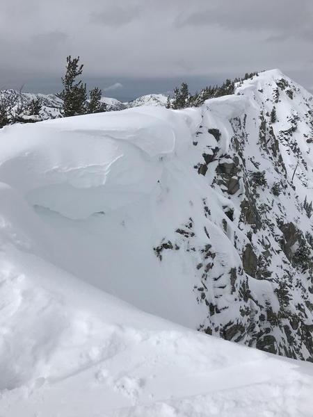
Today there are three avalanche problems to watch for. Strong southerly winds have drifted snow and formed fresh slabs that should be easily triggered today. With more snow and more wind, these slabs will make the danger CONSIDERABLE at upper elevations. As snow falls today, shallow soft slabs of new snow could produce avalanches at upper and mid elevations. At low and mid elevations, the snow is already wet and rain will make wet avalanches a problem watch for. The avalanche danger at mid and lower elevations is MODERATE but could rise higher if more snow falls than is expected.
Low
Moderate
Considerable
High
Extreme
Learn how to read the forecast here
Special Announcements
HEADS UP for ROOF AVALANCHES: Warm temperatures and rain will make the snow on many roofs unstable. Please alert your friends and family who may not normally check avalanche forecasts. Roof avalanches can be deadly especially for children. Below is a photo (D. Richards) of a roof avalanche this morning in Little Cottonwood Canyon. Notice the dog for scale.
Weather and Snow
Currently: Strong southerly winds began blowing yesterday afternoon. This morning they are averaging about 40 mph at 9000' ridgetops and gusting 55 mph. Temperatures are relatively warm this morning. They are in the low 40s F near 6000 feet and drog drop below freezing until about 8500 feet.
Today: A warm, wet, and windy storm will bring 4-6 inches of dense snow today. Snowfall could be heavy at times, but the arrival of peak snowfall shouldn't arrive until this afternoon. Temperatures should warm a bit this morning with the approaching storm. The rain-snow line will be around 7500 feet today. Strong southerly winds will continue.
This week: Snowfall should continue through tonight with another 2-4 inches falling. Another storm will arrive Friday. This one will come from the northwest with much colder temperatures and lighter snow.
Recent Avalanches
No avalanches were reported in the Ogden area mountains yesterday; however, I suspect some loose wet avalanches occurred at low elevations.
Ad
Avalanche Problem #1
Wind Drifted Snow
Type
Location
Likelihood
Size
Description
Strong southerly winds should have already formed shallow slabs of wind drifted snow this morning. As snow and winds continue today, these should grow in thickness and become more unstable. Yesterday afternoon, wind drifts were already about 6 inches thick in the backcountry near Snowbasin near 9000 feet.
The best strategy is to look for signs of wind loading and avoid these fresh wind drifts. For this morning at mid and upper elevations, avoiding wind loaded slopes will help you avoid most avalanche problems. Heavy snowfall will change this situation as the day progresses. See the New Snow discussion below.
CORNICES - With so much snowfall, cornices are massive. When and where cornices break is totally unpredictable; however, today's snow and wind-loading will add more weight and more stress to them which should make them more likely to break. Photo below is a photo of a cornice yesterday in the Wolverine Cirque. Similar ones exist in the Ogden area mountains.
Avalanche Problem #2
New Snow
Type
Location
Likelihood
Size
Description
As more snow falls, avalanches will become more likely in the new snow. Its always hard to know exactly how the new snow will react, but it is typically most sensitive during periods of heavy snowfall. With such warm temperatures, I expect the new snow to be fairly cohesive and should break as a shallow soft slab where it is resting on loose snow that fell earlier this week.
Pay attention to how the new snow reacts to your weight while traveling today. You should see signs that it is becoming unstable, mainly in the form of cracking in the new snow.
Avalanche Problem #3
Wet Snow
Type
Location
Likelihood
Size
Description
Snow at low and even parts of mid elevations is already wet from warm temperatures yesterday. Rain could trigger loose wet avalanches today. Most of this activity will be at low elevations but
Watch for wet avalanches especially near creek bottoms or other gullies and terrain traps where even an very small wet avalanche can make a deep pile of debris.
General Announcements
This information does not apply to developed ski areas or highways where avalanche control is normally done. This forecast is from the U.S.D.A. Forest Service, which is solely responsible for its content. This forecast describes general avalanche conditions and local variations always occur.