Forecast for the Ogden Area Mountains

Drew Hardesty
Issued by Drew Hardesty for
Wednesday, March 20, 2019
Most terrain has a LOW avalanche danger. Pockets of MODERATE danger, however, may exist for newly developed shallow wind drifts in steep north facing terrain. Shallow wet loose avalanches are again possible with daytime heating.
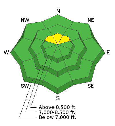
Low
Moderate
Considerable
High
Extreme
Learn how to read the forecast here
Special Announcements
Shame and the Social Contract - The latest blog-cast is out (this is a short one - 10 minutes)
Weather and Snow
Spring Equinox. But you, the migrating birds, the snowpack, and my magnolia tree already knew that.
Skies are partly cloudy-trending mostly cloudy. Mountain temps are in the mid to upper 20s.
The southeast winds stole the show, however, and are blowing 25-30mph with gusts to 40.
Variable snow conditions exist with newly wind damaged soft settled recrystallized powder on the steep northerly aspects with a wide window of supportable spring corn-like conditions on the southerly slopes.

For today, we'll see increasing clouds, moderate southeasterly winds, and mountain temps warming into the low 30s along the upper ridgelines and the mid-40s at the base areas and trailheads. A couple of loosely organized storms are on the doorstep and while it appears the bulk of the energy will affect central and southern Utah, the spillover could add up to a foot or more by late weekend.
Recent Avalanches
"Tranquil days" is how one snow safety professional described it yesterday.
Avalanche activity involved only a couple small wet point release avalanches with sun and daytime warming.
Ad
Avalanche Problem #1
Wind Drifted Snow
Type
Location
Likelihood
Size
Description
Shallow but sensitive wind drifts are now likely to be found in the north facing terrain. These may be triggered from a distance and - as always - most problematic in unforgiving terrain. The ramped-up east to southeast winds and weak snow surfaces should be enough to recalibrate one's mindset if headed to the more aggressive alpine terrain today.
Avalanche Problem #2
Normal Caution
Type
Location
Likelihood
Size
Description
Risk is inherent in mountain travel. Remember that even minor avalanche problems can pose issues in or beneath radical terrain. General considerations for today:
1) Loose wet avalanches: As the day heats up, avoid steep slopes that are becoming wet and sloppy. Stay out from under sun-baked, rocky, snow covered faces and avoid steep couloirs that can act as solar ovens. An early start is key.
2) Loose dry avalanches: Shallow loose dry avalanches are possible on steep, upper elevation, northerly aspects.
3) Cornices were noted to be more sensitive yesterday. Don't become lazy or complacent if traveling along the heavily corniced ridgelines.

Continue to practice safe travel techniques and carry appropriate rescue gear - beacon, probe, and shovel.
General Announcements
This information does not apply to developed ski areas or highways where avalanche control is normally done. This forecast is from the U.S.D.A. Forest Service, which is solely responsible for its content. This forecast describes general avalanche conditions and local variations always occur.