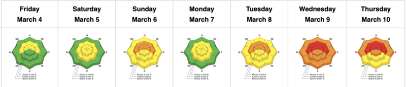
We have warm temperatures and increasing clouds ahead of the next quick hitting storm system. Temps are in the upper 20s and low 30s. Winds backed to the southwest overnight and are blowing 30mph with gusts to 45 along the Ogden skyline. Anemometers off the main ridgelines have hourly averages of 20-25mph with gusts to 45. We may see 5-10" by early evening with temps dropping back to the low to mid-20s. Winds will veer to the west northwest post frontal and blow 20mph with gusts to 35. Clearing tomorrow with more snow Tuesday night into Wednesday.
Greg Gagne's Week in Review is published and can be found
HERE.
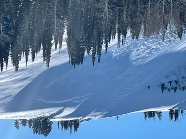
Observers near Monte Cristo noted new human triggered avalanches near
Whiskey Hill. Photo below.
A snowmobiler triggered a large and dangerous avalanche above Farmington Canyon on Friday. (
INFO). It was triggered from a distance and ripped out 2' deep and 300' wide on a northeast facing slope at 8000'.
On Thursday, a snowmobiler was caught but not buried in the mountains above Bountiful. The second rider on the slope was carried in the avalanche but not buried and not hurt. This slide occurred in the mountains just above the town of Bountiful. They were going one at a time and all had rescue gear. If the rider had been buried, they would have been able to find him very quickly.
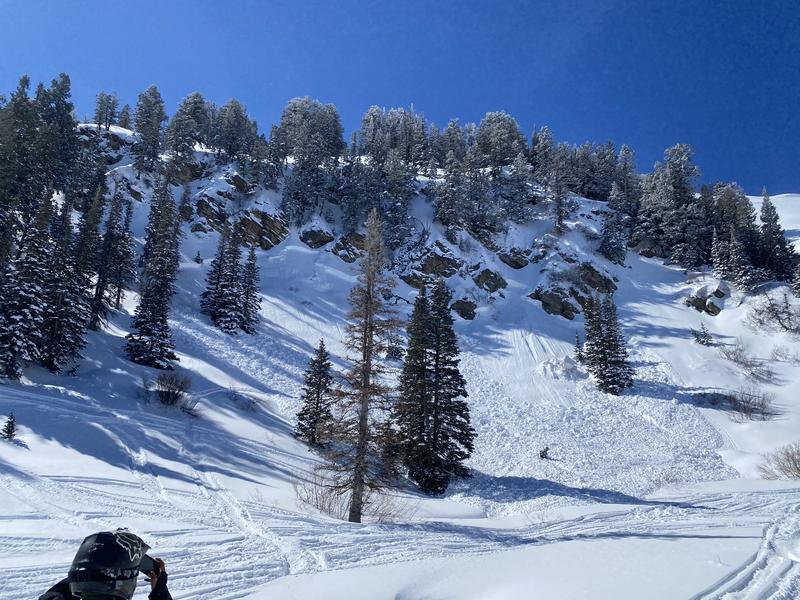
The Ogden area mountains experienced a widespread avalanche cycle with the mid-week storm. See
photos/obs. Conditions remain dangerous.