Forecast for the Ogden Area Mountains

Evelyn Lees
Issued by Evelyn Lees for
Sunday, February 3, 2019
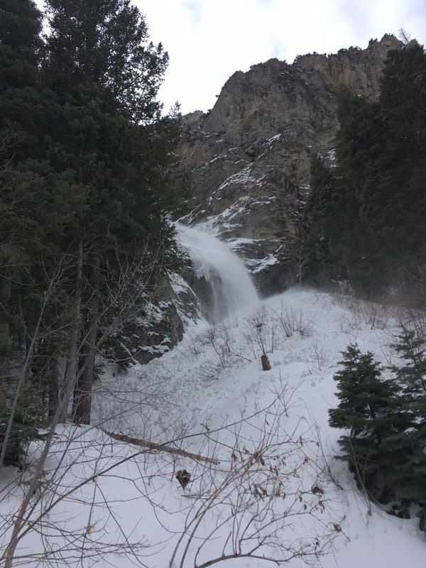
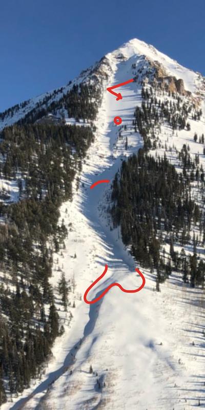
The avalanche danger is CONSIDERABLE on all elevations and aspects. Warm temperatures, strong winds and heavy wet snow have created dangerous avalanche conditions.
--Careful snowpack evaluation, cautious route-finding, and conservative decision making are essential for travel in the backcountry.
--Avoid steep slopes and avalanche runout zones such as gullies and couloirs.
--The avalanche danger will spike during periods of heavy snowfall or increased winds - natural avalanches will become likely.
Low
Moderate
Considerable
High
Extreme
Learn how to read the forecast here
Special Announcements
Check out a new blog post - The Risks and Rewards of Ski Patrol - A Conversation with Jake Hutchinson.
Weather and Snow
The warm, wet storm left behind 4 to 8” of heavy, dense snow above about 8,000', containing 1 to 2 inches of water. Low elevations and trail heads received more rain than snow. It is still snowing in the Ogden area mountains. Temperatures are too warm - in the low 30s at the trail heads, mid to upper 20 up high. There will rain soaked snow at the bottom of the new snow at the mid and low elevations, but the graupel laden snow should be drier near the top of the snow. The south to southwesterly winds were strong in the Ogden area mountains during the last 24 hours, maxing out around 50 mph averages, with gusts to 70 mph.
For today, mostly cloudy skies, with scattered snow showers producing another 3 to 6 inches of snow. West to southwesterly winds will be in the 20 to 30 mph range, with gusts to 40 mph. Speeds will increase again this afternoon, and high ridge lines could average 35 to 45 mph, with gusts in the 60s and 70s. Temperatures will remain in the mid 20s to mid 30s.
Recent Avalanches
Check out the avalanche activity from further south - A significant natural wet loose avalanche cycle occurred on northerly facing slopes in Santaquin Canyon and the lower couloirs in Little Cottonwood, occurring before it rained. It surprised me, but the simple combination of clouds and warm temperatures was enough to heat the facets and trigger these slides. Santaquin avalanche below, photo by Luke. Santiquin observations HERE and HERE.
There was a very close call in the northwest couloir on Timpanogos - a wind slab broke on the 3rd person, who fought and got out to side and grabbed tree. As the slide ran down, it broke out another 2-3 foot deep crown 600’ below. We’re assuming it broke on a sugary, faceted weak layer. There were other reports of shallow wind slabs breaking on facets. Photo below.
Ad
Avalanche Problem #1
Wind Drifted Snow
Type
Location
Likelihood
Size
Description
24 hours of moderate to strong winds have drifted the snow at mid and upper elevations. On the shadier, northwest through south easterly facing slopes, the new drifts will be sitting on weak, sugary snow. It will be possible to trigger these new drifts from a distance or from below. Human triggered avalanches likely, failing at the old snow surface or perhaps within the storm snow. Any new cornices along the upper and mid elevation ridgelines will be very sensitive today. Give them a wide berth - travel well back from the edges and avoid travel beneath them.
Even out of the wind, the new snow may not have bonded well to the variety of old snow surfaces, consisting of crusts and preserved sugary facets. Or slides may fail with in the new snow on a mid storm weakness or where there are pools of graupel. Even a shallow new snow slide will pack a punch, due to the dense snow.
Avalanche Problem #2
Wet Snow
Type
Location
Likelihood
Size
Description
With the rain/snow line varying from around 6,500 feet to 7,500’, the wet soggy snow will need time to cool. It will be possible to trigger wet, loose sluffs today on all low and mid elevation slopes, and the shady slopes might be the most sensitive. Avoid travel in steep gullies and couloirs. Even a small wet sluff in a steep terrain trap such as a creek bed or road cut can pile up cement like debris deeply.
General Announcements
This information does not apply to developed ski areas or highways where avalanche control is normally done. This forecast is from the U.S.D.A. Forest Service, which is solely responsible for its content. This forecast describes general avalanche conditions and local variations always occur.