Forecast for the Ogden Area Mountains

Drew Hardesty
Issued by Drew Hardesty for
Saturday, February 16, 2019
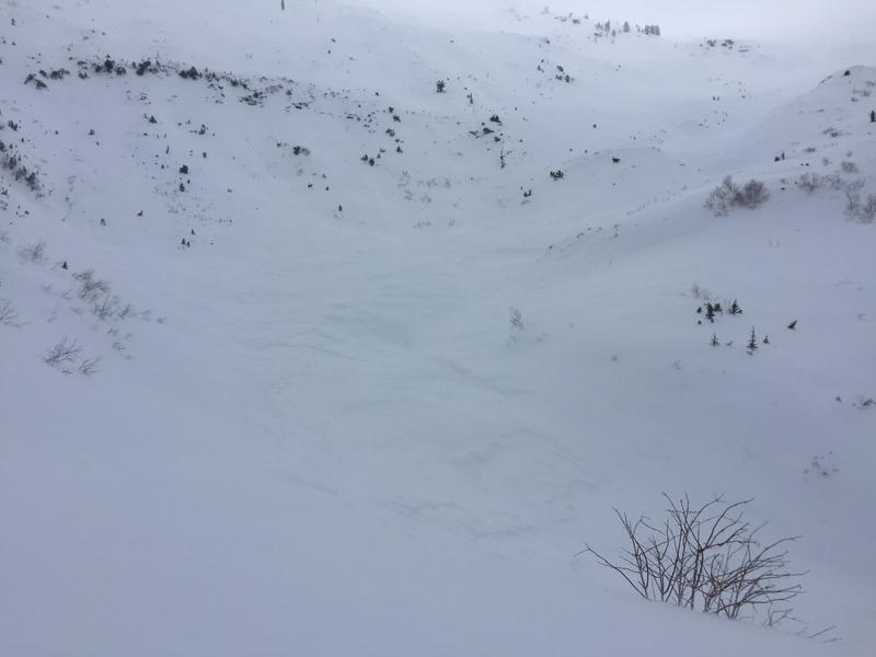
Areas of CONSIDERABLE DANGER exist for heavily wind loaded slopes. The danger is most pronounced on upper elevation northerly through easterly facing terrain. Non-wind drifted slopes have a MODERATE danger. Cornices are an issue - Exercise great caution along and underneath the heavily corniced ridgelines.
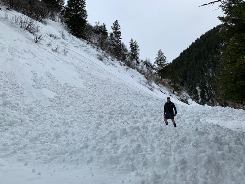
Safe Travel Protocols are critical: one at a time, get out of the way at the bottom, have a plan.
Low
Moderate
Considerable
High
Extreme
Learn how to read the forecast here
Special Announcements
An AVALANCHE WARNING for the Uintas and the Manti-Skyline Plateau remains in effect with a HIGH avalanche danger.

The accident reports for the four avalanche fatalities are all finalized and worth reading. We all have something to learn so that we can get home safely to our loved ones.
Jan 18 Electric Lake Report (Skyline area)
Jan 25 Laurel Peak Report (Moab area)
Feb 7 Circleville Mtn Report (Southwest area near Beaver)
Feb 9 Chalk Creek Report (Western Uintas)
The latest UAC Podcast was just released: The Message and the Messengers - A Conversation with Alex Hamlin. In this podcast, we sit down with Alex Hamlin. For over fifteen years, Alex Hamlin has worked at the intersection of storytelling and outdoor sport, with experience at magazines, global retail brands and creative agencies..
Weather and Snow
Skies are overcast with light snow falling in the mountains. Skiing and riding today will be quite good.
Overnight storm totals are 6"/0.38"-8"/0.61" in the Ogden areas mountains. We'll see another couple-inches during the day today.
Winds are generally light from the west-northwest but are blowing 20-25mph along the highest ridgelines.
Temperatures are in the teens, mercifully.
It's been quite the run. Since Wednesday, snow and water amounts are roughly 32"/4.0" snow-water-equivalent.
Snow depths are 95" (and - mind you - these snow stakes are at 7500'-8000')!

Remember you can always find good info on Instagram at ogdenavalanche and #ogdenavalanche (check out Bill Brand'ts video of wind loading and of broken trees!)
Recent Avalanches
Natural wet avalanche from yesterday. Photo below. Perhaps below 6,000'. Hopefully the cold temps will lock this up.
Ski area control teams triggered many wind and storm snow avalanches with at least one stepping to the ground into old snow. One person had a cornice break behind him and he went for a 500' ride down the slope but ended up ok. Bill Brandt noted a large avalanche INFO off Willard Peak (SE at 9400') with an impressive debris pile in Cutler Creek. (pic Brandt)
We did hear of some natural avalanche activity overnight in the north and eastern part of the forecast zone near the Hardware Ranch.
Wheeler Canyon, Don Mueller photo
Ad
Avalanche Problem #1
Wind Drifted Snow
Type
Location
Likelihood
Size
Description
Heavily wind loaded areas are still suspect. Soft and hard wind slabs may be triggered in steep terrain today, primarily in the upper elevations on northerly through easterly aspects. They'll be challenging to recognize as they're now buried underneath 6-8" of powder. Tremper used to call it "sucker snow" for good reason as it'll lure you out onto the wind slab. These drifts are becoming increasingly stubborn, but they do have the nasty habit of pulling out on perhaps the third or fourth person down the slope, perhaps where the lens of the teardrop-shaped drift tapers small. They also like to pull out well above you. The term "unmanageable" comes to mind.
The majority of these drifts are in upper elevation northerly through easterly aspects but scattered around the compass in the mid-elevations due to terrain channeling.
Avalanche Problem #2
New Snow
Type
Location
Likelihood
Size
Description
The low density snow will sluff on the steepest slopes today and may run naturally with any localized spike in snowfall today. Sluff management will be critical if headed into steep, sustained couloirs today. The low density smoke can easily knock you off your feet or ride and pile up deeply into gullies or other terrain traps.
Avalanche Problem #3
Cornice
Type
Location
Likelihood
Size
Description
CORNICES ARE ENORMOUS. Most of these are too large to intentionally drop onto a slope below. They will break back farther than you think, well back from the apex of the ridgeline. 5% of our avalanche fatalities in Utah have involved cornice fall. Exercise great caution along and underneath the heavily corniced ridgelines.
Additional Information
We're in luck in the powder preservation department: we'll have cloudy skies with a few more inches of snow today with cool weather and light wind through the week. The overall avalanche danger will slowly trend toward Moderate and Low in the coming days.
General Announcements
This information does not apply to developed ski areas or highways where avalanche control is normally done. This forecast is from the U.S.D.A. Forest Service, which is solely responsible for its content. This forecast describes general avalanche conditions and local variations always occur.