Forecast for the Ogden Area Mountains

Greg Gagne
Issued by Greg Gagne for
Friday, December 9, 2022
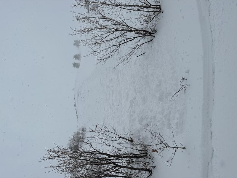
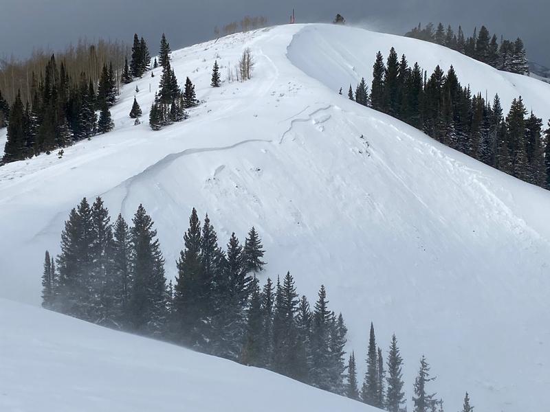
The avalanche danger is CONSIDERABLE on mid and upper elevation aspects facing northwest through north and east where avalanches may break down 1-3' deep and up to 200' wide. The avalanche danger is MODERATE at the mid and upper elevations on slopes facing west through south and southeast as well as low-elevation slopes facing northwest through north and east. There is a LOW avalanche danger on low elevation slopes facing west through south and southeast.
The good news is that there are fabulous riding conditions on low-angled slopes on all aspects.
Low
Moderate
Considerable
High
Extreme
Learn how to read the forecast here
Special Announcements
Join the Utah Avalanche Center and the Division of Outdoor Recreation to celebrate the Fourth Annual Avalanche Awareness week, from December 4 - December 11. Click here to view the full list of events for the week which includes a large number of avalanche education opportunities!
Weather and Snow
Temperatures have slowly risen overnight and are in the upper teens and low 20's F. Winds are from the south and southwest and have also increased overnight. At mid elevations, winds are averaging in the teens with gusts in the 20's and 30's mph. Along the upper-most elevations and ridges, winds are averaging in the 30's with gusts near 50 mph. Snow surfaces may be slightly crusted on some solar aspects.
For today, temperatures will rise into the low 20's F but will begin dropping during the afternoon. Winds will be from the south/southwest and remain about where they are this morning with mid elevations averaging in the teens and gusting into the 20's mph while upper elevation wind speeds will average in the 20's and gusting into the low 50's mph. We should pick up a few inches of snow earlier in the day with partly cloudy skies forecast during the afternoon.
For those that enjoy storms, the extended forecast looks quite promising. Saturday will be partly cloudy with increasing wind speeds out of the southwest ahead of a long-duration storm that begins on Sunday and may last into Tuesday.

Although more specific to the Salt lake mountains, our Week in Review, where we highlight significant snow and avalanche events from this past week, has been published. Mark Staples has also written an excellent piece describing the weather from the early winter.
Recent Avalanches
No avalanches reported from the backcountry on Thursday, but we did receive two excellent observations:
Derek DeBruin - North Ogden Divide
Noah Sievers - Sharp Mountain
The last reported avalanche occurred on Sunday, December 4 on Cutler Ridge.
Read about all avalanche activity reported to the UAC.
Ad
Avalanche Problem #1
Persistent Weak Layer
Type
Location
Likelihood
Size
Description
A persistent weak layer (PWL) of faceted snow and surface hoar that formed during the mid-November dry spell has been buried underneath snowfall and wind-drifted snow over the past two weeks. Avalanches have been failing on this PWL, breaking down 1-3' deep and over 100' wide. Although the PWL is present on all aspects and at all elevations, it is most pronounced on mid and upper elevation aspects facing northwest through north and east. Moderate to strong winds overnight and into today may drift snow onto these aspects, creating an additional load and further stressing this buried PWL.
You may get warning signs of instability such as loud collapses and cracking, but persistent weak layers are also notorious for not providing these obvious clues of instability, and instead wait for the 2nd, 5th, or 15th rider on the slope before avalanching. These avalanches may be triggered remotely (from a distance) and may also allow you to get well onto a slope before fracturing far above you.
The strategy to avoid getting involved in one of these large and dangerous avalanches is to not travel on, below, or adjacent to slopes 30° or steeper on aspects facing northwest through north and east. Fortunately, cold temperatures and regular snowfall are providing great riding conditions on low-angled slopes on all aspects.
Additional Information
MOST ACCIDENTS AND FATALITIES OCCUR DURING A CONSIDERABLE AVALANCHE DANGER THAT INVOLVES A PERSISTENT WEAK LAYER.
A word to the wise: Don't get fooled.
As avalanches become more stubborn and cracking and cracking become less commonplace, there can be a tendency to believe that conditions are improving faster than they are.
The GOOD NEWS is that riding conditions are 5 STAR on shady low angle slopes. Choose low angle terrain with nothing steep above you.
General Announcements

This information does not apply to developed ski areas or highways where avalanche control is normally done. This forecast is from the U.S.D.A. Forest Service, which is solely responsible for its content. This forecast describes general avalanche conditions and local variations always occur.