Check Out Our Holiday Auction!

Forecast for the Ogden Area Mountains

Brooke Maushund
Issued by Brooke Maushund on
Friday morning, December 5, 2025

While many slopes didn't have much snow before this storm, danger will rise to CONSIDERABLE in high, northerly terrain by the end of the day. Rising temperatures and snow levels during a wet, warm, and windy storm throughout the day mean an upside-down, dense load on top of a weak snowpack. There will be two different worlds you'll step into today: large slides breaking widely on weak snow on the high, north half of the compass, especially where wind has drifted snow. Storm snow on southerlies will be just thick enough to keep low-tide hazards out of view. Note that in the shady mid-elevation terrain, you will find a MODERATE danger.

Avalanche danger will continue to rise overnight as the bulk of the precipitation comes in this evening.

Low
Moderate
Considerable
High
Extreme
Learn how to read the forecast here
Special Announcements

This week is Avalanche Awareness Week. Events are happening daily across the state to prepare you for winter and get you thinking about avalanche safety.

Find out about all our events HERE.

Weather and Snow

Overnight into this morning, a wet, warm, and windy storm arrived on a northwesterly flow. Temperatures rose overnight into the low 20s F, as NW winds picked up to moderate gusting strong at ridgelines. Anemometers along the highest elevations are registering 30 to 45mph with gusts near 60mph. Precipitation began late last night, with some favored areas receiving about an inch of new snow at the time of writing this at 6:00am.

Today, expect mountain temperatures to continue to rise throughout the day, reaching up into the high 20s F and even low 30s in select locations by tonight. Due to a warm advection regime, snow levels will increase from 5100' this morning to around 6800' by 17:00 tonight. NW winds are currently blowing 15 to 20mph, gusting into the 30s. Showers will pulse in and out throughout the day, with the bulk of the intense precipitation rates happening early this evening into the night.

With uncertainty in the models, by 5:00pm, we can expect:

  • Snowbasin: 2-4" of snow (0.2-0.4" snow water equivalent)
  • Powder Mountain: 2-4" of snow (0.2-0.4 SWE)

Tonight, snow levels will continue to rise, reaching over 7500'. By 8am, tomorrow morning, favored areas along the Ogden skyline can see up to an additional 8-10" of snow.

This weekend into next week, temperatures will drop back down Saturday midday as cold air returns to our area, but most of the precipitation will have already fallen. Precipitation looks to taper off into Sunday morning. Next week, the weather looks to continue to be unsettled with a warmer trend in temperatures.

Our hard-working partners at the Salt Lake City National Weather Service issued a Winter Storm Warning last night until 5:00am Sunday due to the heavy, wet precipitation. For more information, head over to their sites linked above.

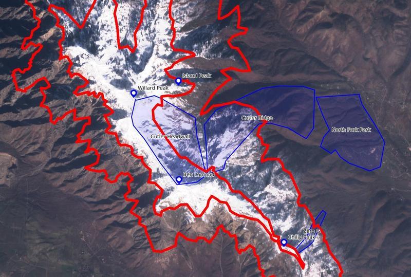
Pro-observer Derek DeBruin did some excellent mapping on where weak, old snow was lingering before last week's storm and has some insights in his observation from yesterday, here.

Nikki and I enjoyed seeing folks at the Ogden Avalanche SnowBash last night!

Recent Avalanches

No recent avalanche activity has been reported in the Ogden area.

You can find recent observations HERE

Avalanche Problem #1
Persistent Weak Layer
Type
Location
Likelihood
Size
Description

Old, weak lingering snow from October and November on W-N-E facing mid- to -upper elevation slopes was buried last weekend by 6-10 inches of new snow. Today we add a heavy, dense load of new snow on top of these layers which already produced numerous D1-D2 avalanches in the Central Wasatch, both natural and skier-triggered (one from a distance) this past week.

In wind-exposed areas near ridgelines and near mid-slope features like gullies, these slides were larger, denser slabs sitting on top of these facets. In more sheltered terrain, the rotten old snow and faceting snow from last week has less cohesion, and any slides may gouge down to the ground.

This slide that Pro-observer Mark White remotely-triggered in the Central Wasatch two days ago is similar to slides you could trigger in the Ogden area today.

Avalanche Problem #2
Wind Drifted Snow
Type
Location
Likelihood
Size
Description

As this storm system moved in overnight on northwesterly flow, NW winds picked up to moderate gusting strong at ridgelines. Anemometers along the highest elevations are registering 30 to 45mph with gusts near 60mph, and we can expect this to continue throughout the day today. These winds will load both new and pre-existing snow in wind-exposed areas near ridgelines and along mid-slope catchment areas. Drifts, dunes, and pillows are signs that the wind has been at work.

A wind pillow on the leeward side of East Bowl Pass in LCC earlier this week.

General Announcements

This information does not apply to developed ski areas or highways where avalanche control is normally done. This forecast is from the U.S.D.A. Forest Service, which is solely responsible for its content. This forecast describes general avalanche conditions and local variations always occur.