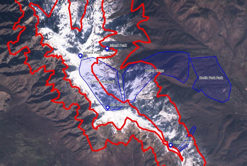
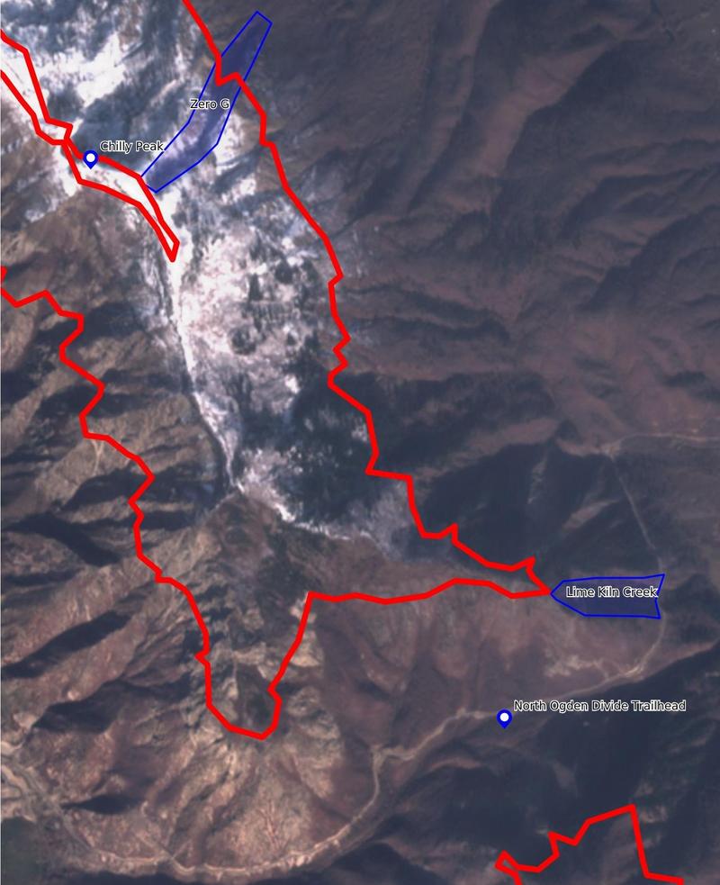
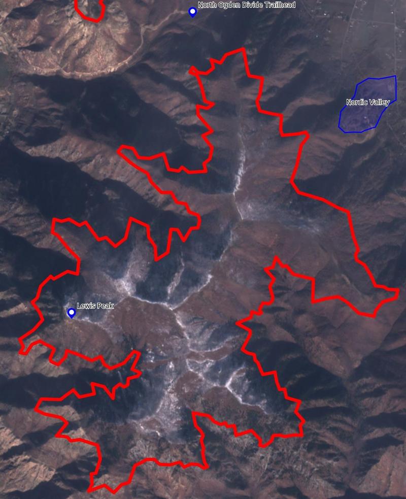
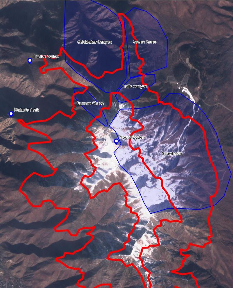
The storm is at our doorstep and I think there's decent confidence that it will produce enough snow to 1) make travel in the backcountry seem tenable for many people and 2) create potential for avalanches. So, here's the satellite imagery for the old snow on the ground. These images are from just before the post-Thanksgiving snowfall, so the snow on the ground in these images represents the most likely places to have weak snow at the base of the snowpack.
The red lines in the images are approximate contour lines for 8500ft and 7000ft, which differentiate Ogden's upper, mid, and low elevation bands. The outside edge of each image is the low elevation band, the inner part of each image is the upper elevations, with mid between the red lines. Indicated in blue are some well known landmarks, zones, etc. to help identify the features in the satellite imagery. The entire Ogden skyline is posted here from north to south: Ben Lomond, Chilly Peak, Lewis Peak, and Mount Ogden.
In my opinion, anywhere painted in white in these images is suspect, even more so if the upper end of the forecasted snow range comes to fruition. This includes much of the commonly traveled terrain on Ben Lomond (Cutler, Rodeo, etc.). Lewis Peak was relatively dry before the snow arrived earlier this week, but the ridgeline has old snow, and that same ridgeline loves to catch wind and make stiff pockets of wind slab. Old snow can also be found on the polar aspects around Mount Ogden/Snowbasin--think Banana Chute, Hells Canyon, upper Coldwater, etc. The snow coverage in those zones is a bit obscured by the shadows in the satellite imagery, but rest assured there's old snow there.